Area Overview for NN3 8UP
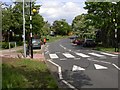
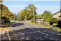
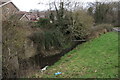
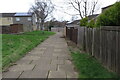
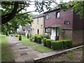
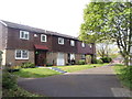
Photos of NN3 8UP


Area Information
NN3 8UP is a small, densely populated residential cluster in England, spanning just 3.7 hectares and home to 1,700 people. With a population density of 46,000 people per square kilometre, this area is compact, with homes closely grouped. The median age of 47 suggests a mature community, predominantly adults aged 30–64, many of whom are likely long-term residents. Living here means proximity to essential amenities, including retail outlets like Aldi Overstone and Tesco Northampton, as well as transport hubs such as Northampton Railway Station and the University Bus Interchange. While the area is small, its strategic location offers access to nearby services, making it practical for daily life. However, its limited size means the housing stock is finite, and buyers should consider the local character, which balances residential tranquillity with the convenience of nearby urban connectivity.
- Area Type
- Postcode
- Area Size
- 3.7 hectares
- Population
- 1700
- Population Density
- 2455 people/km²
The property market in NN3 8UP is characterised by a 43% home ownership rate, with houses being the primary accommodation type. This suggests a small, established residential area where many properties are owner-occupied, though the limited size of the postcode means the housing stock is finite. The presence of houses rather than flats or apartments implies a focus on traditional, family-friendly homes. For buyers, this small area offers a mix of potential opportunities and constraints: the proximity to amenities like Northampton Railway Station and nearby retail hubs may be appealing, but the limited land area means competition for properties could be fierce. Those considering the area should weigh the balance between the local character and the practicalities of limited housing availability.
House Prices in NN3 8UP
Showing 35 properties
| Address | Type | Beds | Baths | Last Sale Price | Last Sale Date | |
|---|---|---|---|---|---|---|
| 23 Dairymeadow Court, Northampton, NN3 8UP | house | 6 | - | £154,000 | Mar 2020 | |
| 19 Dairymeadow Court, Northampton, NN3 8UP | Terraced | 3 | - | £150,000 | Apr 2019 | |
| 28 Dairymeadow Court, Northampton, NN3 8UP | Terraced | 3 | 1 | £130,000 | Mar 2019 | |
| 25 Dairymeadow Court, Northampton, NN3 8UP | Terraced | 3 | 1 | £155,000 | Nov 2017 | |
| 30 Dairymeadow Court, Northampton, NN3 8UP | house | - | - | £144,950 | Nov 2017 | |
| 20 Dairymeadow Court, Northampton, NN3 8UP | Terraced | 3 | 2 | £127,000 | Sep 2016 | |
| 32 Dairymeadow Court, Northampton, NN3 8UP | Terraced | 2 | 1 | £93,000 | Feb 2014 | |
| 21 Dairymeadow Court, Northampton, NN3 8UP | Terraced | 4 | 1 | £100,000 | Jul 2013 | |
| 27 Dairymeadow Court, Northampton, NN3 8UP | house | 3 | - | £82,500 | Apr 2010 | |
| 10 Dairymeadow Court, Northampton, NN3 8UP | Detached | 3 | 1 | £60,000 | Mar 2010 |
Energy Efficiency in NN3 8UP
The lifestyle in NN3 8UP is supported by a range of nearby amenities, including five retail outlets such as Aldi Overstone, Tesco Northampton, and Co-op Bushland. These shops provide access to groceries, household goods, and everyday necessities. The proximity to the University Bus Interchange and Northampton Bus Interchange ensures reliable public transport options, while Northampton Railway Station offers connections to broader rail networks. Though the area is small, its accessibility to urban centres means residents can enjoy both local convenience and regional opportunities. The mix of retail and transport options suggests a practical, community-focused lifestyle, where daily needs are met without the need for long commutes.
Amenities
Schools
The nearest school to NN3 8UP is Thorplands Primary School, which serves the local community with a primary education offering. The school holds an Ofsted rating of ‘good’, indicating a satisfactory standard of teaching and facilities. While the data does not mention secondary schools, the presence of a primary school suggests that families with younger children may find the area convenient. However, the lack of additional schools in the data means that residents may need to travel further for secondary education. The single primary school available reflects the small size of the area, and its rating provides a benchmark for educational quality in the immediate vicinity.
| Rank | School | Type | Entry gender | Ages |
|---|
Explore more schools in this area
Go to Schools tabDemographics
The community in NN3 8UP is predominantly composed of adults aged 30–64, with a median age of 47. This suggests a population that is largely established, with fewer younger families or retirees. Home ownership accounts for 43% of properties, indicating a mix of owner-occupied homes and rental units. The accommodation type is primarily houses, which is uncommon in high-density areas, hinting at a blend of traditional housing styles. The predominant ethnic group is White, with no data provided on other demographics. The age profile and home ownership figures suggest a stable, long-term resident base, though the relatively high population density may influence community dynamics.
Household Size
Accommodation Type
Tenure
Ethnic Group
Religion
Household Composition
Age
Household Deprivation
NS-SEC
Explore more demographic insights in this area
Go to Demographics tabPlanning
Planning Constraints
- Flood RiskPremium
- Ramsar Wetland SitesPremium
- Area of Outstanding Natural BeautyPremium
- Protected Nature ReservePremium
- Protected WoodlandPremium