Area Overview for NN3 8UN
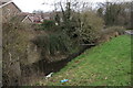
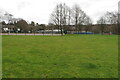
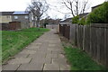
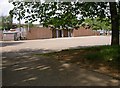
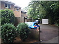
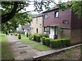
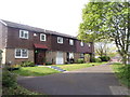
Photos of NN3 8UN

Area Information
Living in NN3 8UN offers a compact, densely populated residential experience within a small cluster of homes. The area spans just 3.1 hectares, housing 1,700 people at a density of 55,723 per square kilometre. This high concentration creates a tight-knit community feel, where local amenities and services are within close reach. The area is characterised by its mix of older and newer housing stock, predominantly owner-occupied homes. Residents benefit from proximity to Thorplands Primary School, which has a good Ofsted rating, and nearby transport links, including bus interchanges and a railway station. While the area lacks large-scale retail or leisure facilities, its small size means daily needs are met by nearby towns. The demographic profile suggests a mature population, with a median age of 47, and a focus on family-oriented living. For buyers, NN3 8UN presents a unique blend of affordability and convenience, though its limited size means expansion is not an option.
- Area Type
- Postcode
- Area Size
- 3.1 hectares
- Population
- 1700
- Population Density
- 2455 people/km²
The property market in NN3 8UN is defined by its small scale and predominantly owner-occupied nature. With 43% of homes owned by residents, the area leans towards a stable, long-term housing stock rather than a rental-focused market. The accommodation type is largely houses, which may appeal to families seeking more space than flats. However, the limited area size—just 3.1 hectares—means the housing stock is finite, with little scope for new developments. Buyers should consider that the market is likely to be competitive, with properties in demand due to their proximity to local schools and transport links. The absence of high-end or luxury properties suggests a focus on practical, functional homes. For those seeking investment, the area’s compact nature may limit future growth potential, though its established character could attract buyers prioritising community over expansion.
House Prices in NN3 8UN
Showing 68 properties
| Address | Type | Beds | Baths | Last Sale Price | Last Sale Date | |
|---|---|---|---|---|---|---|
| 64 Midfield Court, Northampton, NN3 8UN | Terraced | 3 | - | £230,000 | Jun 2025 | |
| 50 Midfield Court, Northampton, NN3 8UN | Terraced | 4 | 1 | £180,000 | May 2024 | |
| 20 Midfield Court, Northampton, NN3 8UN | Flat | - | - | £115,000 | Dec 2023 | |
| 39 Midfield Court, Northampton, NN3 8UN | Terraced | 2 | 1 | £168,000 | Jul 2023 | |
| 47 Midfield Court, Northampton, NN3 8UN | Terraced | 3 | 1 | £190,000 | Nov 2022 | |
| 44 Midfield Court, Northampton, NN3 8UN | house | - | - | £160,000 | Jul 2022 | |
| 41 Midfield Court, Northampton, NN3 8UN | house | - | - | £152,000 | Nov 2019 | |
| 24 Midfield Court, Northampton, NN3 8UN | Terraced | 3 | 1 | £156,000 | Oct 2018 | |
| 17 Midfield Court, Northampton, NN3 8UN | Flat | 2 | 1 | £103,000 | Jun 2018 | |
| 22 Midfield Court, Northampton, NN3 8UN | Terraced | 3 | 1 | £149,995 | Nov 2017 |
Energy Efficiency in NN3 8UN
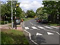
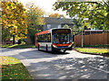
Daily life in NN3 8UN is shaped by its proximity to essential amenities. Retail options include Tesco Northampton, Co-op Bushland, and Aldi Overstone, all within practical reach, offering groceries and household essentials. The area’s transport links, such as the University Bus Interchange and Northampton Bus Interchange, provide easy access to wider shopping, dining, and leisure opportunities in nearby towns. While the area itself lacks large-scale parks or recreational facilities, the surrounding region likely offers green spaces. The presence of a railway station at Northampton further enhances connectivity, allowing residents to explore cultural or entertainment venues in the city. The compact nature of NN3 8UN means that convenience is prioritised over scale, with local needs met by nearby towns and efficient transport networks.
Amenities
Schools
The nearest school to NN3 8UN is Thorplands Primary School, which serves the area with a good Ofsted rating. This primary school is a key asset for families, offering a reliable educational foundation for young children. However, the data does not list any secondary schools or further education institutions in the immediate vicinity, which may require residents to commute to nearby towns for higher education. The presence of a well-rated primary school enhances the area’s appeal for families, though it is essential to plan for secondary schooling options. The school’s good rating indicates a focus on quality teaching and facilities, which can be a decisive factor for homebuyers prioritising education.
| Rank | School | Type | Entry gender | Ages |
|---|
Explore more schools in this area
Go to Schools tabDemographics
The community in NN3 8UN is predominantly composed of adults aged 30–64, with a median age of 47. Home ownership sits at 43%, indicating a mix of owner-occupied and rented properties. The area is largely inhabited by White residents, with no specific data on other ethnic groups provided. The high population density—55,723 people per square kilometre—suggests a compact, possibly multi-generational living environment. This density may influence local services and infrastructure, though the area’s small size means resources are concentrated. The age profile implies a stable population with established households, which could affect the demand for schools and community facilities. While no deprivation data is explicitly stated, the lack of significant environmental constraints and the presence of basic amenities suggest a functional, if modest, quality of life.
Household Size
Accommodation Type
Tenure
Ethnic Group
Religion
Household Composition
Age
Household Deprivation
NS-SEC
Explore more demographic insights in this area
Go to Demographics tabPlanning
Planning Constraints
- Flood RiskPremium
- Ramsar Wetland SitesPremium
- Area of Outstanding Natural BeautyPremium
- Protected Nature ReservePremium
- Protected WoodlandPremium