Area Overview for NN3 6PS
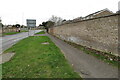
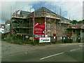
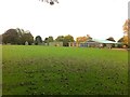
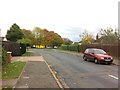
Photos of NN3 6PS


Area Information
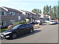
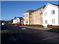
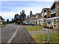
NN3 6PS is a compact residential postcode in England, covering just 2,501 square metres and home to 1,625 residents. Its high population density of 649,708 people per square kilometre reflects a tightly knit community, though the area’s small size means it is not sprawling. The postcode is characterised by a mature demographic, with a median age of 47 and the majority of residents falling within the 30–64 age range. This suggests a stable population of working-age adults and families, with 58% owning their homes. The area is predominantly composed of houses, not flats, which may appeal to those seeking traditional family homes. While the data does not provide details on local landmarks or historical context, the proximity to Northampton Railway Station and multiple bus interchanges indicates it is well-connected to nearby towns and services. For buyers, this small cluster offers a mix of residential living with access to essential amenities, though its limited size means the immediate surroundings are key to assessing lifestyle options.
- Area Type
- Postcode
- Area Size
- 2501 m²
- Population
- 1625
- Population Density
- 4158 people/km²
The property market in NN3 6PS is dominated by owner-occupied homes, with 58% of properties owned by residents rather than rented. This suggests a community of long-term residents rather than a transient rental market. The accommodation type is primarily houses, which may appeal to buyers seeking traditional family homes or those who prefer the space and privacy of a detached property. However, the small area size of 2,501 square metres means the housing stock is limited, potentially leading to competition among buyers. The lack of data on property prices or recent sales trends means it is unclear whether this area is a buyer’s market or one with limited availability. For those considering NN3 6PS, proximity to amenities such as Northampton Railway Station and nearby retail outlets may be key factors in assessing the area’s value. Buyers should also consider the surrounding regions for additional housing options, as the immediate postcode is small.
House Prices in NN3 6PS
No properties found in this postcode.
Energy Efficiency in NN3 6PS
Residents of NN3 6PS have access to a range of nearby amenities, including five retail outlets such as Tesco Spinny, Co-op Bushland, and Morrisons Kingsley. These shops provide convenience for daily shopping, from groceries to household essentials. The area’s transport links are also a key lifestyle factor, with two bus interchanges and a railway station offering connectivity to Northampton and beyond. While the data does not mention parks or leisure facilities, the presence of multiple retail and transport options suggests a focus on practicality and accessibility. For those prioritising convenience, the proximity to major supermarkets and transport hubs may outweigh the absence of detailed information on recreational spaces. The small size of the postcode means the immediate surroundings are critical to assessing lifestyle suitability, particularly for those seeking a balance between urban and suburban living.
Amenities
Schools
The nearest school to NN3 6PS is Boothville Primary School, which is rated ‘good’ by Ofsted. This primary school serves the local community, offering education for younger children. However, the data does not list any secondary schools in the immediate area, which may be a consideration for families with older children. The presence of a primary school with a positive rating is a positive factor for families prioritising early education, though they may need to look further afield for secondary schooling. The single school listed suggests a focus on primary education, which could align with the area’s demographic profile of adults in their 30s to 60s, many of whom may have children in primary school. Parents should assess the distance to secondary schools and the availability of transport options for older students.
| Rank | School | Type | Entry gender | Ages |
|---|---|---|---|---|
| 1 | Boothville Primary School | primary | N/A | N/A |
Explore more schools in this area
Go to Schools tabDemographics
The community in NN3 6PS is largely composed of adults aged 30–64, with a median age of 47. This suggests a population that is neither heavily skewed towards younger or older demographics, potentially indicating a stable, working-age community. Home ownership stands at 58%, with houses being the predominant type of accommodation. This contrasts with areas where rental properties dominate, suggesting a more settled population. The predominant ethnic group is White, though no specific data on diversity or deprivation levels is provided. The high population density of 649,708 people per square kilometre implies a compact, possibly urbanised environment, though the exact implications for quality of life—such as access to green spaces or community facilities—are not detailed. The data does not indicate whether the area has a higher proportion of single-person households or families, but the prevalence of houses may suggest a focus on family-oriented living.
Household Size
Accommodation Type
Tenure
Ethnic Group
Religion
Household Composition
Age
Household Deprivation
NS-SEC
Explore more demographic insights in this area
Go to Demographics tabPlanning
Planning Constraints
- Flood RiskPremium
- Ramsar Wetland SitesPremium
- Area of Outstanding Natural BeautyPremium
- Protected Nature ReservePremium
- Protected WoodlandPremium
- Crime RiskPremium