Area Overview for NN3 6PG
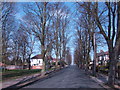
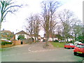
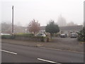
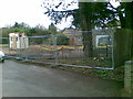
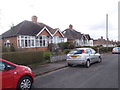
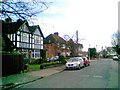
Photos of NN3 6PG
Area Information
NN3 6PG is a small, tightly packed residential area in England, covering just 1.1 hectares. With a population of 1,625 people, it is a compact cluster of homes, characterised by a high population density of 145,332 people per square kilometre. This suggests a closely knit community where proximity to neighbours is almost inevitable. The area is predominantly home to adults aged 30–64, with a median age of 47, indicating a mature demographic. Daily life here is likely shaped by the local amenities and transport links, with residents relying on nearby shops, schools, and public transport. The area’s small size means that most essential services are within walking distance, though its limited footprint also means the housing stock is finite. For those considering living in NN3 6PG, the balance of convenience and community is evident, though the high density may influence the pace of life. The presence of nearby retail hubs and transport options ensures that residents are well-connected, even within this modest postcode.
- Area Type
- Postcode
- Area Size
- 1.1 hectares
- Population
- 1625
- Population Density
- 4158 people/km²
The property market in NN3 6PG is dominated by owner-occupied homes, with 58% of residents owning their properties. The accommodation type is primarily houses, suggesting a focus on family homes rather than flats or apartments. This mix implies a market that caters to long-term residents, with limited turnover. Given the area’s small size—just 1.1 hectares—the housing stock is finite, which may mean competition for properties. For buyers, this could translate to a stable but constrained market, where availability is limited but demand is steady. The predominance of houses may appeal to those seeking space and privacy, though the high population density suggests that proximity to neighbours is a given. For those considering the area, the focus on owner-occupation indicates a community of settled residents, which may influence the character and stability of the local market.
House Prices in NN3 6PG
Showing 30 properties
| Address | Type | Beds | Baths | Last Sale Price | Last Sale Date | |
|---|---|---|---|---|---|---|
| 179 Churchill Avenue, Northampton, NN3 6PG | Terraced | 3 | 1 | £218,000 | Feb 2024 | |
| 181 Churchill Avenue, Northampton, NN3 6PG | Terraced | 3 | 1 | £180,000 | Jan 2019 | |
| 175 Churchill Avenue, Northampton, NN3 6PG | house | - | - | £100,000 | Aug 2010 | |
| 169 Churchill Avenue, Northampton, NN3 6PG | Terraced | - | - | £115,000 | Jul 2005 | |
| 203 Churchill Avenue, Northampton, NN3 6PG | Bungalow | - | - | - | - | |
| 201 Churchill Avenue, Northampton, NN3 6PG | Bungalow | - | - | - | - | |
| 197 Churchill Avenue, Northampton, NN3 6PG | Flat | - | - | - | - | |
| 193 Churchill Avenue, Northampton, NN3 6PG | Flat | - | - | - | - | |
| 189 Churchill Avenue, Northampton, NN3 6PG | Flat | - | - | - | - | |
| 90 Churchill Avenue, Northampton, NN3 6PG | Bungalow | - | - | - | - |
Energy Efficiency in NN3 6PG
The lifestyle in NN3 6PG is shaped by its proximity to essential amenities. Within practical reach are five retail outlets, including major chains like Tesco Spinny, Co-op Bushland, and Morrisons Kingsley, ensuring residents have access to groceries, household goods, and other necessities. The area’s transport links are robust, with two bus interchanges—University Bus Interchange and Northampton Bus Interchange—providing connections to nearby towns, and Northampton Railway Station offering regional rail access. While parks or leisure facilities are not explicitly mentioned, the presence of multiple retail and transport hubs suggests a focus on convenience over expansive recreational spaces. For daily life, the compact nature of the area means most needs are met locally, though those seeking larger green spaces may need to travel further. The mix of shops and transport options ensures a practical, accessible lifestyle for residents.
Amenities
Schools
The nearest school to NN3 6PG is Boothville Primary School, which has an Ofsted rating of “good.” This is a primary school, catering to younger children, and its rating suggests a satisfactory standard of education. The absence of secondary schools in the immediate vicinity means families may need to look further afield for secondary education, though the primary school’s quality is a positive for those with young children. The single primary school in the area may indicate a focus on early education, with limited options for older students. For parents prioritising a strong foundation in primary education, Boothville Primary School’s “good” rating is a key consideration. However, the lack of secondary school options within the area could be a practical challenge for families requiring a full range of educational facilities.
| Rank | School | Type | Entry gender | Ages |
|---|
Explore more schools in this area
Go to Schools tabDemographics
The population of NN3 6PG is predominantly adults aged 30–64, with a median age of 47. This suggests a community of established professionals and families, rather than a younger or retired demographic. Home ownership is at 58%, meaning nearly six in ten residents own their homes, while the remaining 42% are likely to be renters. The area is composed mainly of houses, rather than flats or apartments, which aligns with the higher proportion of owner-occupied properties. The predominant ethnic group is White, reflecting a homogenous demographic profile. The high population density—145,332 people per square kilometre—indicates a compact, possibly urbanised setting, though the area’s small size (1.1 hectares) means it is not a sprawling suburb. This density may influence local amenities and social dynamics, with limited space for expansion but a strong focus on existing infrastructure.
Household Size
Accommodation Type
Tenure
Ethnic Group
Religion
Household Composition
Age
Household Deprivation
NS-SEC
Explore more demographic insights in this area
Go to Demographics tabPlanning
Planning Constraints
- Flood RiskPremium
- Ramsar Wetland SitesPremium
- Area of Outstanding Natural BeautyPremium
- Protected Nature ReservePremium
- Protected WoodlandPremium