Area Overview for NN3 6PP
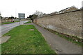
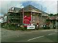
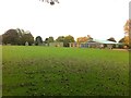
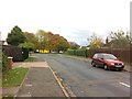
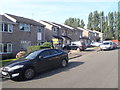
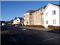
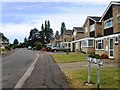
Photos of NN3 6PP


Area Information
Living in NN3 6PP offers a compact, tightly knit residential experience in a small cluster of homes. With a population of 1625 spread across 4912 square metres, the area is densely populated, reflecting a community that prioritises proximity to essential services. The median age of 47 suggests a mature demographic, with adults aged 30-64 forming the largest group. Daily life here is shaped by practicality, with residents relying on nearby amenities for shopping, transport, and education. The postcode’s proximity to Northampton Railway Station and multiple bus interchanges ensures connectivity to the wider region, while the area’s broadband score of 100 underscores its appeal for remote workers. However, the medium crime risk score of 49 means residents should remain vigilant. Despite its small size, NN3 6PP balances convenience with the challenges of high density, making it a viable option for those seeking a manageable, service-rich environment.
- Area Type
- Postcode
- Area Size
- 4912 m²
- Population
- 1625
- Population Density
- 4158 people/km²
The property market in NN3 6PP is characterised by a 58% home ownership rate, with houses forming the predominant accommodation type. This suggests a residential area where owner-occupation is common, though not universal. The small size of the postcode—4912 square metres—means the housing stock is limited, and buyers should consider the immediate surroundings for more options. The focus on houses rather than flats or apartments indicates a preference for traditional family homes. However, the high population density may mean properties are closely spaced, which could be a consideration for those seeking larger plots. For buyers, the area’s compact nature means proximity to amenities is a key advantage, though the market may lack the diversity of larger towns.
House Prices in NN3 6PP
Showing 13 properties
| Address | Type | Beds | Baths | Last Sale Price | Last Sale Date | |
|---|---|---|---|---|---|---|
| 8 Appleby Walk, Northampton, NN3 6PP | house | - | - | £230,000 | Jul 2024 | |
| 1 Appleby Walk, Northampton, NN3 6PP | Terraced | 3 | 1 | £168,000 | Feb 2019 | |
| 3 Appleby Walk, Northampton, NN3 6PP | house | - | - | £95,000 | Jul 2015 | |
| 5 Appleby Walk, Northampton, NN3 6PP | house | 3 | 1 | £88,000 | Dec 2011 | |
| 6 Appleby Walk, Northampton, NN3 6PP | house | 3 | - | £102,000 | Mar 2011 | |
| 7 Appleby Walk, Northampton, NN3 6PP | Terraced | 3 | - | £90,000 | Oct 2005 | |
| 12 Appleby Walk, Northampton, NN3 6PP | Terraced | 3 | 1 | £67,210 | Feb 2004 | |
| 2 Appleby Walk, Northampton, NN3 6PP | Terraced | 3 | 1 | - | - | |
| 11 Appleby Walk, Northampton, NN3 6PP | Terraced | - | - | - | - | |
| 14 Appleby Walk, Northampton, NN3 6PP | house | - | - | - | - |
Energy Efficiency in NN3 6PP
The lifestyle in NN3 6PP is shaped by its proximity to retail and transport hubs. Nearby shops include Tesco Spinny, Co-op Bushland, and Morrisons Kingsley, offering a range of grocery and everyday goods. While the data does not mention dining or leisure venues, the presence of multiple retail outlets suggests convenience for daily errands. The area’s transport links to Northampton’s bus and rail networks provide access to broader cultural and recreational opportunities in the city. However, the lack of named parks or leisure facilities in the data implies residents may need to travel for outdoor activities. The compact nature of the area means amenities are closely clustered, which can be both a convenience and a limitation depending on individual needs.
Amenities
Schools
The nearest school to NN3 6PP is Boothville Primary School, which holds a ‘good’ Ofsted rating. As a primary school, it serves the needs of younger families in the area, though no secondary schools are listed in the data. This means parents may need to look beyond NN3 6PP for secondary education options. The presence of a well-rated primary school is a positive factor for families with young children, offering a reliable foundation for early education. However, the absence of secondary schools nearby could be a limitation for households planning long-term stays. The school’s rating suggests a satisfactory standard of teaching and facilities, but further research would be needed to assess its capacity and catchment area.
| Rank | School | Type | Entry gender | Ages |
|---|
Explore more schools in this area
Go to Schools tabDemographics
The community in NN3 6PP is predominantly composed of adults aged 30-64, with a median age of 47. This suggests a stable, mature population, likely with established careers and family ties. Home ownership stands at 58%, indicating a mix of owner-occupied properties and rental units. The accommodation type is primarily houses, which aligns with the area’s residential character. The predominant ethnic group is White, reflecting a homogenous demographic profile. While the data does not specify deprivation levels, the high population density of 330,827 people per square kilometre implies limited space for expansion, which could affect quality of life for growing families. The age distribution and ownership rates suggest a community focused on long-term stability rather than transient living.
Household Size
Accommodation Type
Tenure
Ethnic Group
Religion
Household Composition
Age
Household Deprivation
NS-SEC
Explore more demographic insights in this area
Go to Demographics tabPlanning
Planning Constraints
- Flood RiskPremium
- Ramsar Wetland SitesPremium
- Area of Outstanding Natural BeautyPremium
- Protected Nature ReservePremium
- Protected WoodlandPremium