Area Overview for NN3 6HN
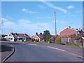
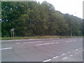
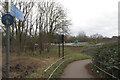
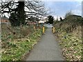
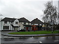
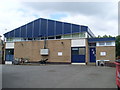
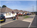
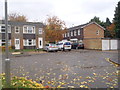
Photos of NN3 6HN


Area Information
Living in NN3 6HN offers a compact, densely populated residential environment within a small cluster of 2.3 hectares. With 1,625 residents, the area is characterised by a high population density of 70,998 people per square kilometre, reflecting a tightly knit community. This postcode is positioned near key transport hubs, including Northampton Railway Station and two major bus interchanges, making it practical for commuters. Daily life here is shaped by proximity to retail options such as Tesco Spinny, Co-op Bushland, and Morrisons Kingsley, ensuring convenience for shopping and dining. The area’s small size means residents are close to essential services, though the limited space may influence the character of the neighbourhood. For families, the presence of Boothville Primary School, rated ‘good’ by Ofsted, adds to the appeal. While the area lacks expansive green spaces or protected natural sites, its accessibility to urban amenities and transport links makes it a practical choice for those prioritising connectivity over rural tranquillity.
- Area Type
- Postcode
- Area Size
- 2.3 hectares
- Population
- 1625
- Population Density
- 4158 people/km²
NN3 6HN is primarily an owner-occupied area, with 58% of properties owned by their residents. The accommodation type is predominantly houses, which contrasts with areas where flats or apartments dominate. This suggests a focus on family homes or larger properties, which may influence the local property market’s character. Given the area’s small size and high population density, the housing stock is likely limited, meaning buyers may need to consider nearby areas for more options. The high home ownership rate indicates a stable market, but the absence of rental data means it is unclear whether this is a buyer’s or landlord’s market. For those seeking a home in NN3 6HN, the compact nature of the area means proximity to amenities is a key advantage, though property availability may be constrained by the postcode’s size.
House Prices in NN3 6HN
Showing 39 properties
| Address | Type | Beds | Baths | Last Sale Price | Last Sale Date | |
|---|---|---|---|---|---|---|
| 520 Kettering Road North, Northampton, NN3 6HN | Terraced | 3 | 1 | £222,000 | Oct 2025 | |
| 526 Kettering Road North, Northampton, NN3 6HN | Terraced | 3 | 1 | £220,000 | Dec 2024 | |
| 582 Kettering Road North, Northampton, NN3 6HN | Bungalow | 2 | 1 | £360,000 | Aug 2023 | |
| 524 Kettering Road North, Northampton, NN3 6HN | house | - | - | £215,000 | Dec 2021 | |
| 554 Kettering Road North, Northampton, NN3 6HN | house | - | - | £320,000 | Nov 2020 | |
| 522 Kettering Road North, Northampton, NN3 6HN | Terraced | 3 | - | £167,000 | Jan 2020 | |
| 552 Kettering Road North, Northampton, NN3 6HN | house | - | - | £181,505 | Jun 2019 | |
| 586 Kettering Road North, Northampton, NN3 6HN | Semi-detached | 3 | 1 | £259,995 | Aug 2018 | |
| 570 Kettering Road North, Northampton, NN3 6HN | Semi-detached | 3 | - | £285,000 | Mar 2018 | |
| 590 Kettering Road North, Northampton, NN3 6HN | house | - | - | £377,500 | Dec 2016 |
Energy Efficiency in NN3 6HN
The lifestyle in NN3 6HN is shaped by its proximity to retail and transport hubs. Local shops such as Tesco Spinny, Co-op Bushland, and Morrisons Kingsley provide everyday essentials, reducing the need for long journeys. The area’s transport links, including Northampton Railway Station and two bus interchanges, offer easy access to broader urban amenities. While there is no mention of parks or leisure facilities in the data, the compact layout ensures residents are close to services. The presence of Boothville Primary School adds to the community’s character, supporting families. However, the absence of green spaces or recreational areas may be a drawback for those seeking outdoor activities. Overall, the area prioritises convenience over expansive leisure options, catering to those who value accessibility over natural surroundings.
Amenities
Schools
The nearest school to NN3 6HN is Boothville Primary School, which serves the local community with a ‘good’ Ofsted rating. This institution provides education for younger children, making it a critical factor for families with primary-school-aged children. The absence of secondary schools or further education institutions in the data suggests that students may need to travel to nearby areas for higher education. The presence of a well-rated primary school enhances the area’s appeal for families, though the lack of additional schools could be a consideration for those requiring a full range of educational options. The school’s performance reflects positively on the local infrastructure, but parents should verify whether secondary schooling is accessible within a reasonable distance.
| Rank | School | Type | Entry gender | Ages |
|---|
Explore more schools in this area
Go to Schools tabDemographics
The population of NN3 6HN skews towards adults aged 30–64, with a median age of 47. This suggests a mature, stable community where most residents are likely to be established professionals or families. Home ownership is high at 58%, with houses being the predominant type of accommodation. The demographic data indicates a predominantly White population, though specific diversity metrics are not provided. The age profile implies a lower proportion of younger residents or retirees compared to other areas, which may influence local services and amenities. With a population density over 70,000 per square kilometre, the area is intensely populated, which could affect living conditions and community dynamics. The lack of data on deprivation means it is unclear how economic factors might impact quality of life, but the high home ownership rate suggests a degree of financial stability among residents.
Household Size
Accommodation Type
Tenure
Ethnic Group
Religion
Household Composition
Age
Household Deprivation
NS-SEC
Explore more demographic insights in this area
Go to Demographics tabPlanning
Planning Constraints
- Flood RiskPremium
- Ramsar Wetland SitesPremium
- Area of Outstanding Natural BeautyPremium
- Protected Nature ReservePremium
- Protected WoodlandPremium