Area Overview for NN3 2SH
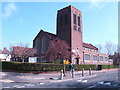
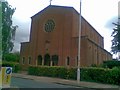
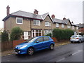
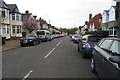
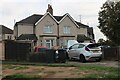
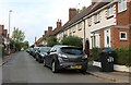
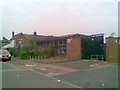
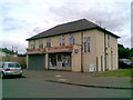
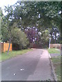
Photos of NN3 2SH
Area Information
Living in NN3 2SH means inhabiting a compact, residential postcode area in England that is both densely populated and tightly defined. Covering just 3,862 square metres, this small cluster of homes accommodates 1,595 residents, translating to a population density of 413,012 people per square kilometre. The area’s character is shaped by its mature demographic, with a median age of 47 and a majority of residents aged 30–64. This suggests a community rooted in stability, with many long-term residents and families. The high home ownership rate of 75% and the prevalence of houses over flats indicate a focus on private, family-oriented living. While the area is small, it is well-connected to nearby amenities, from retail hubs to transport links, making it practical for daily life. The absence of environmental constraints like protected woodlands or AONB designations means development is not restricted, though the area remains low-risk for flooding. For those seeking a tightly knit, established neighbourhood with access to essential services, NN3 2SH offers a blend of practicality and proximity.
- Area Type
- Postcode
- Area Size
- 3862 m²
- Population
- 1595
- Population Density
- 6430 people/km²
The property market in NN3 2SH is characterised by a high rate of home ownership (75%) and a focus on houses rather than flats or apartments. This suggests a market skewed towards owner-occupied properties, with limited rental availability. The prevalence of houses indicates a demand for family homes, likely catering to the area’s mature demographic of adults aged 30–64. Given the small size of the postcode area (3,862 m²), the housing stock is likely limited, making the market competitive for buyers. The compact nature of the area means that properties are closely clustered, which could be a consideration for those seeking space or privacy. For buyers, this small, densely populated area offers a mix of established homes but may lack the variety of housing types found in larger neighbourhoods. The high home ownership rate also implies a stable market with fewer short-term rental pressures.
House Prices in NN3 2SH
Showing 8 properties
| Address | Type | Beds | Baths | Last Sale Price | Last Sale Date | |
|---|---|---|---|---|---|---|
| 6 Lindsay Avenue, Northampton, NN3 2SH | Semi-detached | 3 | 1 | £273,000 | Apr 2023 | |
| 3 Lindsay Avenue, Northampton, NN3 2SH | Semi-detached | 3 | - | £248,000 | Sep 2021 | |
| 5 Lindsay Avenue, Northampton, NN3 2SH | Semi-detached | 3 | - | £155,000 | Jul 2016 | |
| 2 Lindsay Avenue, Northampton, NN3 2SH | Semi-detached | - | - | £130,000 | Jul 2004 | |
| 1 Lindsay Avenue, Northampton, NN3 2SH | Semi-detached | - | - | £95,000 | Jun 2003 | |
| 4 Lindsay Avenue, Northampton, NN3 2SH | house | - | - | - | - | |
| 8 Lindsay Avenue, Northampton, NN3 2SH | house | - | - | - | - | |
| 7 Lindsay Avenue, Northampton, NN3 2SH | Semi-detached | - | - | - | - |
Energy Efficiency in NN3 2SH
The lifestyle in NN3 2SH is shaped by its proximity to essential amenities and retail hubs. Within practical reach are five retail outlets, including Co-op Birchfield and Co-op Bushland, offering everyday shopping needs. The presence of the University Bus Interchange and Northampton Bus Interchange ensures easy access to public transport, facilitating travel to nearby towns or workplaces. While the area lacks detailed information on parks or leisure facilities, its transport links and retail options suggest a practical, service-oriented daily life. The compact nature of the area means residents can access shops, dining, and transport without long commutes. For those valuing convenience over expansive recreational spaces, NN3 2SH provides a functional environment with direct access to the essentials.
Amenities
Schools
Residents of NN3 2SH have access to a range of educational institutions, including Cedar Road Primary School, which holds an Ofsted rating of ‘good’, and Weston Favell Preparatory School, an independent institution. The presence of two Cedar Road Primary Schools suggests a strong local focus on primary education, with one receiving a positive evaluation from inspectors. For families seeking independent schooling, Weston Favell offers an alternative to state-run options. The mix of school types provides flexibility, allowing parents to choose between state and private education. However, no secondary schools are listed in the data, which may require families to look beyond the immediate area for comprehensive schooling. The proximity of these schools to homes in NN3 2SH makes them a practical option for daily commutes, reinforcing the area’s appeal for families.
| Rank | School | Type | Entry gender | Ages |
|---|
Explore more schools in this area
Go to Schools tabDemographics
The community in NN3 2SH is predominantly composed of adults aged 30–64, with a median age of 47. This suggests a mature population, likely with established careers and families. Home ownership is high at 75%, indicating a strong presence of long-term residents rather than renters. The accommodation type is primarily houses, reflecting a preference for private, family-sized properties. The predominant ethnic group is White, though no specific data on diversity or deprivation is provided. The population density of 413,012 people per square kilometre is exceptionally high for such a small area, which may influence the character of daily life, fostering a sense of closeness among residents. This density, combined with the age profile, points to a community that values stability and continuity. However, the lack of specific data on income levels or diversity means broader conclusions about quality of life remain limited to the given statistics.
Household Size
Accommodation Type
Tenure
Ethnic Group
Religion
Household Composition
Age
Household Deprivation
NS-SEC
Explore more demographic insights in this area
Go to Demographics tabPlanning
Planning Constraints
- Flood RiskPremium
- Ramsar Wetland SitesPremium
- Area of Outstanding Natural BeautyPremium
- Protected Nature ReservePremium
- Protected WoodlandPremium