Area Overview for NN3 2SN
Photos of NN3 2SN


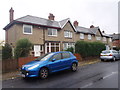
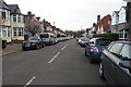
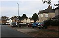
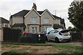
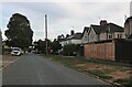
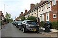
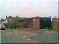
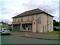
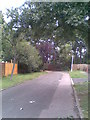
75 photos from this area
Area Information
Key information about the NN3 2SN including its size, population, and administrative classification.
- Area Type
- Postcode
- Area Size
- 6159 m²
- Population
- 1689
- Population Density
- 8152 people/km²
House Prices in NN3 2SN
27
Properties
£147,230
Average Sold Price
£57,000
Lowest Price
£215,000
Highest Price
Showing 27 properties
| Address | Type | Beds | Baths | Last Sale Price | Last Sale Date | |
|---|---|---|---|---|---|---|
| 248 Birchfield Road East, Northampton, NN3 2SN | Terraced | 2 | 1 | £215,000 | Feb 2024 | |
| 244 Birchfield Road East, Northampton, NN3 2SN | house | 2 | - | £160,000 | Apr 2022 | |
| 230 Birchfield Road East, Northampton, NN3 2SN | Terraced | 2 | - | £190,000 | Aug 2021 | |
| 250 Birchfield Road East, Northampton, NN3 2SN | Terraced | 2 | - | £155,000 | Feb 2020 | |
| 275 Birchfield Road East, Northampton, NN3 2SN | Terraced | 2 | - | £159,000 | Jul 2019 | |
| 273 Birchfield Road East, Northampton, NN3 2SN | Terraced | 2 | 1 | £170,000 | Nov 2018 | |
| 228 Birchfield Road East, Northampton, NN3 2SN | Terraced | 2 | - | £159,995 | Dec 2016 | |
| 252 Birchfield Road East, Northampton, NN3 2SN | Semi-detached | 3 | - | £199,995 | Aug 2016 | |
| 246 Birchfield Road East, Northampton, NN3 2SN | house | 2 | - | £130,000 | Jun 2016 | |
| 267 Birchfield Road East, Northampton, NN3 2SN | Terraced | 2 | 1 | £135,000 | May 2015 |
Page 1 of 3
Energy Efficiency in NN3 2SN
Amenities
Schools
| Rank | School | Type | Entry gender | Ages |
|---|
Explore more schools in this area
Go to Schools tabDemographics
Household Size
Family (3-5 people)
most common
Accommodation Type
Houses
most common
Tenure
47
majority
Ethnic Group
White
most common
Religion
N/A
most common
Household Composition
N/A
most common
Age
47
median
Adults (30-64 years)
most common
Household Deprivation
N/A
with no deprivation
NS-SEC
20
in Lower managerial occupations
Explore more demographic insights in this area
Go to Demographics tabPlanning
Planning Constraints
- Flood RiskPremium
- Ramsar Wetland SitesPremium
- Area of Outstanding Natural BeautyPremium
- Protected Nature ReservePremium
- Protected WoodlandPremium