Area Overview for NN3 2SG
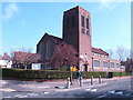
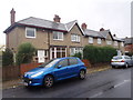
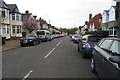
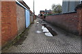
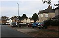
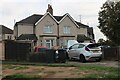
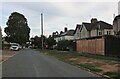
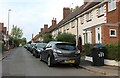
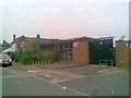
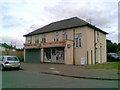
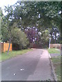
Photos of NN3 2SG

Area Information
NN3 2SG is a small, densely populated residential area in England, covering just 2.3 hectares and home to 1,689 residents. Its compact size means it is a tight-knit community, with a high population density of 73,998 people per square kilometre. This postcode area is characterised by its cluster of homes, primarily single-family properties, and its proximity to key transport hubs. Daily life here is shaped by its practical location, with nearby retail outlets, bus routes, and a railway station providing easy access to Northampton and surrounding areas. While the area lacks natural reserves or protected landscapes, its strength lies in its connectivity and the availability of essential services. Residents benefit from excellent broadband infrastructure, with a score of 99 for fixed broadband, ensuring reliable internet for work and leisure. However, the area’s high crime risk score of 33 means residents should consider security measures. For those seeking a compact, functional living space with access to transport and amenities, NN3 2SG offers a straightforward, no-frills environment.
- Area Type
- Postcode
- Area Size
- 2.3 hectares
- Population
- 1689
- Population Density
- 8152 people/km²
The property market in NN3 2SG is dominated by single-family homes, with no flats or apartments present. Home ownership stands at 47%, meaning nearly half of residents rent their homes. This suggests a mixed market, with a significant portion of the housing stock available for rental. Given the area’s small size—just 2.3 hectares—properties are likely to be close together, with limited scope for expansion. The predominance of houses over other accommodation types indicates a focus on traditional, family-friendly living. For buyers, this means a limited selection of homes, all of which are likely to be owner-occupied or long-term rental properties. The compact nature of the area means any new developments would need to integrate with existing structures, making it a niche market for those prioritising proximity to transport and amenities over larger living spaces.
House Prices in NN3 2SG
Showing 58 properties
| Address | Type | Beds | Baths | Last Sale Price | Last Sale Date | |
|---|---|---|---|---|---|---|
| 16 Norman Road, Northampton, NN3 2SG | Semi-detached | 3 | 1 | £260,000 | Jul 2025 | |
| 35 Norman Road, Northampton, NN3 2SG | Semi-detached | 1 | 1 | £255,000 | Aug 2024 | |
| 22 Norman Road, Northampton, NN3 2SG | Semi-detached | 3 | 1 | £265,000 | Aug 2023 | |
| 15 Norman Road, Northampton, NN3 2SG | house | 3 | 3 | £286,500 | Nov 2022 | |
| 17 Norman Road, Northampton, NN3 2SG | Retail | 3 | 1 | £295,000 | Jun 2022 | |
| 48 Norman Road, Northampton, NN3 2SG | house | - | - | £230,000 | Oct 2021 | |
| 56 Norman Road, Northampton, NN3 2SG | Semi-detached | 3 | 2 | £265,000 | Aug 2021 | |
| 68 Norman Road, Northampton, NN3 2SG | house | - | - | £230,000 | Jan 2021 | |
| 46 Norman Road, Northampton, NN3 2SG | Semi-detached | 3 | - | £195,000 | Jun 2019 | |
| 66 Norman Road, Northampton, NN3 2SG | Semi-detached | 3 | 1 | £170,000 | May 2019 |
Energy Efficiency in NN3 2SG
Living in NN3 2SG offers access to essential retail and transport hubs. The area includes five notable retail outlets, such as Co-op Birchfield, Aldi Headlands, and Co-op Bushland, providing everyday shopping convenience. Two bus interchanges—University Bus Interchange and Northampton Bus Interchange—offer regular services, while the Northampton Railway Station connects residents to broader networks. These amenities create a practical, accessible lifestyle, with minimal need to travel far for essentials. The presence of multiple retail options and transport links suggests a community focused on efficiency rather than leisure. While there are no parks or recreational spaces listed, the proximity to transport and shopping areas compensates with convenience. The area’s character is defined by its functionality, catering to those prioritising accessibility over expansive green spaces.
Amenities
Schools
| Rank | School | Type | Entry gender | Ages |
|---|
Explore more schools in this area
Go to Schools tabDemographics
The community in NN3 2SG is predominantly middle-aged, with a median age of 47 and the most common age range being adults aged 30–64. This suggests a population skewed towards established professionals and families. Home ownership here is relatively low, with 47% of residents owning their homes, while the remaining 53% likely rent. The area is composed almost entirely of houses, with no flats or apartments reported, indicating a traditional, family-oriented housing stock. The predominant ethnic group is White, though no data is provided on minority representation. The high population density—73,998 people per square kilometre—suggests a mix of households, though specific deprivation data is not available. The age profile and housing type suggest a stable, long-term resident base, though the lack of diversity data limits a full understanding of the community’s social fabric.
Household Size
Accommodation Type
Tenure
Ethnic Group
Religion
Household Composition
Age
Household Deprivation
NS-SEC
Explore more demographic insights in this area
Go to Demographics tabPlanning
Planning Constraints
- Flood RiskPremium
- Ramsar Wetland SitesPremium
- Area of Outstanding Natural BeautyPremium
- Protected Nature ReservePremium
- Protected WoodlandPremium