Area Overview for NN3 2HJ
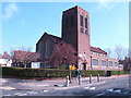
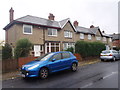
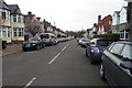
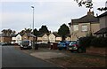
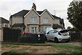
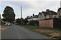
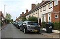
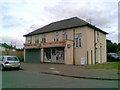
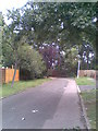
Photos of NN3 2HJ


Area Information
NN3 2HJ is a compact residential postcode in England, covering just 4,833 square metres and home to 1,689 people. Its population density of 349,496 people per square kilometre reflects its small, tightly packed nature, typical of a residential cluster. The area is characterised by a mature demographic, with a median age of 47 and most residents falling within the 30-64 age range. This suggests a community of established adults, likely with families or long-term tenure in the area. The housing stock is predominantly houses, not flats, which is unusual for such a small area. While the postcode itself is limited in size, its proximity to Northampton’s transport hubs and retail centres offers practical access to amenities. The broadband score of 99 ensures reliable internet connectivity, while the nearby Northampton Railway Station and two bus interchanges provide easy access to regional travel. However, the area’s high crime risk score of 33 means residents should be mindful of security measures. For those seeking a quiet, established residential environment with access to urban services, NN3 2HJ offers a unique blend of compact living and connectivity.
- Area Type
- Postcode
- Area Size
- 4833 m²
- Population
- 1689
- Population Density
- 8152 people/km²
The property market in NN3 2HJ is defined by its small size and limited housing stock. With 47% of residents owning their homes, the area is not heavily dominated by rental properties, though the exact proportion of renters is not specified. The accommodation type is exclusively houses, which is unusual for such a compact postcode. This suggests a mix of semi-detached and terraced housing, typical of older residential areas. Given the area’s small footprint, the property market is likely constrained, with limited new developments. Buyers should consider the proximity to Northampton’s amenities, including retail and transport links, which may offset the area’s density. However, the high crime risk score of 33 could influence property values and desirability. For those seeking a house in a small, established community with access to urban services, NN3 2HJ offers a niche opportunity, though its limited size may require buyers to look beyond the immediate postcode for more options.
House Prices in NN3 2HJ
Showing 24 properties
| Address | Type | Beds | Baths | Last Sale Price | Last Sale Date | |
|---|---|---|---|---|---|---|
| 14 Briton Terrace, Northampton, NN3 2HJ | Flat | - | - | - | - | |
| 18 Briton Terrace, Northampton, NN3 2HJ | Maisonette | - | - | - | - | |
| 16 Briton Terrace, Northampton, NN3 2HJ | Flat | - | - | - | - | |
| 13 Briton Terrace, Northampton, NN3 2HJ | house | - | - | - | - | |
| 7 Briton Terrace, Northampton, NN3 2HJ | Maisonette | - | - | - | - | |
| 10 Briton Terrace, Northampton, NN3 2HJ | Maisonette | - | - | - | - | |
| 1 Briton Terrace, Northampton, NN3 2HJ | Maisonette | - | - | - | - | |
| 5 Briton Terrace, Northampton, NN3 2HJ | house | - | - | - | - | |
| 8 Briton Terrace, Northampton, NN3 2HJ | Maisonette | - | - | - | - | |
| 2 Briton Terrace, Northampton, NN3 2HJ | Maisonette | - | - | - | - |
Energy Efficiency in NN3 2HJ
Daily life in NN3 2HJ is shaped by its proximity to practical amenities. Within reach are five retail outlets, including Co-op Birchfield, Tesco Kingsley, and M&S Abington Ave Northampton BP, providing essential shopping and dining options. The area’s transport links, such as the Northampton Railway Station and two bus interchanges, ensure easy access to the city’s cultural and commercial hubs. While the postcode itself is small, its connection to Northampton means residents can enjoy the city’s broader offerings. The absence of large parks or leisure facilities within the postcode suggests that outdoor activities may require travel to nearby green spaces. However, the presence of multiple retail and transport options enhances convenience. The community’s mature demographic and house-based housing stock create a stable, low-key environment. For those prioritising accessibility over expansive leisure options, NN3 2HJ offers a practical, compact lifestyle with reliable access to urban amenities.
Amenities
Schools
| Rank | School | Type | Entry gender | Ages |
|---|
Explore more schools in this area
Go to Schools tabDemographics
The community in NN3 2HJ is predominantly composed of adults aged 30-64, with a median age of 47. This suggests a population of middle-aged individuals, many of whom may be in their prime working years or nearing retirement. Home ownership stands at 47%, indicating that nearly half of residents own their properties, while the remaining 53% likely rent. The accommodation type is exclusively houses, not flats, which is uncommon for a small postcode area. The predominant ethnic group is White, with no specific data provided on other demographics. The high population density of 349,496 people per square kilometre implies a tightly packed residential layout, which may influence the character of daily life. While the data does not include deprivation metrics, the age profile and housing type suggest a stable, mature community. However, the high crime risk score of 33 may impact perceived safety and quality of life for some residents.
Household Size
Accommodation Type
Tenure
Ethnic Group
Religion
Household Composition
Age
Household Deprivation
NS-SEC
Explore more demographic insights in this area
Go to Demographics tabPlanning
Planning Constraints
- Flood RiskPremium
- Ramsar Wetland SitesPremium
- Area of Outstanding Natural BeautyPremium
- Protected Nature ReservePremium
- Protected WoodlandPremium