Area Overview for NN18 9BE
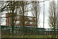
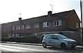
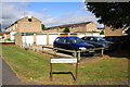
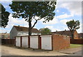
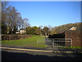
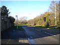
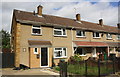
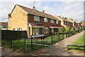
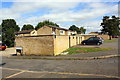
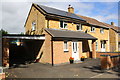
Photos of NN18 9BE


Area Information
NN18 9BE is a compact residential postcode in Corby, Northamptonshire, covering just 4.3 hectares with a dense population of 1,489 people. This small cluster sits within a town historically shaped by industry, designated a new town in 1950 to accommodate growth driven by steelworks. Today, the area reflects a mature community, with a median age of 47 and a population skewed toward adults aged 30–64. Daily life here is defined by proximity to essential services, with nearby primary schools, retail outlets, and transport links. The area’s compact size means residents are close to amenities, though its industrial legacy persists in the broader Corby landscape. For buyers, NN18 9BE offers a mix of owner-occupied homes and a tightly knit community, though the high population density may influence property availability. Its location near Corby Railway Station and Kettering adds connectivity to nearby towns, while the absence of major natural constraints ensures development potential remains limited to local planning.
- Area Type
- Postcode
- Area Size
- 4.3 hectares
- Population
- 1489
- Population Density
- 2107 people/km²
The property market in NN18 9BE is dominated by owner-occupied homes, with 63% of residents owning their properties. This suggests a stable market with limited rental activity, as the area is not characterised by high turnover or transient populations. The accommodation type is primarily houses, not flats or apartments, which aligns with the demographic of middle-aged adults and families. Given the small area size of 4.3 hectares, the housing stock is likely limited, making the market competitive for buyers. The high population density may mean properties are closely spaced, with little scope for expansion. For prospective buyers, this indicates a focus on existing homes rather than new developments, though the absence of planning constraints such as protected woodlands or AONB designations suggests potential for future growth. However, the compact nature of the area means buyers should consider proximity to amenities and transport links as critical factors.
House Prices in NN18 9BE
Showing 100 properties
| Address | Type | Beds | Baths | Last Sale Price | Last Sale Date | |
|---|---|---|---|---|---|---|
| 24 Southbrook, Corby, NN18 9BE | Bungalow | 2 | 1 | £238,000 | Sep 2024 | |
| 47 Southbrook, Corby, NN18 9BE | Terraced | 3 | 1 | £203,000 | Mar 2023 | |
| 67 Southbrook, Corby, NN18 9BE | house | - | - | £175,000 | Mar 2023 | |
| 21 Southbrook, Corby, NN18 9BE | house | - | - | £160,000 | Jan 2023 | |
| 36 Southbrook, Corby, NN18 9BE | house | 4 | 3 | £360,000 | Jul 2022 | |
| 61 Southbrook, Corby, NN18 9BE | Flat | 2 | 1 | £112,000 | Aug 2021 | |
| 86 Southbrook, Corby, NN18 9BE | house | 4 | 1 | £225,000 | Sep 2020 | |
| 44 Southbrook, Corby, NN18 9BE | Detached | 3 | 1 | £215,000 | Feb 2020 | |
| 50 Southbrook, Corby, NN18 9BE | Detached | - | - | £270,000 | Feb 2020 | |
| 5 Southbrook, Corby, NN18 9BE | Terraced | 3 | 1 | £140,000 | Dec 2019 |
Energy Efficiency in NN18 9BE
Residents of NN18 9BE have access to a range of retail and dining options, including Morrisons Daily Corby, Morrisons Oakley, and Tesco Oakley, all within practical reach. These supermarkets provide convenience for daily shopping, while the nearby rail stations and bus interchange offer connectivity to broader networks. The area’s small size means amenities are closely clustered, reducing the need for long commutes. Though no parks or leisure facilities are explicitly listed in the data, the absence of protected natural areas or planning constraints suggests open spaces may be limited. The presence of multiple primary schools and retail outlets indicates a focus on family needs, with a lifestyle that balances practicality and accessibility. For those prioritising convenience, the proximity of essential services and transport links makes NN18 9BE a viable choice, though larger recreational options may require travel to nearby towns.
Amenities
Schools
Residents of NN18 9BE have access to three primary schools within practical reach: Corby Kingswood Primary School, Kingswood Community Junior School, and Kingswood Primary Academy, which holds an Ofsted rating of ‘good’. These schools cater to young children, providing a range of primary education options. The presence of multiple primary schools suggests a focus on early education, which is beneficial for families with young dependents. Kingswood Primary Academy’s ‘good’ rating indicates a standard of education that meets regulatory benchmarks, though no secondary schools are listed in the data. For parents, the proximity of these schools reduces commuting time and supports a family-oriented lifestyle. The absence of secondary schools may require students to travel to nearby towns, but the overall availability of primary education is a strength of the area for families.
| Rank | School | Type | Entry gender | Ages |
|---|
Explore more schools in this area
Go to Schools tabDemographics
The population of NN18 9BE is predominantly adults aged 30–64, with a median age of 47. This suggests a community of established professionals and families, rather than a younger demographic. Home ownership is high at 63%, indicating a stable, long-term resident base. The area is characterised by houses, not flats, which aligns with a preference for traditional family homes. The predominant ethnic group is White, though specific diversity data is not provided. With a population density of 34,829 people per square kilometre, the area is highly compact, which may influence living conditions and community dynamics. The absence of specific deprivation data means quality of life cannot be fully contextualised, but the low crime score of 71/100 suggests safety is a key factor for residents. This profile paints a picture of a mature, settled community with limited turnover, where housing is primarily owner-occupied and family-focused.
Household Size
Accommodation Type
Tenure
Ethnic Group
Religion
Household Composition
Age
Household Deprivation
NS-SEC
Explore more demographic insights in this area
Go to Demographics tabPlanning
Planning Constraints
- Flood RiskPremium
- Ramsar Wetland SitesPremium
- Area of Outstanding Natural BeautyPremium
- Protected Nature ReservePremium
- Protected WoodlandPremium