Area Overview for NN18 9FJ
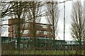
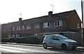
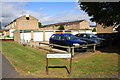
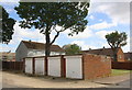
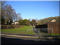
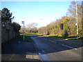
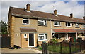
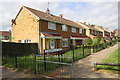
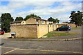
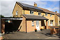
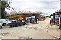
Photos of NN18 9FJ

Area Information
Living in NN18 9FJ means being part of a tightly knit residential cluster in Corby, Northamptonshire. This small postcode area spans 4,950 square metres and is home to 1,613 people, making it one of the most densely populated areas in the region. Corby itself, the town that encompasses this postcode, has a history rooted in industry, designated as a new town in 1950 to accommodate post-war expansion. The area’s compact size means residents are close to essential services, though the population density—325,851 people per square kilometre—reflects a mix of long-standing and more recent arrivals. The town’s historical ties to steelmaking, which shaped its identity in the 20th century, still linger in its infrastructure, though the landscape now balances industrial legacy with modern residential living. For those seeking a community with a distinct character, NN18 9FJ offers proximity to Corby’s cultural landmarks, such as the Corby Pole Fair, while the surrounding area provides a blend of urban convenience and historical depth.
- Area Type
- Postcode
- Area Size
- 4950 m²
- Population
- 1613
- Population Density
- 7014 people/km²
The property market in NN18 9FJ is defined by a 37% home ownership rate, which implies that the majority of residents are renters. This contrasts with areas where owner-occupation is more common, suggesting a rental market that may cater to workers in nearby industries or commuters. The accommodation type is predominantly houses, which is notable in a densely populated postcode. This could indicate a mix of older, larger properties or newer developments designed for family living. Given the small area size and high population density, the housing stock is likely limited, which may influence property values and availability. Buyers considering this area should note the balance between residential demand and the constraints of a compact postcode, which may mean competition for properties and a focus on proximity to local amenities rather than expansive living spaces.
House Prices in NN18 9FJ
Showing 50 properties
| Address | Type | Beds | Baths | Last Sale Price | Last Sale Date | |
|---|---|---|---|---|---|---|
| 7 Gunnell Road, Corby, NN18 9FJ | Flat | 2 | 1 | £133,000 | Apr 2025 | |
| 9 Gunnell Road, Corby, NN18 9FJ | Semi-detached | 3 | 2 | £223,000 | Feb 2023 | |
| 21 Gunnell Road, Corby, NN18 9FJ | house | 2 | 1 | £185,000 | Jul 2022 | |
| 27 Gunnell Road, Corby, NN18 9FJ | Terraced | 2 | - | £144,000 | Dec 2019 | |
| 11 Gunnell Road, Corby, NN18 9FJ | house | - | - | £138,000 | Mar 2017 | |
| 5 Gunnell Road, Corby, NN18 9FJ | house | - | - | £114,000 | Mar 2015 | |
| 29 Gunnell Road, Corby, NN18 9FJ | house | - | - | £115,000 | Jul 2014 | |
| 13 Gunnell Road, Corby, NN18 9FJ | house | - | - | £105,000 | Jan 2013 | |
| 1 Gunnell Road, Corby, NN18 9FJ | house | 3 | - | £111,103 | Sep 2012 | |
| 17 Gunnell Road, Corby, NN18 9FJ | house | 2 | 1 | £90,003 | Aug 2012 |
Energy Efficiency in NN18 9FJ
The lifestyle in NN18 9FJ is shaped by its proximity to retail and transport hubs. Within practical reach are five retail outlets, including Morrisons Daily Corby (63–65), Morrisons Oakley, and Morrisons Daily, providing everyday shopping needs. The area’s rail links to Corby and Kettering stations, along with a bus interchange, offer convenient access to public transport, supporting both local and regional travel. While the data does not specify parks or leisure facilities, the historical industrial character of Corby suggests that recreational spaces may be limited compared to more suburban areas. Nonetheless, the compact layout ensures that essential services are within walking or short driving distance, fostering a practical, community-oriented lifestyle. The presence of multiple supermarkets and transport options indicates a focus on accessibility, though residents may need to venture slightly further for more specialised amenities.
Amenities
Schools
| Rank | School | Type | Entry gender | Ages |
|---|
Explore more schools in this area
Go to Schools tabDemographics
The community in NN18 9FJ is predominantly composed of adults aged 30–64, with a median age of 47. This suggests a mature population, likely with established careers and families. Home ownership rates here are 37%, indicating that a significant portion of residents rent rather than own their homes. The area is characterised by a high proportion of houses, which is unusual for a densely populated postcode, suggesting a mix of larger properties and perhaps some semi-detached or terraced housing. The predominant ethnic group is White, reflecting broader demographic trends in Northamptonshire. With no specific data on deprivation or income levels, it is unclear how economic factors influence quality of life, but the age profile and housing type suggest a stable, working-age population with a focus on long-term residency rather than transient demographics.
Household Size
Accommodation Type
Tenure
Ethnic Group
Religion
Household Composition
Age
Household Deprivation
NS-SEC
Explore more demographic insights in this area
Go to Demographics tabPlanning
Planning Constraints
- Flood RiskPremium
- Ramsar Wetland SitesPremium
- Area of Outstanding Natural BeautyPremium
- Protected Nature ReservePremium
- Protected WoodlandPremium