Area Overview for NN18 9HU
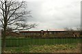
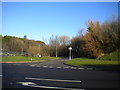
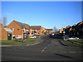
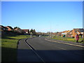
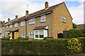
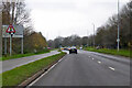
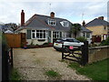
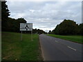
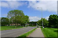
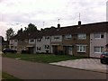
Photos of NN18 9HU


Area Information
NN18 9HU is a small residential cluster in Corby, Northamptonshire, a town designated as a new town in 1950. The area covers just 3.4 hectares, housing 1,489 people in a densely packed postcode. With a population density of 43,279 people per square kilometre, this is a compact, tightly knit community. Corby itself has a long history, from its 8th-century origins as a Danish settlement to its transformation into an industrial hub by the 1930s, when Stewarts & Lloyds built a steelworks that reshaped the town. Today, NN18 9HU reflects a mix of historical and modern influences. Residents here are predominantly adults aged 30–64, with a median age of 47, suggesting a community of established professionals and families. Daily life is shaped by proximity to local amenities, including primary schools, retail outlets, and rail links. The area’s compact size means residents are close to essential services, though its small footprint also means limited space for expansion. Living here offers a blend of convenience and proximity to Corby’s broader infrastructure, including its railway stations and industrial heritage.
- Area Type
- Postcode
- Area Size
- 3.4 hectares
- Population
- 1489
- Population Density
- 2107 people/km²
The property market in NN18 9HU is characterised by a high rate of home ownership (63%) and a predominance of houses. This suggests a community where long-term residency is the norm, with few rental properties available. The focus on houses, rather than flats or apartments, indicates a preference for traditional, family-oriented housing. Given the area’s small size—just 3.4 hectares—there is limited scope for new developments or larger housing projects. Buyers considering this area should expect a market dominated by owner-occupied properties, with limited availability for renters. The compact nature of the postcode means that properties are likely to be in close proximity to local amenities, including schools, retail, and transport links. However, the small footprint also means that the housing stock is finite, and competition for properties could be intense. For buyers, this suggests a need to act quickly if a suitable home becomes available, as the market may not offer many alternatives.
House Prices in NN18 9HU
Showing 12 properties
| Address | Type | Beds | Baths | Last Sale Price | Last Sale Date | |
|---|---|---|---|---|---|---|
| 13 Alberta Close, Corby, NN18 9HU | house | - | - | £220,000 | Jan 2015 | |
| 3 Alberta Close, Corby, NN18 9HU | house | - | - | £177,000 | May 2012 | |
| 7 Alberta Close, Corby, NN18 9HU | house | - | - | £175,000 | Feb 2012 | |
| 9 Alberta Close, Corby, NN18 9HU | Detached | - | - | £159,995 | Feb 2005 | |
| 1 Alberta Close, Corby, NN18 9HU | Detached | - | - | £103,000 | Dec 1999 | |
| 5 Alberta Close, Corby, NN18 9HU | house | - | - | £80,000 | Jan 1999 | |
| 33 Alberta Close, Corby, NN18 9HU | Land | 3 | - | - | - | |
| 15 Alberta Close, Corby, NN18 9HU | house | - | - | - | - | |
| 11 Alberta Close, Corby, NN18 9HU | Terraced | - | - | - | - | |
| 35 Alberta Close, Corby, NN18 9HU | Bungalow | - | - | - | - |
Energy Efficiency in NN18 9HU
Residents of NN18 9HU have access to a range of amenities within practical reach. Retail options include Morrisons Oakley, Morrisons Daily Corby 63–65, and Tesco Oakley, providing grocery and daily essentials. The area’s proximity to Corby’s rail network, including Corby and Kettering stations, enhances connectivity to nearby towns and cities. A bus interchange is also nearby, offering additional transport flexibility. While the area is small, its compact size ensures that shops, transport, and services are within walking or short driving distance. The presence of multiple retail outlets suggests a convenience-focused retail environment, though the absence of leisure or recreational facilities within the postcode means residents may need to travel further for parks or entertainment. The mix of retail and transport options supports a lifestyle that balances local convenience with regional accessibility, making it suitable for those prioritising practicality over expansive amenities.
Amenities
Schools
The schools nearest to NN18 9HU include Corby Kingswood Primary School, Kingswood Community Junior School, and Kingswood Primary Academy. All are primary schools, catering to children aged 4–11. Kingswood Primary Academy holds a good Ofsted rating, indicating a school that meets or exceeds national standards for teaching and pupil outcomes. The presence of three primary schools within the area suggests a strong local education infrastructure, though no secondary schools are listed. For families with young children, this cluster of primary schools provides multiple options for schooling, reducing the need to travel far for education. The good rating at Kingswood Primary Academy may be a particular draw for parents seeking quality education. However, the absence of secondary schools means families may need to look further afield for high school options, which could be a consideration for those planning long-term residency.
| Rank | School | Type | Entry gender | Ages |
|---|
Explore more schools in this area
Go to Schools tabDemographics
The community in NN18 9HU is predominantly composed of adults aged 30–64, making up the most common age range. With a median age of 47, this suggests a mature population, likely with established careers and families. Home ownership is high at 63%, indicating a stable, long-term resident base. The area is primarily composed of houses, reflecting a preference for traditional housing over flats or apartments. The predominant ethnic group is White, though no specific data on diversity or deprivation is provided. The high home ownership rate and adult demographic suggest a community focused on long-term residency rather than transient populations. The absence of specific data on deprivation means it is unclear how economic challenges might affect quality of life, but the low crime risk and safety score of 71/100 imply a generally secure environment. This demographic profile points to a place where families and professionals might find stability, though the small size of the area limits opportunities for expansion or new development.
Household Size
Accommodation Type
Tenure
Ethnic Group
Religion
Household Composition
Age
Household Deprivation
NS-SEC
Explore more demographic insights in this area
Go to Demographics tabPlanning
Planning Constraints
- Flood RiskPremium
- Ramsar Wetland SitesPremium
- Area of Outstanding Natural BeautyPremium
- Protected Nature ReservePremium
- Protected WoodlandPremium