Area Overview for NN18 9FD
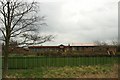
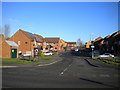
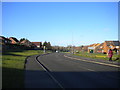
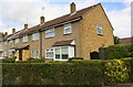
Photos of NN18 9FD


Area Information
NN18 9FD is a compact residential cluster in England, covering just 3.3 hectares and home to 1,613 residents. Its high population density of 49,021 people per square kilometre reflects a tightly knit community, typical of areas with limited expansion. Located in Corby, a town designated a new town in 1950, the area benefits from its industrial heritage while offering modern living. Corby’s history as a steelmaking hub, established in 1935, still shapes the town’s character, though the landscape here is more residential than industrial. Daily life in NN18 9FD is defined by proximity to essential services and transport links. The area’s small size means residents are close to amenities like supermarkets, rail stations, and bus routes, making it practical for commuters and families. With a median age of 47, the community is predominantly middle-aged, suggesting a stable, long-term presence. The postcode’s compact nature ensures a quiet, localised feel, though its connection to Corby’s broader infrastructure provides access to regional opportunities.
- Area Type
- Postcode
- Area Size
- 3.3 hectares
- Population
- 1613
- Population Density
- 7014 people/km²
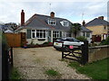
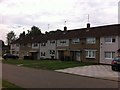
The property market in NN18 9FD is shaped by its small size and limited housing stock. With 37% of homes owned by residents, the area leans more towards rental occupancy than owner-occupation, which is typical for smaller, densely populated postcodes. The accommodation type here is primarily houses, which is noteworthy given the area’s compact nature. This suggests a mix of semi-detached or terraced properties, possibly inherited from Corby’s post-war development era. For buyers, the small footprint of NN18 9FD means competition for available homes is likely, and proximity to amenities like supermarkets and rail stations adds to its appeal. However, the limited land area restricts new construction, meaning the housing stock is unlikely to expand significantly. Investors should consider the balance between rental demand and the potential for property appreciation in a constrained market.
House Prices in NN18 9FD
Showing 21 properties
| Address | Type | Beds | Baths | Last Sale Price | Last Sale Date | |
|---|---|---|---|---|---|---|
| 6 Sharman Drive, Corby, NN18 9FD | Detached | 3 | 1 | £240,000 | Jul 2024 | |
| 18 Sharman Drive, Corby, NN18 9FD | Semi-detached | 4 | 2 | £234,000 | Aug 2021 | |
| 8 Sharman Drive, Corby, NN18 9FD | Bungalow | - | - | £170,000 | May 2021 | |
| 10 Sharman Drive, Corby, NN18 9FD | Bungalow | - | - | £178,000 | Nov 2020 | |
| 14 Sharman Drive, Corby, NN18 9FD | house | - | - | £220,000 | Jun 2019 | |
| 12 Sharman Drive, Corby, NN18 9FD | Semi-detached | 4 | 2 | £129,153 | Dec 2011 | |
| 5 Sharman Drive, Corby, NN18 9FD | Flat | - | - | £55,000 | Jun 2011 | |
| 16 Sharman Drive, Corby, NN18 9FD | house | - | - | £121,500 | May 2011 | |
| 11 Sharman Drive, Corby, NN18 9FD | house | - | - | £105,700 | May 2011 | |
| 125 Lincoln Way, Corby, NN18 9FD | undefined | - | - | £80,000 | Feb 2006 |
Energy Efficiency in NN18 9FD
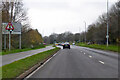
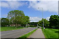
Living in NN18 9FD offers convenient access to essential amenities. Within practical reach are five retail outlets, including Morrisons Daily Corby, Tesco Oakley, and Morrisons Oakley, ensuring everyday shopping needs are met without long journeys. The area’s proximity to Corby and Kettering railway stations provides swift access to regional services, while the nearby bus interchange enhances local mobility. Though the postcode is small, the presence of multiple supermarkets and transport options suggests a functional, community-focused lifestyle. The compact nature of the area means residents are close to both local shops and broader infrastructure, blending convenience with the quiet charm of a residential cluster. For those who prefer walking or cycling, the density of services reduces reliance on cars, contributing to a practical, low-stress daily routine.
Amenities
Schools
| Rank | School | Type | Entry gender | Ages |
|---|
Explore more schools in this area
Go to Schools tabDemographics
The population of NN18 9FD is 1,613, with a median age of 47, indicating a mature demographic. The majority of residents fall within the 30-64 age range, suggesting a community of working-age adults and families. Home ownership here is relatively low at 37%, implying that a significant portion of the housing stock is rented. The area is predominantly composed of houses, which is unusual for a postcode of this size, hinting at a mix of older properties and newer developments. The predominant ethnic group is White, reflecting broader trends in the region. This demographic profile suggests a stable, established community with limited turnover. However, the low home ownership rate may indicate a reliance on rental markets, which could affect property values and investment potential. The absence of specific data on deprivation means its impact on quality of life remains unquantified, but the age profile and housing stock suggest a balanced, if modest, standard of living.
Household Size
Accommodation Type
Tenure
Ethnic Group
Religion
Household Composition
Age
Household Deprivation
NS-SEC
Explore more demographic insights in this area
Go to Demographics tabPlanning
Planning Constraints
- Flood RiskPremium
- Ramsar Wetland SitesPremium
- Area of Outstanding Natural BeautyPremium
- Protected Nature ReservePremium
- Protected WoodlandPremium