Area Overview for NN18 9FG
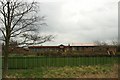
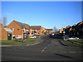
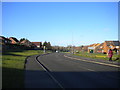
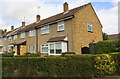
Photos of NN18 9FG


Area Information
NN18 9FG is a small residential cluster in Northamptonshire, part of the town of Corby, which was designated a new town in 1950. With a population of 1,613 spread across just 1,305 square metres, the area is densely populated, creating a compact community feel. Corby itself has a rich industrial history, shaped by the steelworks that transformed it from a small village into a major settlement by the late 1930s. Today, NN18 9FG reflects a mature demographic, with a median age of 47 and a majority of residents aged 30–64. Daily life here is practical and community-oriented, with access to essential services within walking or short driving distance. The area’s proximity to rail and bus networks, combined with excellent broadband connectivity, supports both local employment and remote working. While the town’s industrial roots remain evident, the modern landscape is defined by residential housing and a focus on accessibility, making it a viable choice for those seeking a balanced, functional living environment.
- Area Type
- Postcode
- Area Size
- 1305 m²
- Population
- 1613
- Population Density
- 7014 people/km²
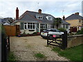
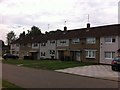
The property market in NN18 9FG is defined by a low home ownership rate of 37%, indicating that the area is more rental-focused than owner-occupied. The primary accommodation type is houses, which contrasts with urban areas where flats or apartments dominate. This suggests a preference for single-family homes, likely appealing to families or individuals seeking more space. However, the small area size and high population density imply limited housing stock, which could create competition for available properties. Buyers should consider that the market is constrained by the area’s physical boundaries, with few options beyond immediate surroundings. The predominance of houses may also mean fewer modern developments or new builds, potentially limiting choices for those seeking specific property types. For those interested in purchasing, the market’s tightness and focus on existing homes may require flexibility in location or property specifications.
House Prices in NN18 9FG
Showing 12 properties
| Address | Type | Beds | Baths | Last Sale Price | Last Sale Date | |
|---|---|---|---|---|---|---|
| 3 Boston Close, Corby, NN18 9FG | Detached | 4 | 1 | £174,000 | Apr 2018 | |
| 5 Boston Close, Corby, NN18 9FG | house | - | - | £125,000 | Apr 2012 | |
| 1 Boston Close, Corby, NN18 9FG | house | - | - | £109,000 | Jul 2011 | |
| 109 Lincoln Way, Corby, NN18 9FG | undefined | - | - | - | - | |
| 103 Lincoln Way, Corby, NN18 9FG | undefined | - | - | - | - | |
| 107 Lincoln Way, Corby, NN18 9FG | undefined | - | - | - | - | |
| 111 Lincoln Way, Corby, NN18 9FG | undefined | - | - | - | - | |
| 113 Lincoln Way, Corby, NN18 9FG | undefined | - | - | - | - | |
| 105 Lincoln Way, Corby, NN18 9FG | undefined | - | - | - | - | |
| 99 Lincoln Way, Corby, NN18 9FG | undefined | - | - | - | - |
Energy Efficiency in NN18 9FG
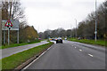
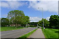
Residents of NN18 9FG have access to essential amenities within practical reach, including retail options such as Morrisons Daily Corby, Morrisons Oakley, and Tesco Oakley. These supermarkets provide convenience for daily shopping and groceries, supporting a practical lifestyle. The area’s proximity to Corby Railway Station and Kettering Railway Station, along with a bus interchange, enhances mobility for both local and regional travel. While the area lacks large-scale leisure or recreational facilities, its compact nature ensures that essential services are nearby, reducing the need for long commutes. The presence of multiple retail outlets and transport links contributes to a functional, efficient lifestyle, ideal for those prioritising accessibility over expansive leisure options. The community’s character is shaped by its practicality, with amenities tailored to meet the needs of a mature, established population.
Amenities
Schools
| Rank | School | Type | Entry gender | Ages |
|---|
Explore more schools in this area
Go to Schools tabDemographics
The community in NN18 9FG is predominantly composed of adults aged 30–64, with a median age of 47. This reflects a mature, stable population profile, typical of areas with long-standing residential patterns. Home ownership rates are relatively low at 37%, suggesting that a significant portion of the housing stock is rented, which may influence the local property market dynamics. The area is characterised by houses as the primary accommodation type, indicating a lack of high-rise or apartment-based living. The predominant ethnic group is White, which aligns with broader trends in the region. The population density of 1,235,817 people per square kilometre is exceptionally high, underscoring the area’s compact nature. This density may contribute to a tightly knit community but could also impact housing availability and living space per household. The demographic profile suggests a focus on established families and professionals, with limited representation of younger or more transient populations.
Household Size
Accommodation Type
Tenure
Ethnic Group
Religion
Household Composition
Age
Household Deprivation
NS-SEC
Explore more demographic insights in this area
Go to Demographics tabPlanning
Planning Constraints
- Flood RiskPremium
- Ramsar Wetland SitesPremium
- Area of Outstanding Natural BeautyPremium
- Protected Nature ReservePremium
- Protected WoodlandPremium