Area Overview for NG17 1EU
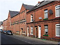
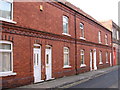
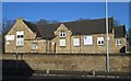
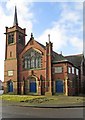
Photos of NG17 1EU


Area Information
Living in NG17 1EU means inhabiting a tightly packed residential cluster in England, where 1,195 people reside across just 8,119 square metres. This density creates a compact, closely knit community, though the area’s small size means every resident shares proximity to local amenities and transport links. The population is predominantly adults aged 30–64, reflecting a mature demographic with established routines. Daily life here is shaped by practicality: with limited open space, the focus is on accessible services and efficient connectivity. The area’s proximity to rail networks and high broadband scores suggests it caters to commuters and those working remotely. While the community is small, its infrastructure is functional, with shops, transport hubs, and digital services within reach. However, the high population density and limited land area mean the environment is more urban than rural, with little scope for expansion. For buyers, NG17 1EU offers a snapshot of a settled, adult-oriented community, though its size and layout demand consideration of space constraints.
- Area Type
- Postcode
- Area Size
- 8119 m²
- Population
- 1195
- Population Density
- 3304 people/km²
The property market in NG17 1EU is characterised by a low home ownership rate of 38%, suggesting that most residents are renters rather than homeowners. The area is dominated by houses, which contrasts with the higher prevalence of flats in more densely packed urban settings. This mix of standalone properties and rental availability may appeal to those seeking private living spaces without the financial burden of ownership. However, the small size of the area—just 8,119 square metres—limits the housing stock, making competition for properties likely. Buyers should consider that the local market is not geared toward large-scale development, and any available homes are likely to be in close proximity to one another. The predominance of houses may also mean that the area is less suited to younger buyers or those seeking more affordable, smaller units.
House Prices in NG17 1EU
Showing 7 properties
| Address | Type | Beds | Baths | Last Sale Price | Last Sale Date | |
|---|---|---|---|---|---|---|
| 10 Titchfield Avenue, Sutton In Ashfield, NG17 1EU | Bungalow | - | - | £270,000 | Jul 2022 | |
| Chesterfield House, Titchfield Avenue, Sutton In Ashfield, NG17 1EU | house | - | - | £495,000 | Oct 2021 | |
| Brown Eaves, Titchfield Avenue, Sutton In Ashfield, NG17 1EU | Bungalow | 3 | 2 | £350,000 | Jan 2020 | |
| Chalfont, 8 Titchfield Avenue, Sutton In Ashfield, NG17 1EU | Retail | 4 | 1 | - | - | |
| Lynton, 4 Titchfield Avenue, Sutton In Ashfield, NG17 1EU | Detached | 3 | 2 | - | - | |
| Verton, 2 Titchfield Avenue, Sutton In Ashfield, NG17 1EU | house | - | - | - | - | |
| Turnberry, 6 Titchfield Avenue, Sutton In Ashfield, NG17 1EU | Detached | - | - | - | - |
Energy Efficiency in NG17 1EU
Daily life in NG17 1EU is shaped by its proximity to practical amenities. Within walking or short driving distance are shops such as Heron Carsic Estate, Iceland, and Co-op Sutton in, offering essentials for groceries, household goods, and convenience. The rail network is a key feature, with stations like Sutton Parkway and Mansfield providing access to broader regional connections. While the area lacks large parks or leisure facilities, its compact layout ensures that residents can reach retail and transport hubs without long commutes. The presence of multiple railway stations suggests a focus on mobility, catering to commuters and those who prefer public transport. For those prioritising convenience over expansive recreational spaces, NG17 1EU offers a functional lifestyle, though its limited land area means community events or open spaces are not prominent features.
Amenities
Schools
| Rank | School | Type | Entry gender | Ages |
|---|
Explore more schools in this area
Go to Schools tabDemographics
The community in NG17 1EU is overwhelmingly composed of adults aged 30–64, with a median age of 47. This suggests a population of established professionals, families, or retirees, rather than a younger or student demographic. Home ownership is relatively low at 38%, indicating that a majority of residents rent their homes. The area is dominated by houses rather than flats, reflecting a preference for standalone properties. The predominant ethnic group is White, with no specific data on diversity beyond this. The high population density—147,178 people per square kilometre—raises questions about living conditions, though no deprivation metrics are provided. For residents, this density likely means shared spaces and a focus on communal resources. The age profile suggests a stable, long-term population, though the lack of younger residents may influence local schools and amenities.
Household Size
Accommodation Type
Tenure
Ethnic Group
Religion
Household Composition
Age
Household Deprivation
NS-SEC
Explore more demographic insights in this area
Go to Demographics tabPlanning
Planning Constraints
- Flood RiskPremium
- Ramsar Wetland SitesPremium
- Area of Outstanding Natural BeautyPremium
- Protected Nature ReservePremium
- Protected WoodlandPremium