Area Overview for NG17 1AL
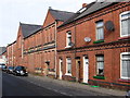
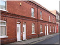
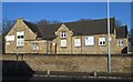
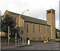
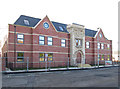
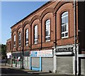
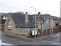
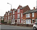
Photos of NG17 1AL


Area Information
NG17 1AL is a small, densely populated postcode area in England, covering 4,793 square metres and home to 2,013 residents. This compact cluster of homes is characterised by a high population density of 420,029 people per square kilometre, suggesting a tightly knit community. The area is predominantly residential, with houses making up the primary accommodation type. Residents are largely adults aged 30–64, reflecting a mature demographic profile. The median age of 47 indicates a stable population with strong ties to the local area. While the exact nature of employment and local industries is not specified, the proximity to rail networks and retail hubs suggests a mix of commuters and local workers. Living here means navigating a small, manageable environment where amenities are close but limited in scale. The area’s compact size and high density may appeal to those seeking a quiet, community-focused lifestyle, though it may also mean limited space for expansion or development.
- Area Type
- Postcode
- Area Size
- 4793 m²
- Population
- 2013
- Population Density
- 4441 people/km²
The property market in NG17 1AL is defined by a 43% home ownership rate, indicating that over half of residents rent their homes. This suggests a rental market that may be influenced by the area’s small size and limited housing stock. The primary accommodation type is houses, which is notable given the high population density. This mix of house ownership and rental properties may reflect a balance between long-term residents and transient workers or families seeking larger living spaces. The area’s compact nature means that property options are limited, and buyers should consider the proximity to nearby towns for more extensive choices. For those seeking a home in NG17 1AL, the focus is likely on existing houses rather than new developments. The high population density may also mean that properties are closely spaced, with little scope for expansion or major renovations. Buyers should weigh the benefits of a tight-knit community against the constraints of a small, mature housing market.
House Prices in NG17 1AL
Showing 29 properties
| Address | Type | Beds | Baths | Last Sale Price | Last Sale Date | |
|---|---|---|---|---|---|---|
| 8A Brook Street, Sutton In Ashfield, NG17 1AL | Retail | 3 | 1 | £54,000 | Jun 2001 | |
| Broadway, 4 Brook Street, Sutton In Ashfield, NG17 1AL | Flat | 2 | 1 | - | - | |
| 30A, Old Police Station, Brook Street, Sutton In Ashfield, NG17 1AL | Flat | - | - | - | - | |
| 1, The Old Post Office, Brook Street, Sutton In Ashfield, NG17 1AL | Flat | 3 | - | - | - | |
| 15 Brook Street, Sutton In Ashfield, NG17 1AL | undefined | - | - | - | - | |
| 16A Brook Street, Sutton In Ashfield, NG17 1AL | Flat | - | - | - | - | |
| Broadway, 1A Brook Street, Sutton In Ashfield, NG17 1AL | Flat | - | - | - | - | |
| 10 Brook Street, Sutton In Ashfield, NG17 1AL | shop | - | - | - | - | |
| Broadway, 1 Brook Street, Sutton In Ashfield, NG17 1AL | Flat | - | - | - | - | |
| Broadway, 4A Brook Street, Sutton In Ashfield, NG17 1AL | Flat | - | - | - | - |
Energy Efficiency in NG17 1AL
Daily life in NG17 1AL is shaped by its proximity to retail and rail amenities. The area includes five retail outlets, such as Heron Carsic Estate, Iceland, and Asda Sutton, providing essential shopping options for groceries, household items, and general needs. These stores are within practical reach, reducing the need for long trips to larger centres. Rail connectivity is robust, with stations like Sutton Parkway and Kirkby in Ashfield offering links to nearby towns, including Mansfield. This accessibility supports both commuting and leisure travel, though the absence of parks, leisure facilities, or recreational spaces means outdoor activities may require venturing beyond the area. The compact nature of NG17 1AL fosters convenience, with amenities clustered closely, but it also limits the diversity of experiences available. Residents benefit from a practical, no-frills lifestyle where essentials are within reach, though those seeking extensive leisure or green spaces may need to look further afield.
Amenities
Schools
Residents of NG17 1AL have access to two educational institutions within practical reach. Sutton Centre Community College is a primary school, offering early education and foundational learning for younger children. Nearby, Sutton Community Academy is an academy with a good Ofsted rating, providing secondary education and specialist provisions. The presence of both a primary school and an academy suggests a range of educational options for families, though the area’s small size may limit additional choices. The good Ofsted rating for the academy is a positive indicator for parents seeking quality secondary education. However, the absence of other schools or nurseries means that families may need to travel further for alternative schooling or extracurricular activities. For those prioritising education, the combination of a primary school and a well-rated academy provides a solid foundation for children’s learning, though the area’s limited scale may restrict broader opportunities.
| Rank | School | Type | Entry gender | Ages |
|---|
Explore more schools in this area
Go to Schools tabDemographics
The community in NG17 1AL is predominantly composed of adults aged 30–64, with a median age of 47. This suggests a population skewed towards middle-aged individuals, likely with established careers and families. Home ownership stands at 43%, indicating that nearly half of residents rent their homes, which may reflect the area’s small size and limited housing stock. The accommodation type is primarily houses, which is unusual for a densely populated area, hinting at a mix of older properties and possibly larger family homes. The predominant ethnic group is White, though no specific data on diversity or minority representation is provided. With a population of 2,013, the area is small enough to foster a close-knit community but large enough to support basic amenities. The absence of specific deprivation data means it is unclear how economic factors influence quality of life, though the high population density may suggest shared resources and potential strain on local services.
Household Size
Accommodation Type
Tenure
Ethnic Group
Religion
Household Composition
Age
Household Deprivation
NS-SEC
Explore more demographic insights in this area
Go to Demographics tabPlanning
Planning Constraints
- Flood RiskPremium
- Ramsar Wetland SitesPremium
- Area of Outstanding Natural BeautyPremium
- Protected Nature ReservePremium
- Protected WoodlandPremium