Area Overview for NG17 1EP
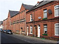
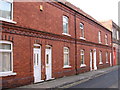
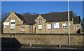
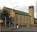
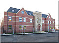
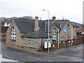
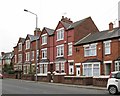
Photos of NG17 1EP


Area Information
Living in NG17 1EP means inhabiting a compact, densely populated postcode area in England, where 2,013 residents occupy just 4,237 square metres. This small residential cluster is defined by its high population density of 475,105 people per square kilometre, suggesting a tightly knit community. The area’s character is shaped by its predominantly adult population, with most residents aged 30–64 years. Daily life here is likely centred around local amenities, with a mix of homes and a focus on practical living. Proximity to Sutton Parkway Railway Station and nearby schools such as Sutton Community Academy indicates a balance between convenience and connectivity. While the area is small, it offers access to essential services within walking or short driving distance, making it appealing for those prioritising accessibility over expansive space. The high density may foster a sense of community, though it also means limited land for expansion or development. For buyers, NG17 1EP represents a compact, well-served locale with a clear emphasis on local infrastructure and proximity to transport networks.
- Area Type
- Postcode
- Area Size
- 4237 m²
- Population
- 2013
- Population Density
- 4441 people/km²
The property market in NG17 1EP is shaped by its 43% home ownership rate and a focus on houses as the primary accommodation type. This suggests a mix of owner-occupied properties and rental units, though the small area size may limit the overall housing stock. The presence of houses indicates a preference for family homes, which could appeal to buyers seeking stability or long-term investment. However, the high population density of 475,105 people per square kilometre suggests limited availability of new developments, potentially driving competition among buyers. The area’s compact nature means that property values may be influenced more by proximity to amenities like schools and transport links than by size or land availability. For buyers, this small postcode area offers a focused market with clear priorities: accessibility to services and a balance between residential and community needs. The low home ownership rate also hints at a rental market component, which could affect price trends and investment potential.
House Prices in NG17 1EP
Showing 36 properties
| Address | Type | Beds | Baths | Last Sale Price | Last Sale Date | |
|---|---|---|---|---|---|---|
| 19, Brookhill Court, Woods Hill, Sutton In Ashfield, NG17 1EP | Flat | - | - | £62,500 | Oct 2018 | |
| 21, Brookhill Court, Woods Hill, Sutton In Ashfield, NG17 1EP | Flat | - | - | £29,000 | Apr 2013 | |
| 29, Brookhill Court, Woods Hill, Sutton In Ashfield, NG17 1EP | Flat | - | - | - | - | |
| 31, Brookhill Court, Woods Hill, Sutton In Ashfield, NG17 1EP | Flat | - | - | - | - | |
| 17, Brookhill Court, Woods Hill, Sutton In Ashfield, NG17 1EP | Flat | - | - | - | - | |
| 18, Brookhill Court, Woods Hill, Sutton In Ashfield, NG17 1EP | Flat | - | - | - | - | |
| 20, Brookhill Court, Woods Hill, Sutton In Ashfield, NG17 1EP | Flat | - | - | - | - | |
| 34, Brookhill Court, Woods Hill, Sutton In Ashfield, NG17 1EP | Flat | - | - | - | - | |
| 35, Brookhill Court, Woods Hill, Sutton In Ashfield, NG17 1EP | Flat | - | - | - | - | |
| 24, Brookhill Court, Woods Hill, Sutton In Ashfield, NG17 1EP | Flat | - | - | - | - |
Energy Efficiency in NG17 1EP
The lifestyle in NG17 1EP is defined by its proximity to essential amenities, including retail and transport hubs. Local shops such as Heron Carsic Estate, Iceland, and Asda provide access to everyday goods, reducing the need for long trips to larger centres. The presence of multiple railway stations, including Sutton Parkway and Mansfield, enhances mobility, connecting residents to broader networks for work, leisure, or travel. While the area lacks detailed information on parks or leisure facilities, the compact layout suggests that daily life revolves around nearby services and community spaces. The combination of retail options and rail links creates a practical environment where residents can meet most needs within a short distance. This convenience is particularly beneficial in a high-density area, where space is limited but accessibility is prioritised. The lifestyle here appears to balance efficiency with the essentials, making it suitable for those who value proximity to services over expansive recreational areas.
Amenities
Schools
Residents of NG17 1EP have access to two notable schools: Sutton Centre Community College, a primary school, and Sutton Community Academy, an academy with a good Ofsted rating. The presence of both a primary school and an academy provides families with options for different stages of education. Sutton Community Academy’s good rating suggests a reliable standard of teaching and facilities, which is crucial for parents prioritising quality education. The proximity of these schools to the area means that families can reasonably expect a commute within practical limits. The mix of school types may also reflect a diversity of educational approaches, allowing parents to choose between traditional and academy-led models. For buyers, the availability of well-rated schools is a key consideration, as it enhances the area’s appeal for families with children. The absence of additional schools in the data means the focus remains on these two institutions as the primary educational resources.
| Rank | School | Type | Entry gender | Ages |
|---|
Explore more schools in this area
Go to Schools tabDemographics
The community in NG17 1EP is predominantly composed of adults aged 30–64 years, with a median age of 47. This suggests a mature population, likely with established careers and families. Home ownership is relatively low at 43%, indicating a mix of owner-occupied and rental properties. The area is characterised by houses as the primary accommodation type, which is unusual for a densely populated postcode but may reflect a focus on family homes. The predominant ethnic group is White, though specific data on diversity or deprivation is not provided. The high population density of 475,105 people per square kilometre implies a compact, possibly urbanised environment where space is limited. This density could influence quality of life, with potential trade-offs between proximity to amenities and personal living space. The demographic profile suggests a stable, middle-aged population with established routines, though the lack of data on income or deprivation levels means broader implications for lifestyle remain unclear.
Household Size
Accommodation Type
Tenure
Ethnic Group
Religion
Household Composition
Age
Household Deprivation
NS-SEC
Explore more demographic insights in this area
Go to Demographics tabPlanning
Planning Constraints
- Flood RiskPremium
- Ramsar Wetland SitesPremium
- Area of Outstanding Natural BeautyPremium
- Protected Nature ReservePremium
- Protected WoodlandPremium