Area Overview for NG17 1EX
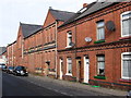
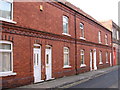
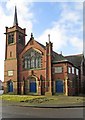
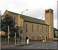
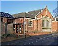
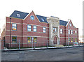
Photos of NG17 1EX

Area Information
Living in NG17 1EX means inhabiting a compact, densely populated residential cluster in England. The area covers just 1.3 hectares, yet it is home to 1,195 residents, resulting in a population density of 92,625 people per square kilometre. This high density suggests a tightly knit community, though the small size means the area is likely to feel intimate rather than sprawling. The postcode is characterised by a predominance of houses, reflecting a traditional, perhaps older housing stock. With a median age of 47, the population skews toward adults aged 30–64, indicating a mature demographic. Daily life here is likely shaped by proximity to local amenities and transport links, though the area’s small footprint means residents may rely heavily on nearby towns for broader services. The absence of environmental constraints like protected woodlands or AONB status suggests a straightforward, unencumbered living environment. However, the high crime risk score—0 out of 100—demands attention, as it is above average and could influence perceptions of safety.
- Area Type
- Postcode
- Area Size
- 1.3 hectares
- Population
- 1195
- Population Density
- 3304 people/km²
The property market in NG17 1EX is defined by a low home ownership rate—38%—suggesting that the area is more rental-focused than owner-occupied. This could indicate a transient population or limited availability of long-term investment opportunities. The accommodation type is predominantly houses, which is atypical for a small, densely populated area. This mix of house stock may reflect older, perhaps traditional properties, but the lack of data on property ages or conditions means buyers must approach the market cautiously. The small size of the area—just 1.3 hectares—means the housing stock is likely limited, with little scope for new developments. For buyers, this could translate to a competitive market with limited options, though the proximity to rail stations and retail amenities might offset the area’s constraints. Those considering purchase should weigh the rental market’s dynamics against the potential for long-term value retention.
House Prices in NG17 1EX
Showing 19 properties
| Address | Type | Beds | Baths | Last Sale Price | Last Sale Date | |
|---|---|---|---|---|---|---|
| Strawcroft, Church Street, Sutton In Ashfield, NG17 1EX | Semi-detached | 3 | 1 | £270,000 | Jul 2024 | |
| Braemar, Church Street, Sutton In Ashfield, NG17 1EX | Detached | 4 | 3 | £700,000 | Aug 2022 | |
| Lindum, Church Street, Sutton In Ashfield, NG17 1EX | house | 3 | - | £272,000 | Aug 2021 | |
| Wilmar, Church Street, Sutton In Ashfield, NG17 1EX | Detached | 3 | 1 | £275,000 | Oct 2020 | |
| The Pantiles, Church Street, Sutton In Ashfield, NG17 1EX | Detached | 4 | - | £250,000 | May 2017 | |
| Church Hill House, Church Street, Sutton In Ashfield, NG17 1EX | Detached | 4 | 1 | £230,000 | May 2016 | |
| The Limes, Church Street, Sutton In Ashfield, NG17 1EX | Semi-detached | 3 | - | £176,000 | Mar 2014 | |
| Riversdale, Church Street, Sutton In Ashfield, NG17 1EX | house | - | - | £195,000 | Dec 2004 | |
| 28 Church Street, Sutton In Ashfield, NG17 1EX | Flat | 4 | - | £150,000 | Jun 1998 | |
| Birkland, Church Street, Sutton In Ashfield, NG17 1EX | Detached | - | - | £150,000 | Jun 1997 |
Energy Efficiency in NG17 1EX
Residents of NG17 1EX have access to a range of nearby amenities, including five retail outlets such as Co-op Sutton in, Heron Carsic Estate Sutton in, and Iceland Sutton. These stores provide essential shopping and services, reducing the need to travel further afield. The area’s rail connectivity—five stations within practical reach—offers convenient access to broader regional networks, supporting both daily commutes and weekend excursions. While the data does not mention parks or leisure facilities, the proximity to rail and retail suggests a lifestyle focused on practicality and convenience. The small footprint of the area means amenities are likely clustered closely, fostering a sense of accessibility. However, the absence of specific details on dining or recreational options leaves some aspects of daily life unexplored.
Amenities
Schools
| Rank | School | Type | Entry gender | Ages |
|---|
Explore more schools in this area
Go to Schools tabDemographics
The community in NG17 1EX is predominantly composed of adults aged 30–64, with a median age of 47. This suggests a mature population, likely with established careers and families. Home ownership rates stand at 38%, meaning a majority of residents rent their homes. The accommodation type is primarily houses, which is unusual for areas with high population density. The predominant ethnic group is White, though no further breakdown of diversity is provided. The high population density—92,625 people per square kilometre—raises questions about the quality of life, though it may also indicate strong social cohesion. The lack of specific data on deprivation or income levels means it is difficult to assess economic challenges, but the low home ownership rate could imply limited opportunities for property investment. This demographic profile suggests a community that is stable but perhaps less dynamic, with residents prioritising security and familiarity over expansion.
Household Size
Accommodation Type
Tenure
Ethnic Group
Religion
Household Composition
Age
Household Deprivation
NS-SEC
Explore more demographic insights in this area
Go to Demographics tabPlanning
Planning Constraints
- Flood RiskPremium
- Ramsar Wetland SitesPremium
- Area of Outstanding Natural BeautyPremium
- Protected Nature ReservePremium
- Protected WoodlandPremium