Area Overview for NG16 6LH
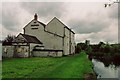
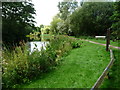
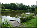
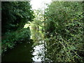
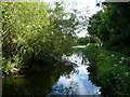
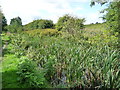
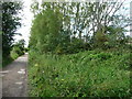
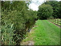
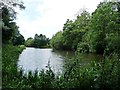
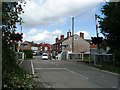
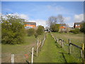
Photos of NG16 6LH
Area Information
NG16 6LH is a small, tightly packed residential postcode in England, covering just 2.3 hectares and home to 1,333 people. Its compact size means it is a quiet, close-knit area, ideal for those seeking a slower pace of life. The population density of 760 people per square kilometre reflects a mix of long-term residents and families. With a median age of 47, the community is predominantly adults aged 30–64, suggesting a stable demographic of homeowners and established households. The area is characterised by its housing stock, with 65% of properties owned outright and the majority being houses rather than flats. While it lacks the vibrancy of larger towns, its proximity to nearby amenities and transport links offers practical convenience. Residents benefit from low flood risk and a moderate crime score, though standard security measures are advisable. The area’s small footprint means it is best suited for those prioritising community cohesion over expansive urban offerings.
- Area Type
- Postcode
- Area Size
- 2.3 hectares
- Population
- 1333
- Population Density
- 760 people/km²
The property market in NG16 6LH is dominated by owner-occupied homes, with 65% of properties owned outright. The accommodation type is predominantly houses, which is unusual for a small postcode but suggests a focus on family living and long-term investment. This composition indicates a market where rental options are limited, and buyers are more likely to be purchasing for occupancy rather than investment. The small area size means the housing stock is finite, and those seeking larger properties or more options may need to look beyond NG16 6LH itself. The high home ownership rate and house-centric market suggest a community that values stability and permanence. For buyers, this means competition for available properties, though the compact nature of the area ensures a tight-knit, low-maintenance environment.
House Prices in NG16 6LH
Showing 41 properties
| Address | Type | Beds | Baths | Last Sale Price | Last Sale Date | |
|---|---|---|---|---|---|---|
| 125 Wharf Road, Pinxton, NG16 6LH | house | 3 | 1 | £100,000 | Jul 2025 | |
| 51 Wharf Road, Pinxton, NG16 6LH | Terraced | 2 | - | £110,000 | May 2023 | |
| 43 Wharf Road, Pinxton, NG16 6LH | Semi-detached | - | - | £200,000 | Apr 2023 | |
| 29 Wharf Road, Pinxton, NG16 6LH | Semi-detached | 3 | 1 | £93,500 | Sep 2019 | |
| 115 Wharf Road, Pinxton, NG16 6LH | house | - | - | £113,500 | Oct 2017 | |
| 75 Wharf Road, Pinxton, NG16 6LH | Semi-detached | 4 | 2 | £118,000 | Sep 2017 | |
| 33 Wharf Road, Pinxton, NG16 6LH | Detached | 4 | 1 | £95,000 | Oct 2016 | |
| 27 Wharf Road, Pinxton, NG16 6LH | house | 3 | - | £95,000 | Sep 2016 | |
| 37 Wharf Road, Pinxton, NG16 6LH | house | 4 | 1 | £56,000 | Oct 2015 | |
| 25 Wharf Road, Pinxton, NG16 6LH | Semi-detached | 4 | - | £68,000 | Nov 2012 |
Energy Efficiency in NG16 6LH
The lifestyle in NG16 6LH is shaped by its proximity to retail and rail amenities. Nearby shops include Co-op Pinxton, M&S Mansfield, and Morrisons Daily, offering a range of grocery and retail options within practical reach. These stores cater to daily needs, reducing the necessity for long trips to larger centres. The rail network provides access to broader regional services, enhancing connectivity for leisure and work. While the area lacks detailed information on parks or leisure facilities, the presence of retail and transport options suggests a practical, convenience-focused lifestyle. Residents benefit from a balance between local amenities and the ability to access larger towns for additional services. The compact nature of the area means that most needs can be met without extensive travel, supporting a low-maintenance, community-oriented way of life.
Amenities
Schools
Residents of NG16 6LH have access to two primary schools within practical reach. Longwood Community Infant School is a traditional primary school, while Longwood Infant Academy is an academy with an outstanding Ofsted rating. The presence of both school types offers families flexibility, with the academy’s high rating providing confidence in educational standards. These schools cater to younger children, making the area appealing to families with pre-school or primary-age children. The proximity of these institutions reduces the need for long commutes, enhancing the area’s practicality for parents. However, no secondary schools are listed in the data, so families may need to consider nearby towns for secondary education. The mix of school types ensures a range of options, though the absence of higher-level schooling is a consideration for long-term planning.
| Rank | School | Type | Entry gender | Ages |
|---|
Explore more schools in this area
Go to Schools tabDemographics
The population of NG16 6LH is 1,333, with a median age of 47 and the largest age group being adults aged 30–64. This suggests a mature, settled community with a strong presence of middle-aged households. Home ownership is high at 65%, and the accommodation type is predominantly houses, reflecting a traditional, family-oriented demographic. The predominant ethnic group is White, though no specific data on diversity or deprivation is provided. The population density of 760 people per square kilometre indicates a moderately compact settlement, which aligns with the area’s small size. This profile suggests a community focused on stability, with limited transient populations. The age distribution and ownership rates imply a low turnover of properties, reinforcing the area’s character as a place where residents stay for extended periods.
Household Size
Accommodation Type
Tenure
Ethnic Group
Religion
Household Composition
Age
Household Deprivation
NS-SEC
Explore more demographic insights in this area
Go to Demographics tabPlanning
Planning Constraints
- Flood RiskPremium
- Ramsar Wetland SitesPremium
- Area of Outstanding Natural BeautyPremium
- Protected Nature ReservePremium
- Protected WoodlandPremium