Area Overview for NG16 6NZ
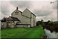
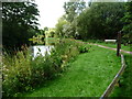
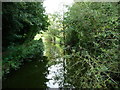
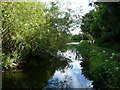
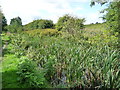
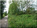
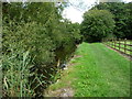
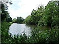
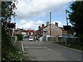
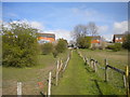
Photos of NG16 6NZ
Area Information
NG16 6NZ is a small, tightly defined postcode area in England, covering 6,237 square metres and home to 1,333 residents. Its compact size means the community is close-knit, with daily life centred around local amenities and nearby towns. The area’s population density of 760 people per square kilometre reflects a mix of established residents and families. With a median age of 47, the demographic skews towards adults aged 30–64, suggesting a stable, mature community. Most homes are owner-occupied, at 65%, with houses being the primary accommodation type. This hints at a residential area where long-term living is common. The postcode’s proximity to rail networks and retail hubs adds practicality, while its lack of environmental constraints like protected woodlands or AONB status means development is not restricted. For buyers, NG16 6NZ offers a blend of simplicity and accessibility, though its small size means housing options are limited to the immediate area.
- Area Type
- Postcode
- Area Size
- 6237 m²
- Population
- 1333
- Population Density
- 760 people/km²
The property market in NG16 6NZ is dominated by owner-occupied homes, with 65% of properties owned by residents rather than rented. This suggests a stable market where long-term investment is common. The accommodation type is primarily houses, which is unusual for areas with higher flat or apartment density. This may reflect a preference for single-family homes, appealing to families or those seeking more space. However, the area’s small size means the housing stock is limited, and buyers may need to consider nearby postcode areas for more options. The lack of planning constraints like protected woodlands or AONB status means development is not restricted, though the compact nature of the postcode means new builds are unlikely to significantly expand the market. For buyers, this is a niche area where properties are likely to be in demand due to their scarcity and the appeal of a house-based community.
House Prices in NG16 6NZ
Showing 10 properties
| Address | Type | Beds | Baths | Last Sale Price | Last Sale Date | |
|---|---|---|---|---|---|---|
| 7 Wharf Road, Pinxton, NG16 6NZ | house | 3 | 1 | £150,000 | Jul 2025 | |
| 21 Wharf Road, Pinxton, NG16 6NZ | house | - | - | £180,000 | Mar 2020 | |
| 15 Wharf Road, Pinxton, NG16 6NZ | house | - | - | £64,300 | Dec 2005 | |
| 5 Wharf Road, Pinxton, NG16 6NZ | house | - | - | £89,950 | Aug 2004 | |
| 17 Wharf Road, Pinxton, NG16 6NZ | house | - | - | £16,000 | Jun 2002 | |
| 13 Wharf Road, Pinxton, NG16 6NZ | house | - | - | - | - | |
| 23 Wharf Road, Pinxton, NG16 6NZ | Detached | - | - | - | - | |
| 19 Wharf Road, Pinxton, NG16 6NZ | Terraced | - | - | - | - | |
| Flat, 9-11 Wharf Road, Pinxton, NG16 6NZ | Flat | - | - | - | - | |
| 9 Wharf Road, Pinxton, NG16 6NZ | house | - | - | - | - |
Energy Efficiency in NG16 6NZ
The lifestyle in NG16 6NZ is shaped by its proximity to retail and transport hubs. Within practical reach are five retail outlets, including Co-op Pinxton, Morrisons Daily, and Co-op Selston, providing everyday shopping needs. These stores suggest a mix of local and chain retailers, offering convenience for groceries and household items. The area’s rail links to Alfreton, Kirkby in Ashfield, and Sutton Parkway add to its accessibility, allowing residents to commute to nearby towns for work, leisure, or services not available locally. While the data does not mention parks or leisure facilities, the lack of environmental constraints like protected woodlands implies space for informal outdoor activities. The combination of retail access and rail connectivity makes daily life functional, though the small size of the postcode means residents may need to venture further for specialist amenities or entertainment.
Amenities
Schools
Residents of NG16 6NZ have access to two primary educational institutions: Longwood Community Infant School, a standard primary school, and Longwood Infant Academy, an academy with an outstanding Ofsted rating. The presence of both a traditional school and an academy provides families with choice, though the latter’s high rating suggests it is a strong option for parents seeking quality education. The proximity of these schools to the postcode means children can attend without long commutes. However, the data does not specify secondary schools or further education options, so families may need to look beyond NG16 6NZ for comprehensive schooling. The mix of school types reflects a balance between established institutions and newer, high-performing academies, which is typical of areas with moderate population sizes.
| Rank | School | Type | Entry gender | Ages |
|---|
Explore more schools in this area
Go to Schools tabDemographics
The community in NG16 6NZ is predominantly composed of adults aged 30–64, with a median age of 47. This suggests a population that is largely in their prime working and family-raising years. Home ownership is high at 65%, indicating a stable, long-term resident base rather than a transient rental market. The area is characterised by houses rather than flats, which aligns with the demographic profile of older, family-oriented households. The predominant ethnic group is White, though no data is provided on the proportion of other ethnicities. With a population of 1,333, the area is small enough to foster familiarity but large enough to support essential services. The absence of specific deprivation data means no conclusions can be drawn about socioeconomic challenges, but the high home ownership rate and age profile suggest a relatively secure, middle-income community.
Household Size
Accommodation Type
Tenure
Ethnic Group
Religion
Household Composition
Age
Household Deprivation
NS-SEC
Explore more demographic insights in this area
Go to Demographics tabPlanning
Planning Constraints
- Flood RiskPremium
- Ramsar Wetland SitesPremium
- Area of Outstanding Natural BeautyPremium
- Protected Nature ReservePremium
- Protected WoodlandPremium