Area Overview for NG16 6LE
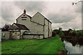
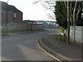
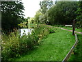
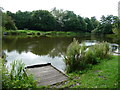
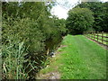
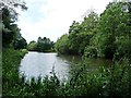
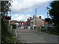
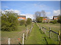
Photos of NG16 6LE
Area Information
Living in NG16 6LE offers a compact, residential experience within a small cluster of 3.3 hectares, home to 1,333 residents. The area’s density—760 people per square kilometre—suggests a tight-knit community, with a median age of 47 and a majority of adults aged 30–64. This suggests a mature population, likely with established careers and families. The area is dominated by owner-occupied homes, with 65% of properties owned by residents, and the housing stock is primarily single-family dwellings. Daily life here is likely characterised by proximity to local amenities, with nearby shops and rail links providing connectivity. While the area is small, its strategic placement near multiple railway stations and retail hubs may offer convenience for commuting or leisure. The absence of significant environmental constraints, such as protected nature reserves or AONB designations, means development is likely unimpeded, though flood risk remains a notable factor.
- Area Type
- Postcode
- Area Size
- 3.3 hectares
- Population
- 1333
- Population Density
- 760 people/km²
The property market in NG16 6LE is largely owner-occupied, with 65% of homes owned by residents rather than rented. The housing stock is dominated by single-family dwellings, suggesting a focus on traditional, detached or semi-detached homes. Given the area’s small size—just 3.3 hectares—the number of properties is limited, which may mean buyers should consider nearby areas for more options. The prevalence of owner-occupied homes indicates a stable market, but the lack of rental data means it is unclear how much demand exists for lettings. For buyers, this could mean competition for available properties, particularly if the area’s amenities and connectivity make it desirable. The absence of large-scale developments or new builds may also mean limited scope for property value growth.
House Prices in NG16 6LE
Showing 6 properties
| Address | Type | Beds | Baths | Last Sale Price | Last Sale Date | |
|---|---|---|---|---|---|---|
| Imh Teamwear, Unit 2, 46 Brookhill Road, Pinxton, NG16 6LE | storage_distribution | - | - | - | - | |
| Swift Precision Ltd, Unit 1, 46 Brookhill Road, Pinxton, NG16 6LE | storage_distribution | - | - | - | - | |
| Manor Building, Sedgwick Close, Pinxton, NG16 6LE | warehouse | - | - | - | - | |
| Lynx Marketing Services Limited, Unit 3, 46 Brookhill Road, Pinxton, NG16 6LE | Industrial | - | - | - | - | |
| E Bacon Transport, 52-58 Brookhill Road, Pinxton, NG16 6LE | warehouse | - | - | - | - | |
| Metal Process Services, 25 Brookhill Road, Pinxton, NG16 6LE | Industrial | - | - | - | - |
Energy Efficiency in NG16 6LE
Residents of NG16 6LE benefit from a range of nearby amenities that support daily life. Retail options include Co-op Pinxton, Co-op Selston, and Morrisons Daily, ensuring access to groceries and essentials without long trips. The area’s rail links, with stations like Alfreton and Sutton Parkway, provide easy access to regional hubs and employment centres. While the data does not specify parks or leisure facilities, the proximity to rail and retail suggests a focus on practicality over large-scale recreation. The compact size of the area may foster a community-oriented lifestyle, with local shops and transport links serving as focal points for social and economic activity.
Amenities
Schools
Residents of NG16 6LE have access to two primary educational institutions. Longwood Community Infant School is a standard primary school, while Longwood Infant Academy is an academy with an outstanding Ofsted rating. The presence of both a traditional school and an academy offers families choice in educational approaches. The outstanding rating at Longwood Infant Academy suggests high standards in teaching and facilities, which could be a key draw for families prioritising academic excellence. However, the data does not specify secondary schools or further education options in the immediate area, so parents may need to consider nearby towns for comprehensive schooling. The mix of school types may also reflect a blend of local and specialist provision, catering to different educational needs.
| Rank | School | Type | Entry gender | Ages |
|---|
Explore more schools in this area
Go to Schools tabDemographics
The population of NG16 6LE is predominantly adults aged 30–64, with a median age of 47. This suggests a community of middle-aged residents, many of whom may be in their peak earning years or raising families. Home ownership is strong, with 65% of properties owned by residents, indicating a stable housing market. The area is characterised by houses rather than flats or apartments, reflecting a preference for traditional family homes. The predominant ethnic group is White, though no specific data on diversity or deprivation is provided. The age profile implies a balance between working-age adults and those nearing retirement, potentially shaping local services and infrastructure needs. The absence of detailed socioeconomic data means further insights into quality of life or community challenges are not available.
Household Size
Accommodation Type
Tenure
Ethnic Group
Religion
Household Composition
Age
Household Deprivation
NS-SEC
Explore more demographic insights in this area
Go to Demographics tabPlanning
Planning Constraints
- Flood RiskPremium
- Ramsar Wetland SitesPremium
- Area of Outstanding Natural BeautyPremium
- Protected Nature ReservePremium
- Protected WoodlandPremium