Area Overview for NG16 6LN
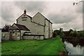
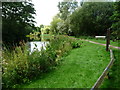
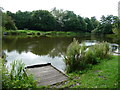
Photos of NG16 6LN
Area Information
Living in NG16 6LN offers a compact, residential environment with a population of 1,492 spread across 9,966 square metres. This small postcode area is characterised by a moderate population density of 765 people per square kilometre, creating a close-knit community feel. The area is predominantly occupied by adults aged 30–64, with a median age of 47, suggesting a stable, family-oriented demographic. While the housing stock is primarily composed of individual homes, the relatively small size of the area means residents are likely to know their neighbours. Daily life is shaped by proximity to local amenities and transport links, though the area’s limited scale means it is best suited for those prioritising a quiet, established residential setting over urban vibrancy. The absence of major environmental constraints, such as protected woodlands or Areas of Outstanding Natural Beauty, ensures development is not restricted, though the community remains anchored to its local character.
- Area Type
- Postcode
- Area Size
- 9966 m²
- Population
- 1492
- Population Density
- 765 people/km²
The property market in NG16 6LN is defined by a 55% home ownership rate, with houses forming the predominant accommodation type. This suggests a market skewed towards owner-occupied properties rather than a high proportion of rentals. The limited area size means the housing stock is likely to be modest in scale, with individual homes rather than high-density developments. For buyers, this implies a focus on traditional, family-sized homes rather than modern apartments or larger estates. The small footprint of the area may limit availability, making it essential for buyers to consider nearby postcode areas for broader options. The absence of major environmental constraints, such as protected land or flood risk, reduces planning complexities, though the compact nature of the area means properties are likely to be closely spaced.
House Prices in NG16 6LN
Showing 25 properties
| Address | Type | Beds | Baths | Last Sale Price | Last Sale Date | |
|---|---|---|---|---|---|---|
| 3 Redgate Street, Pinxton, NG16 6LN | Semi-detached | 3 | 1 | £140,000 | Jun 2025 | |
| 22 Redgate Street, Pinxton, NG16 6LN | Semi-detached | 3 | 1 | £145,000 | Feb 2023 | |
| 13 Redgate Street, Pinxton, NG16 6LN | Semi-detached | 3 | 1 | £135,000 | Dec 2022 | |
| 30 Redgate Street, Pinxton, NG16 6LN | house | - | - | £128,000 | Feb 2021 | |
| 33 Redgate Street, Pinxton, NG16 6LN | Semi-detached | 3 | 2 | £132,400 | Nov 2020 | |
| 14 Redgate Street, Pinxton, NG16 6LN | house | - | - | £282,500 | Oct 2020 | |
| 24 Redgate Street, Pinxton, NG16 6LN | Detached | 3 | 1 | £190,000 | Sep 2019 | |
| 37 Redgate Street, Pinxton, NG16 6LN | Detached | 3 | - | £116,000 | Feb 2017 | |
| 28 Redgate Street, Pinxton, NG16 6LN | Semi-detached | 3 | - | £101,000 | Oct 2016 | |
| 5 Redgate Street, Pinxton, NG16 6LN | Semi-detached | 2 | - | £63,000 | Mar 2014 |
Energy Efficiency in NG16 6LN
The lifestyle in NG16 6LN is shaped by nearby amenities, including retail options such as Co-op Pinxton, M&S Mansfield, and Morrisons Daily, which provide essential shopping and dining choices. These stores cater to daily needs, ensuring residents have access to groceries, clothing, and other household items without long journeys. The area’s rail stations, including Alfreton and Sutton Parkway, offer connections to broader transport networks, facilitating travel to larger towns for leisure or work. While the area is small, the presence of these amenities and transport links fosters a balance between local convenience and regional accessibility. The mix of retail and rail options supports a practical lifestyle, allowing residents to enjoy both the quiet of their postcode area and the vibrancy of nearby centres.
Amenities
Schools
Residents of NG16 6LN have access to a range of educational institutions, including Pinxton Nursery School, which provides early years education, and Pinxton Kirkstead Junior School, a primary school serving local children. The nearby Kirkstead Junior Academy, an academy with an Ofsted rating of 'good', offers secondary education. This mix of nursery, primary, and academy schools ensures families can access education at multiple stages without significant travel. The presence of a school with a 'good' Ofsted rating indicates a commitment to quality education, though parents may need to consider additional factors such as school capacity and catchment areas. The proximity of these institutions makes NG16 6LN an attractive option for families prioritising ease of access to educational facilities.
| Rank | School | Type | Entry gender | Ages |
|---|
Explore more schools in this area
Go to Schools tabDemographics
The population of NG16 6LN is predominantly composed of adults aged 30–64, making up the most common age range. With a median age of 47, the area reflects a mature demographic, likely with established careers and families. Home ownership rates stand at 55%, indicating a mix of owner-occupied properties and rental units. The accommodation type is primarily houses, which is typical for smaller, rural or semi-rural postcode areas. The predominant ethnic group is White, reflecting the broader regional demographic. The population density of 765 people per square kilometre suggests a balance between residential space and community interaction. While no specific data on deprivation is provided, the age profile and home ownership rates imply a stable, middle-aged population with moderate economic activity. This demographic structure supports a community focused on long-term residency and local continuity.
Household Size
Accommodation Type
Tenure
Ethnic Group
Religion
Household Composition
Age
Household Deprivation
NS-SEC
Explore more demographic insights in this area
Go to Demographics tabPlanning
Planning Constraints
- Flood RiskPremium
- Ramsar Wetland SitesPremium
- Area of Outstanding Natural BeautyPremium
- Protected Nature ReservePremium
- Protected WoodlandPremium