Area Overview for LN2 2GL
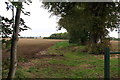
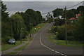
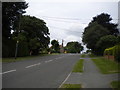
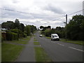
Photos of LN2 2GL


Area Information
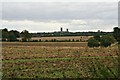
LN2 2GL is a small, compact residential cluster in England, covering just 1.6 hectares and home to 1,535 residents. Its density of 377 people per square kilometre suggests a tightly knit community, where daily life is shaped by proximity to local amenities and a stable, mature demographic. The area is characterised by its focus on single-family homes, with 90% of properties owned by residents rather than rented out. This suggests a long-term presence of households, many of whom are in the 30-64 age range, contributing to a grounded, community-oriented atmosphere. While the area is modest in size, it offers access to nearby retail hubs like Asda Lincoln and rail links to Lincoln Central and Hykeham stations, providing connectivity without the need for a car. The compact nature of LN2 2GL means that residents are likely to know their neighbours, with a shared reliance on local services and a focus on practical living. It is a place where convenience and familiarity outweigh grandeur, ideal for those seeking a quiet, established residential environment.
- Area Type
- Postcode
- Area Size
- 1.6 hectares
- Population
- 1535
- Population Density
- 377 people/km²
The property market in LN2 2GL is dominated by owner-occupied homes, with 90% of properties owned by residents. This high home ownership rate indicates a community that values long-term investment in housing, rather than a transient rental market. The accommodation type is exclusively houses, which are typically larger and more suited to families or individuals seeking space and privacy. Given the area’s small size—just 1.6 hectares—the housing stock is limited, meaning the market is likely tight and competitive for buyers. The prevalence of single-family homes suggests that this area is not ideal for those seeking apartments or shared accommodation. For buyers, this means properties are likely to be in high demand, with limited scope for new developments. The focus on houses also implies that the area is better suited to those prioritising space over density, with no immediate plans for expansion.
House Prices in LN2 2GL
Showing 3 properties
| Address | Type | Beds | Baths | Last Sale Price | Last Sale Date | |
|---|---|---|---|---|---|---|
| 1 Lysterfield End, Nettleham, Lincoln, LN2 2GL | Detached | 5 | 5 | £405,000 | Sep 2019 | |
| 2 Lysterfield End, Nettleham, Lincoln, LN2 2GL | house | - | - | £78,833 | Sep 2018 | |
| 3 Lysterfield End, Nettleham, Lincoln, LN2 2GL | house | - | - | - | - |
Energy Efficiency in LN2 2GL
Living in LN2 2GL offers access to essential retail and transport hubs within practical reach. Local shops such as Lincolnshire Co-operative, Iceland Nettleham, and Asda Lincoln provide everyday convenience for groceries and household needs. The area’s proximity to Lincoln Central and Hykeham railway stations makes commuting to larger cities or regional centres straightforward. For those requiring air travel, RAF Scampton is nearby, though its primary use is military. The absence of major parks or leisure facilities within the postcode itself means residents may need to travel slightly further for recreational activities. However, the compact size of the area ensures that daily errands and travel are manageable without a car. The combination of retail access and rail connectivity creates a lifestyle that prioritises practicality and ease of movement.
Amenities
Schools
| Rank | School | Type | Entry gender | Ages |
|---|
Explore more schools in this area
Go to Schools tabDemographics
The population of LN2 2GL is predominantly middle-aged, with a median age of 47 and the largest age group falling between 30 and 64 years. This reflects a mature, settled community where most residents are likely to be in their peak working years or nearing retirement. Home ownership is exceptionally high at 90%, indicating a strong preference for long-term residency over rental living. The area is composed almost entirely of houses, rather than flats or apartments, which aligns with the demographic profile of older, family-oriented households. The predominant ethnic group is White, which, while not explicitly stating diversity levels, suggests a homogenous community. The age distribution and ownership figures imply a low turnover of residents, fostering a stable environment where local traditions and social networks are likely to be well-established.
Household Size
Accommodation Type
Tenure
Ethnic Group
Religion
Household Composition
Age
Household Deprivation
NS-SEC
Explore more demographic insights in this area
Go to Demographics tabPlanning
Planning Constraints
- Flood RiskPremium
- Ramsar Wetland SitesPremium
- Area of Outstanding Natural BeautyPremium
- Protected Nature ReservePremium
- Protected WoodlandPremium