Area Overview for LN2 2PY
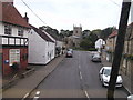
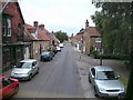
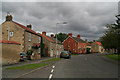
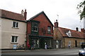
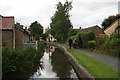
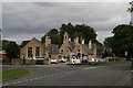
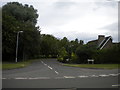
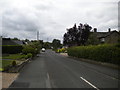
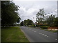
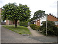
Photos of LN2 2PY


Area Information
Living in LN2 2PY means inhabiting a compact, residential postcode area in England that covers just 4.2 hectares. With a population of 1,510 and a population density of 1,439 people per square kilometre, this is a tightly knit community. The area’s small size and high density suggest a focus on close-knit living, though its exact geographical context is not specified. The demographic profile is notable: the median age is 47, with the elderly (65+) forming the largest age group. This hints at a community with established residents, many of whom may have owned their homes for years. The area is predominantly composed of houses, with 80% of properties owner-occupied, indicating a stable housing market. Daily life here likely revolves around local amenities, schools, and the surrounding infrastructure, with proximity to Lincoln Central Railway Station and RAF Scampton offering connectivity to broader networks. The area’s character is defined by its compactness, its older demographic, and its reliance on private homeownership.
- Area Type
- Postcode
- Area Size
- 4.2 hectares
- Population
- 1510
- Population Density
- 1439 people/km²
The property market in LN2 2PY is characterised by a high rate of home ownership—80% of properties are owner-occupied—suggesting a community where long-term residency is common. The accommodation type is predominantly houses, which is unusual for smaller postcode areas but may reflect the area’s layout or historical development. This mix of owner-occupied homes and a focus on houses implies a market that prioritises stability over rental flexibility. Given the area’s compact size and limited data on property numbers, the housing stock is likely constrained, making it a niche market for buyers seeking established homes. The high home ownership rate also suggests that rental options may be scarce, which could be a consideration for those looking for short-term housing. For buyers, the area offers a chance to invest in a stable, residential environment, though the small size means competition for available properties may be keen.
House Prices in LN2 2PY
Showing 30 properties
| Address | Type | Beds | Baths | Last Sale Price | Last Sale Date | |
|---|---|---|---|---|---|---|
| 18 Washdyke Lane, Nettleham, Lincoln, LN2 2PY | Bungalow | - | - | £420,000 | Oct 2025 | |
| 4 Washdyke Lane, Nettleham, Lincoln, LN2 2PY | Detached | 3 | 1 | £168,500 | Sep 2025 | |
| 38 Washdyke Lane, Nettleham, Lincoln, LN2 2PY | Detached | 5 | 2 | £305,000 | Feb 2024 | |
| 10 Washdyke Lane, Nettleham, Lincoln, LN2 2PY | house | 4 | - | £440,000 | Nov 2023 | |
| 16 Washdyke Lane, Nettleham, Lincoln, LN2 2PY | Detached | 3 | 1 | £335,000 | Oct 2023 | |
| 56 Washdyke Lane, Nettleham, Lincoln, LN2 2PY | house | - | - | £374,500 | Jan 2023 | |
| 24 Washdyke Lane, Nettleham, Lincoln, LN2 2PY | house | 4 | 3 | £465,000 | Nov 2022 | |
| 22 Washdyke Lane, Nettleham, Lincoln, LN2 2PY | house | 4 | 2 | £370,000 | Jun 2022 | |
| 66 Washdyke Lane, Nettleham, Lincoln, LN2 2PY | Detached | 3 | 2 | £334,000 | Jul 2020 | |
| 40 Washdyke Lane, Nettleham, Lincoln, LN2 2PY | Detached | 5 | 2 | £310,000 | Mar 2020 |
Energy Efficiency in LN2 2PY
The lifestyle in LN2 2PY is shaped by its proximity to retail, transport, and local infrastructure. Within practical reach are five retail outlets, including Lincolnshire Co-operative Co, Iceland Nettleham, and Asda Lincoln, offering everyday shopping needs. The Lincoln Central Railway Station provides access to regional travel, while RAF Scampton serves as a nearby airport, though it is a military facility. These amenities suggest a community that balances local convenience with external connectivity. The area’s compactness means residents may rely on nearby towns for more extensive services, but the presence of essential shops and transport links supports a self-contained lifestyle. The mix of retail and transport options indicates a practical, functional environment, though the lack of detailed information on parks or leisure facilities means their impact on daily life remains unclear.
Amenities
Schools
Residents of LN2 2PY have access to three schools within practical reach. The Nettleham Church of England Voluntary Aided Junior School is a primary school with a ‘good’ Ofsted rating, indicating a solid educational offering. The Nettleham Infant School is also a primary school, though its Ofsted rating is not specified. The Nettleham Infant and Nursery School is an academy with a ‘good’ rating, combining early years education with primary schooling. The mix of school types provides families with options, from traditional state schools to academies. The presence of two schools with ‘good’ ratings suggests a generally reliable educational environment, though the lack of data on the Infant School’s performance leaves some uncertainty. For parents, this cluster of schools may offer a range of approaches, though the small area means competition for places could be significant.
| Rank | School | Type | Entry gender | Ages |
|---|
Explore more schools in this area
Go to Schools tabDemographics
The community in LN2 2PY is predominantly elderly, with 65+ year-olds forming the most common age range. The median age of 47 suggests a population skewed towards older adults, which may influence the area’s social dynamics and local services. Home ownership is high at 80%, reflecting a strong preference for private property over rental housing. The accommodation type is primarily houses, which aligns with the higher proportion of owner-occupied properties. The predominant ethnic group is White, though specific data on diversity or deprivation is not provided. This demographic profile implies a stable, long-term resident base with established ties to the area. The high home ownership rate and age profile may indicate a community with lower turnover, where families or retirees have settled for extended periods. The absence of detailed deprivation data means the quality of life can only be inferred from the available statistics, such as the low flood risk and moderate crime level.
Household Size
Accommodation Type
Tenure
Ethnic Group
Religion
Household Composition
Age
Household Deprivation
NS-SEC
Explore more demographic insights in this area
Go to Demographics tabPlanning
Planning Constraints
- Flood RiskPremium
- Ramsar Wetland SitesPremium
- Area of Outstanding Natural BeautyPremium
- Protected Nature ReservePremium
- Protected WoodlandPremium