Area Overview for LN2 2LE
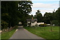
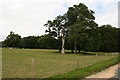
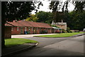
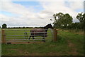
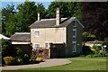
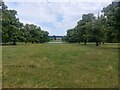
Photos of LN2 2LE


Area Information
Living in LN2 2LE offers a compact, residential experience shaped by its small footprint of 1.3 km² and a population of 2,353 residents. This postcode area, spread across a cluster of homes, is characterised by a low population density of 133 people per square kilometre, suggesting a quiet, community-focused environment. The area’s appeal lies in its accessibility to essential services, with nearby shops, rail links, and schools within practical reach. Daily life here is likely defined by a balance between local amenities and the broader infrastructure of Lincoln and surrounding towns. The presence of independent schools, such as High Leas Education Centre and Northmoor Primary School, hints at a family-oriented demographic, while the predominance of owner-occupied houses suggests a stable, long-term resident base. LN2 2LE’s proximity to Lincoln Central Railway Station and nearby retail hubs like Waitrose and Asda adds to its convenience, making it a viable choice for those prioritising connectivity without the hustle of larger urban centres.
- Area Type
- Postcode
- Area Size
- 1.3 km²
- Population
- 2353
- Population Density
- 133 people/km²
The property market in LN2 2LE is largely owner-occupied, with 74% of homes owned by residents rather than rented. The accommodation type is predominantly houses, which is unusual for areas with higher apartment or flat density. This suggests a housing stock tailored to families or individuals seeking more space, potentially with gardens or larger living areas. Given the small area size of 1.3 km², the market is likely limited in scale, with properties concentrated in a compact cluster. Buyers should consider the proximity to amenities such as schools, rail stations, and retail hubs, which may enhance the area’s appeal. However, the small size of the postcode means the immediate surroundings are critical for assessing broader housing options. For those prioritising home ownership and traditional housing, LN2 2LE presents a niche opportunity, though its limited size may restrict choice.
House Prices in LN2 2LE
Showing 10 properties
| Address | Type | Beds | Baths | Last Sale Price | Last Sale Date | |
|---|---|---|---|---|---|---|
| Beck Cottage, Riseholme Lane, Riseholme, Lincoln, LN2 2LE | house | - | - | £5,000 | Jan 2021 | |
| Lakeview, Riseholme Lane, Riseholme, Lincoln, LN2 2LE | Bungalow | 2 | - | £280,000 | Jul 2015 | |
| The Lodge, Riseholme Lane, Riseholme, Lincoln, LN2 2LE | Detached | - | - | £260,000 | Oct 2008 | |
| Holme Rise, Riseholme Lane, Riseholme, Lincoln, LN2 2LE | Detached | - | - | £272,000 | Aug 2004 | |
| The Old Rectory, Riseholme Lane, Riseholme, Lincoln, LN2 2LE | Detached | - | - | £175,000 | Apr 1998 | |
| The Fives, Riseholme Lane, Riseholme, Lincoln, LN2 2LE | Detached | 4 | 2 | - | - | |
| 2, THE KENNELS, RISEHOLME LANE, Riseholme, Lincoln, LN2 2LE | Detached | - | - | - | - | |
| Flat 1, The Kennels, Riseholme Lane, Riseholme, Lincoln, LN2 2LE | house | - | - | - | - | |
| 1, The Kennels, Riseholme Lane, Riseholme, Lincoln, LN2 2LE | house | - | - | - | - | |
| The Kennels, Riseholme Lane, Riseholme, Lincoln, LN2 2LE | commercial | - | - | - | - |
Energy Efficiency in LN2 2LE
The lifestyle in LN2 2LE is supported by nearby amenities that cater to daily needs. Retail options include major supermarkets such as Waitrose Lincoln, Iceland Nettleham, and Asda Lincoln, ensuring easy access to groceries and household essentials. The area’s rail links to Lincoln Central, Hykeham, and Saxilby stations provide connectivity to urban centres, while RAF Scampton offers proximity to a regional airport. Though the data does not specify parks or leisure facilities, the low population density suggests potential for green spaces or community areas. The combination of retail, transport, and nearby schools creates a convenient environment, ideal for those valuing accessibility without the density of larger towns. For residents, this balance of services and connectivity contributes to a practical, low-stress lifestyle.
Amenities
Schools
Residents of LN2 2LE have access to two independent schools: High Leas Education Centre and Northmoor Primary School – Lincoln Campus. Both institutions are privately run, offering alternatives to state education. The presence of independent schools may attract families seeking specific curricula or smaller class sizes, though no Ofsted ratings are provided in the data. The mix of primary and broader educational institutions suggests a range of options for different age groups. For families prioritising independent schooling, these schools are key considerations. However, the absence of state schools in the data means the area’s educational landscape is narrowly focused on private provision. This could be a decisive factor for buyers with specific educational preferences, though it may also limit accessibility for those relying on state-funded options.
| Rank | School | Type | Entry gender | Ages |
|---|
Explore more schools in this area
Go to Schools tabDemographics
The community in LN2 2LE is predominantly composed of adults aged 30–64, with a median age of 47. This suggests a mature, established population, likely with strong ties to the area. Home ownership is high, at 74%, and the accommodation type is primarily houses, indicating a traditional housing stock with potential for family living. The predominant ethnic group is White, reflecting a homogenous demographic profile. The low population density and age range suggest a community that values stability and proximity to services. While no specific data on deprivation is provided, the high home ownership rate and age profile may correlate with a relatively stable economic environment. This demographic structure implies a neighbourhood where long-term residency is common, and local amenities are likely to cater to the needs of families and older residents.
Household Size
Accommodation Type
Tenure
Ethnic Group
Religion
Household Composition
Age
Household Deprivation
NS-SEC
Explore more demographic insights in this area
Go to Demographics tabPlanning
Planning Constraints
- Flood RiskPremium
- Ramsar Wetland SitesPremium
- Area of Outstanding Natural BeautyPremium
- Protected Nature ReservePremium
- Protected WoodlandPremium