Area Overview for LN2 2NF
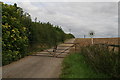
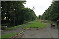
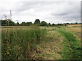
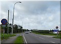
Photos of LN2 2NF


Area Information
Living in LN2 2NF means being part of a tightly knit residential cluster in England, where 2,353 people reside across 55.6 hectares. The area’s compact size fosters a quiet, community-focused environment, with a population density of 133 people per square kilometre. This postcode is characterised by its mix of family homes and a strong emphasis on home ownership, with 74% of properties occupied by their owners. Daily life here is shaped by proximity to essential services, including retail hubs like Asda Lincoln and Waitrose Lincoln, and access to rail links such as Lincoln Central Railway Station. The area’s appeal lies in its balance of residential tranquillity and practical connectivity, making it suitable for those seeking a stable, low-maintenance lifestyle without sacrificing access to amenities. With a median age of 47 and a population skewed towards adults aged 30–64, the community is mature and established, reflecting a demographic that prioritises stability over rapid change.
- Area Type
- Postcode
- Area Size
- 55.6 hectares
- Population
- 2353
- Population Density
- 133 people/km²
The property market in LN2 2NF is dominated by owner-occupied homes, with 74% of properties owned by their residents. This high rate of home ownership suggests a stable market with fewer rental properties, which can be attractive to buyers seeking long-term security. The area’s accommodation is primarily composed of houses, rather than flats or apartments, indicating a focus on family-friendly, spacious living. Given the small size of the postcode area, the housing stock is likely limited, which could mean competition for available properties. Buyers should consider the proximity to amenities such as retail centres and rail links when evaluating the area. The mix of houses and low population density also implies a quieter, more private lifestyle, which may appeal to those prioritising comfort over urban convenience.
House Prices in LN2 2NF
Showing 34 properties
| Address | Type | Beds | Baths | Last Sale Price | Last Sale Date | |
|---|---|---|---|---|---|---|
| Coleraine, Lincoln Road, Lincoln, LN2 2NF | Semi-detached | 3 | 1 | £265,000 | Jul 2025 | |
| Bryteluc, Lincoln Road, Lincoln, LN2 2NF | Semi-detached | 3 | 1 | £280,000 | Mar 2025 | |
| Parkfield, Lincoln Road, Nettleham, Lincoln, LN2 2NF | Detached | 3 | 2 | £535,000 | Feb 2025 | |
| Rockwell Lodge, Danby Hills, Nettleham, Lincoln, LN2 2NF | Detached | 4 | 2 | £825,000 | Apr 2024 | |
| Claremont, Lincoln Road, Lincoln, LN2 2NF | Bungalow | - | - | £220,000 | Jul 2022 | |
| Highfield, Lincoln Road, Lincoln, LN2 2NF | Retail | 3 | 1 | £260,000 | Apr 2022 | |
| Calepatra, Lincoln Road, Lincoln, LN2 2NF | Semi-detached | 3 | - | £278,000 | Sep 2021 | |
| The Haven, Lincoln Road, Lincoln, LN2 2NF | house | - | - | £395,000 | Nov 2020 | |
| Stafford House, Lincoln Road, Lincoln, LN2 2NF | Semi-detached | 5 | 1 | £280,000 | Sep 2020 | |
| Gospatrick, Lincoln Road, Lincoln, LN2 2NF | Semi-detached | 3 | 2 | £177,500 | Oct 2018 |
Energy Efficiency in LN2 2NF
The lifestyle in LN2 2NF is shaped by its proximity to retail and transport hubs. Nearby amenities include Asda Lincoln, Iceland Nettleham, and Waitrose Lincoln, offering a range of shopping and grocery options. The area’s rail links, such as Lincoln Central and Hykeham stations, provide direct access to urban centres and beyond, enhancing mobility for commuters. For those requiring air travel, RAF Scampton is within reach, though it primarily serves military purposes. The mix of retail, transport, and proximity to larger cities ensures a balance between convenience and a quieter residential environment. This combination allows residents to enjoy both the benefits of suburban living and the practicality of urban connectivity.
Amenities
Schools
Residents of LN2 2NF have access to two independent schools: High Leas Education Centre and Northmoor Primary School – Lincoln Campus. Both institutions operate outside the state education system, offering parents alternatives to local authority schools. Independent schools often provide smaller class sizes, specialised curricula, and additional facilities, though they typically require higher fees. The presence of two independent schools in the area suggests a demand for private education, possibly driven by the demographic profile of the community, which includes a significant proportion of adults aged 30–64. Families seeking private schooling options may find this a key advantage, though they should be aware of the associated costs and admissions processes.
| Rank | School | Type | Entry gender | Ages |
|---|
Explore more schools in this area
Go to Schools tabDemographics
The community in LN2 2NF is predominantly composed of adults aged 30–64, with a median age of 47. This suggests a mature, settled population, many of whom are likely to be in their prime working years or nearing retirement. Home ownership is high, at 74%, indicating a strong preference for long-term residency over rental properties. The area is largely composed of houses rather than flats, which aligns with the demographic profile of older, family-oriented residents. The predominant ethnic group is White, reflecting a homogenous community. The population density of 133 people per square kilometre is low enough to suggest a suburban or semi-rural feel, yet close enough to urban centres to ensure access to services. This combination of factors creates a neighbourhood where social cohesion is likely strong, and daily life is shaped by the rhythms of a stable, middle-aged population.
Household Size
Accommodation Type
Tenure
Ethnic Group
Religion
Household Composition
Age
Household Deprivation
NS-SEC
Explore more demographic insights in this area
Go to Demographics tabPlanning
Planning Constraints
- Flood RiskPremium
- Ramsar Wetland SitesPremium
- Area of Outstanding Natural BeautyPremium
- Protected Nature ReservePremium
- Protected WoodlandPremium