Area Overview for DE56 0LN
Photos of DE56 0LN
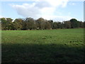
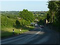
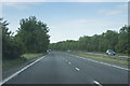
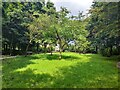
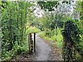
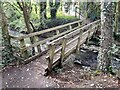
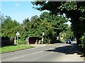
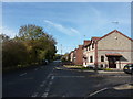
24 photos from this area
Area Information
Key information about the DE56 0LN including its size, population, and administrative classification.
- Area Type
- Postcode
- Area Size
- 13.7 hectares
- Population
- 1745
- Population Density
- 591 people/km²
House Prices in DE56 0LN
14
Properties
£156,832
Average Sold Price
£74,950
Lowest Price
£210,000
Highest Price
Showing 14 properties
| Address | Type | Beds | Baths | Last Sale Price | Last Sale Date | |
|---|---|---|---|---|---|---|
| 7 Rawson Green, Kilburn, Belper, DE56 0LN | Cottage | 2 | 1 | £210,000 | Jul 2023 | |
| 11 Rawson Green, Kilburn, Belper, DE56 0LN | Terraced | 2 | 1 | £177,300 | May 2023 | |
| 13 Rawson Green, Kilburn, Belper, DE56 0LN | Terraced | 2 | 1 | £162,500 | Sep 2022 | |
| 9 Rawson Green, Kilburn, Belper, DE56 0LN | Terraced | 3 | 1 | £175,000 | Apr 2020 | |
| 8 Rawson Green, Kilburn, Belper, DE56 0LN | Terraced | 3 | 1 | £170,000 | Jan 2019 | |
| 15 Rawson Green, Kilburn, Belper, DE56 0LN | house | - | - | £210,000 | Aug 2015 | |
| 17 Rawson Green, Kilburn, Belper, DE56 0LN | Bungalow | - | - | £170,000 | Jun 2014 | |
| 16 Rawson Green, Kilburn, Belper, DE56 0LN | Terraced | - | - | £207,500 | Sep 2004 | |
| 6 Rawson Green, Kilburn, Belper, DE56 0LN | Terraced | - | - | £87,950 | Apr 2003 | |
| 5 Rawson Green, Kilburn, Belper, DE56 0LN | Terraced | - | - | £79,950 | Nov 2002 |
Page 1 of 2
Energy Efficiency in DE56 0LN
Amenities
Schools
| Rank | School | Type | Entry gender | Ages |
|---|
Explore more schools in this area
Go to Schools tabDemographics
Household Size
Two person
most common
Accommodation Type
Houses
most common
Tenure
81
majority
Ethnic Group
White
most common
Religion
N/A
most common
Household Composition
N/A
most common
Age
47
median
Adults (30-64 years)
most common
Household Deprivation
N/A
with no deprivation
NS-SEC
36
in Lower managerial occupations
Explore more demographic insights in this area
Go to Demographics tabPlanning
Planning Constraints
- Flood RiskPremium
- Ramsar Wetland SitesPremium
- Area of Outstanding Natural BeautyPremium
- Protected Nature ReservePremium
- Protected WoodlandPremium