Area Overview for DE11 0UL
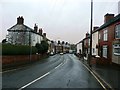
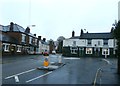
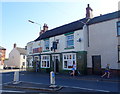
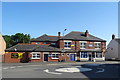
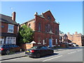
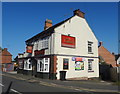
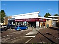
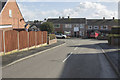
Photos of DE11 0UL

Area Information
Living in DE11 0UL means being part of a tightly knit residential cluster in South Derbyshire, England. The postcode covers just 3.9 hectares, housing 1,361 people in a densely populated area with 34,788 residents per square kilometre. Situated between Swadlincote and Burton upon Trent, this area is steeped in history, shaped by 18th-century industrialisation through coal and clay extraction. Today, it retains a rural character with villages like Newhall and Stanton, connected by roads such as the A444 and A511. The ward’s population grew from 6,214 in 2001 to 6,963, reflecting its enduring appeal. Residents benefit from proximity to nearby towns, with Burton upon Trent about 5 miles away. The area’s compact size means daily life revolves around local amenities, historic sites, and community ties, making it ideal for those seeking a balance between small-town charm and regional connectivity.
- Area Type
- Postcode
- Area Size
- 3.9 hectares
- Population
- 1361
- Population Density
- 1863 people/km²
DE11 0UL is primarily an owner-occupied area, with 65% of homes owned by residents rather than rented. The housing stock consists mainly of houses, which is unusual for a small postcode area but aligns with the region’s traditional building patterns. This suggests a community of long-term residents rather than a transient rental market. The compact size of the area—just 3.9 hectares—means the housing stock is limited, with no indication of large-scale development. Buyers should consider the proximity to nearby towns like Swadlincote and Burton upon Trent, where additional property options may be available. The high home ownership rate indicates stability, but the small size of the area means competition for properties could be fierce. For those prioritising a family home, the presence of a primary school nearby adds to the area’s appeal, though secondary education options would need to be sought elsewhere.
House Prices in DE11 0UL
Showing 62 properties
| Address | Type | Beds | Baths | Last Sale Price | Last Sale Date | |
|---|---|---|---|---|---|---|
| 35 Meadow View Road, Newhall, Swadlincote, DE11 0UL | Terraced | 3 | 1 | £148,000 | Nov 2021 | |
| 16 Meadow View Road, Newhall, Swadlincote, DE11 0UL | Detached | 2 | 1 | £102,500 | May 2020 | |
| 52 Meadow View Road, Newhall, Swadlincote, DE11 0UL | Terraced | 2 | 1 | £115,000 | Mar 2020 | |
| 24 Meadow View Road, Newhall, Swadlincote, DE11 0UL | Terraced | 2 | 1 | £112,500 | Feb 2020 | |
| 27 Meadow View Road, Newhall, Swadlincote, DE11 0UL | house | - | - | £103,000 | Jul 2019 | |
| 4 Meadow View Road, Newhall, Swadlincote, DE11 0UL | Terraced | 3 | 1 | £127,500 | Jun 2018 | |
| 51 Meadow View Road, Newhall, Swadlincote, DE11 0UL | house | - | - | £68,000 | Dec 2016 | |
| 2 Meadow View Road, Newhall, Swadlincote, DE11 0UL | Terraced | 2 | 1 | £115,000 | Aug 2014 | |
| 40 Meadow View Road, Newhall, Swadlincote, DE11 0UL | Semi-detached | 2 | - | £85,000 | Jan 2014 | |
| 32 Meadow View Road, Newhall, Swadlincote, DE11 0UL | house | 3 | - | £94,500 | Jun 2010 |
Energy Efficiency in DE11 0UL
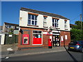
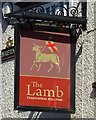
Daily life in DE11 0UL is supported by a range of nearby amenities within practical reach. Five retail outlets include Sainsburys Newhall, Tesco Swadlincote, and Sainsburys Swadlincote, ensuring access to grocery shopping and everyday essentials. The area’s proximity to the A444 and A511 roads also facilitates trips to larger towns for additional services. For leisure, the ward includes Newhall Park, which hosts a composite war memorial, offering a space for reflection and recreation. The historic St John’s Anglican Church and Stanton Methodist Church provide community focal points, while nearby Swadlincote holds St Edward’s Catholic Primary School. The compact layout means amenities are closely clustered, reducing the need for long commutes. However, the absence of listed pubs or cafés in the data suggests a more subdued social scene, with residents likely relying on nearby towns for dining and entertainment.
Amenities
Schools
The nearest school to DE11 0UL is Fairmeadows Foundation Primary School, which serves the local community with a ‘good’ Ofsted rating. This primary school is the only educational institution listed in the data, meaning families with older children would need to look beyond the immediate area for secondary education. The presence of a primary school with a positive rating is a significant draw for families, ensuring access to quality early education. However, the absence of secondary schools within the postcode means parents must plan for commuting to nearby towns like Swadlincote or Burton upon Trent. This could be a practical consideration for those prioritising a school-centric lifestyle. The single school in the area suggests a focus on primary education, which may align with the median age of residents, many of whom are in middle or later life stages.
| Rank | School | Type | Entry gender | Ages |
|---|
Explore more schools in this area
Go to Schools tabDemographics
DE11 0UL’s population skews towards middle-aged and older residents, with a median age of 47 and 65% of the population aged 30–64. Home ownership is high at 65%, indicating a stable community of long-term residents. The area is predominantly composed of houses, reflecting a traditional housing stock. The White ethnic group forms the majority, with no data provided on other demographics. The high population density—34,788 people per square kilometre—suggests a compact, closely spaced residential layout. This density may influence the character of daily life, fostering a sense of familiarity among neighbours. However, it also means limited space for expansion, which could impact future development. The age profile suggests a community with established families and retirees, though the absence of specific data on younger demographics or diversity means the full picture remains incomplete.
Household Size
Accommodation Type
Tenure
Ethnic Group
Religion
Household Composition
Age
Household Deprivation
NS-SEC
Explore more demographic insights in this area
Go to Demographics tabPlanning
Planning Constraints
- Flood RiskPremium
- Ramsar Wetland SitesPremium
- Area of Outstanding Natural BeautyPremium
- Protected Nature ReservePremium
- Protected WoodlandPremium