Area Overview for DE11 0UW
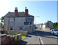
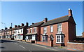
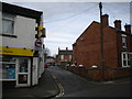
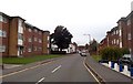
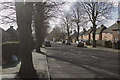
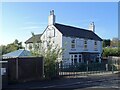
Photos of DE11 0UW

Area Information
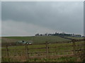
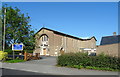
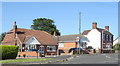
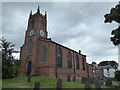
Living in DE11 0UW means being part of a compact, high-density residential cluster nestled in the South Derbyshire district of Derbyshire. This postcode covers 2.5 hectares and is home to 1,258 people, translating to a population density of 50,402 people per square kilometre. Situated between Swadlincote and Burton upon Trent, the area is bordered by the A444 and A511 roads, placing it near key transport routes like the M42 and A38. Historically, the ward of Newhall and Stanton was shaped by 18th-century coal and clay industries, with Newhall once serving as the centre of population for Great Britain in 1971. Today, it retains a mix of rural charm and practical connectivity, with nearby villages like Midway and Swadlincote adding to its character. The area’s small size means residents share close proximity to amenities, from retail outlets to historical sites like St John’s Anglican Church and a composite war memorial. For those seeking a balance between quiet living and accessibility, DE11 0UW offers a compact, well-connected environment.
- Area Type
- Postcode
- Area Size
- 2.5 hectares
- Population
- 1258
- Population Density
- 3562 people/km²
The property market in DE11 0UW is characterised by high home ownership (76%) and a focus on houses rather than flats or apartments. This suggests a residential area where property is primarily owner-occupied, with limited rental activity. The small area size and high population density indicate that the housing stock is fully developed, leaving little scope for new builds or conversions. Buyers considering DE11 0UW should note that the surrounding areas, such as Swadlincote and Midway, may offer more options for property searches. The dominance of houses implies a market geared towards families and individuals seeking space and privacy, though the compact nature of the postcode means competition for available properties could be fierce. For those prioritising proximity to transport links and amenities, the immediate vicinity of DE11 0UW provides practical advantages, despite the limited local housing supply.
House Prices in DE11 0UW
Showing 57 properties
| Address | Type | Beds | Baths | Last Sale Price | Last Sale Date | |
|---|---|---|---|---|---|---|
| 83 Meadow Lane, Newhall, Swadlincote, DE11 0UW | Semi-detached | 2 | 1 | £167,500 | Dec 2024 | |
| 82 Meadow Lane, Newhall, Swadlincote, DE11 0UW | Semi-detached | 3 | 1 | £172,500 | Nov 2024 | |
| 77 Meadow Lane, Newhall, Swadlincote, DE11 0UW | Semi-detached | 3 | 2 | £207,000 | Oct 2024 | |
| 101 Meadow Lane, Newhall, Swadlincote, DE11 0UW | Semi-detached | 2 | 1 | £162,500 | Sep 2023 | |
| 76 Meadow Lane, Newhall, Swadlincote, DE11 0UW | Semi-detached | 2 | 1 | £135,000 | Sep 2023 | |
| 79 Meadow Lane, Newhall, Swadlincote, DE11 0UW | Semi-detached | 3 | 1 | £175,000 | Jul 2021 | |
| 103 Meadow Lane, Newhall, Swadlincote, DE11 0UW | Bungalow | 1 | 1 | £97,500 | Nov 2019 | |
| 93 Meadow Lane, Newhall, Swadlincote, DE11 0UW | Semi-detached | 3 | 1 | £130,000 | Sep 2019 | |
| 48 Meadow Lane, Newhall, Swadlincote, DE11 0UW | Semi-detached | 2 | - | £124,500 | Feb 2019 | |
| 60 Meadow Lane, Newhall, Swadlincote, DE11 0UW | Semi-detached | 2 | 1 | £127,500 | Feb 2018 |
Energy Efficiency in DE11 0UW
Life in DE11 0UW is supported by a range of nearby amenities, including retail outlets such as Sainsburys Newhall, Sainsburys Swadlincote, and Tesco Swadlincote, ensuring daily shopping needs are met. The area’s proximity to rail stations like Burton upon Trent and Willington adds convenience for those relying on public transport. Locally, historical and cultural sites such as St John’s Anglican Church, Stanton Methodist Church, and the composite war memorial at Newhall Park contribute to the area’s character. The presence of listed buildings and a traditional bottle-shaped kiln in Swadlincote highlights the region’s heritage. While the area itself is small, its integration with nearby villages like Swadlincote and Midway expands access to more extensive amenities. For residents, the balance of practical retail, transport links, and historical sites creates a lifestyle that blends convenience with a touch of local history.
Amenities
Schools
| Rank | School | Type | Entry gender | Ages |
|---|
Explore more schools in this area
Go to Schools tabDemographics
The community in DE11 0UW is predominantly composed of adults aged 30–64, with a median age of 47. This suggests a stable population of established families and professionals. Home ownership is high at 76%, with houses being the primary accommodation type, reflecting a preference for private, long-term residency. The predominant ethnic group is White, which aligns with broader trends in the region. The high home ownership rate indicates a community with financial stability and a focus on property as an investment. However, the age profile also suggests a mature demographic, which may influence local services and amenities. With no specific data on deprivation levels, the area’s quality of life appears to be supported by its infrastructure and connectivity, though the absence of younger families might affect the vibrancy of schools and community activities.
Household Size
Accommodation Type
Tenure
Ethnic Group
Religion
Household Composition
Age
Household Deprivation
NS-SEC
Explore more demographic insights in this area
Go to Demographics tabPlanning
Planning Constraints
- Flood RiskPremium
- Ramsar Wetland SitesPremium
- Area of Outstanding Natural BeautyPremium
- Protected Nature ReservePremium
- Protected WoodlandPremium