Area Overview for DE11 0UT
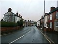
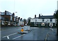
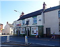
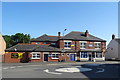
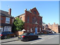
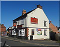
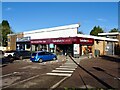
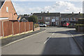
Photos of DE11 0UT


Area Information
Living in DE11 0UT means inhabiting a small, tightly knit residential cluster in South Derbyshire, England. This postcode area, covering just 3.4 hectares, is home to 1,258 people, making it one of the most densely populated regions in the country at 37,398 people per square kilometre. Situated between Swadlincote to the south and Burton upon Trent to the west, the area is defined by its proximity to major roads like the A444 and A511, as well as the M42 motorway. Historically, the region was shaped by 18th-century industrialisation, with coal and clay extraction leaving a legacy of collieries and potteries. Today, the ward of Newhall and Stanton retains a quiet rural character, though its population is predominantly middle-aged adults (30–64 years), with a median age of 47. The area’s compact size means most amenities are within walking distance, while nearby towns offer broader services. Its small footprint and high population density create a community feel, though buyers should consider the limited space for expansion.
- Area Type
- Postcode
- Area Size
- 3.4 hectares
- Population
- 1258
- Population Density
- 3562 people/km²
The property market in DE11 0UT is characterised by a high rate of home ownership (76%), with houses making up the majority of accommodation types. This suggests a predominantly owner-occupied area, rather than one dominated by rental properties. Given the small area size of 3.4 hectares and the high population density, the housing stock is likely limited in volume, with properties concentrated in a compact space. Buyers considering this area should note that the market may have fewer options for expansion or new developments, as the postcode covers a small residential cluster. However, the proximity to larger towns like Swadlincote and Burton upon Trent offers potential for nearby investment or secondary residences. The predominance of houses may appeal to those seeking traditional, spacious homes, though the limited land area means competition for available properties could be intense.
House Prices in DE11 0UT
Showing 33 properties
| Address | Type | Beds | Baths | Last Sale Price | Last Sale Date | |
|---|---|---|---|---|---|---|
| 158 Meadow Lane, Newhall, Swadlincote, DE11 0UT | Bungalow | 2 | 1 | £170,000 | Jul 2025 | |
| 136 Meadow Lane, Newhall, Swadlincote, DE11 0UT | Semi-detached | 3 | 1 | £182,500 | Jul 2022 | |
| 120 Meadow Lane, Newhall, Swadlincote, DE11 0UT | Semi-detached | 3 | 1 | £150,000 | Sep 2021 | |
| 144 Meadow Lane, Newhall, Swadlincote, DE11 0UT | Semi-detached | 2 | 1 | £139,950 | Jun 2020 | |
| 162 Meadow Lane, Newhall, Swadlincote, DE11 0UT | Semi-detached | 2 | 1 | £143,000 | Sep 2019 | |
| 100 Meadow Lane, Newhall, Swadlincote, DE11 0UT | Detached | 5 | 3 | £210,000 | Mar 2019 | |
| 150 Meadow Lane, Newhall, Swadlincote, DE11 0UT | Semi-detached | 2 | - | £113,000 | Oct 2016 | |
| 94 Meadow Lane, Newhall, Swadlincote, DE11 0UT | Detached | 4 | - | £205,000 | Oct 2016 | |
| 128 Meadow Lane, Newhall, Swadlincote, DE11 0UT | house | 2 | - | £94,000 | Oct 2011 | |
| 126 Meadow Lane, Newhall, Swadlincote, DE11 0UT | house | - | - | £85,000 | Oct 2009 |
Energy Efficiency in DE11 0UT
Residents of DE11 0UT have access to essential amenities within practical reach, including retail options like Sainsburys Swadlincote, Tesco Swadlincote, and Sainsburys Newhall. These stores provide convenience for daily shopping needs. The area’s proximity to the A444 and A511 roads, along with nearby towns, ensures a broader range of services. Locally, the ward features notable landmarks such as St John’s Anglican Church and Stanton Methodist Church, as well as a composite war memorial in Newhall Park. The presence of listed buildings and historical sites, like the traditional bottle-shaped kiln in Swadlincote, adds character to the area. While the small footprint means limited green spaces, the nearby villages of Newhall and Stanton offer a mix of rural and semi-urban living. The combination of retail, transport, and heritage sites creates a lifestyle that balances practicality with a touch of historical significance.
Amenities
Schools
| Rank | School | Type | Entry gender | Ages |
|---|
Explore more schools in this area
Go to Schools tabDemographics
The community in DE11 0UT is predominantly composed of adults aged 30–64, with a median age of 47. This suggests a mature population, likely with established careers and families. Home ownership is high at 76%, indicating a stable, long-term resident base rather than a transient rental market. The accommodation type is primarily houses, which aligns with the area’s low density and compact size. The predominant ethnic group is White, reflecting the broader demographic patterns of the East Midlands region. While the data does not specify deprivation levels, the high home ownership rate and age profile suggest a population with financial stability and a focus on long-term residency. This demographic profile implies a community with strong local ties, where most residents are likely to have lived in the area for many years.
Household Size
Accommodation Type
Tenure
Ethnic Group
Religion
Household Composition
Age
Household Deprivation
NS-SEC
Explore more demographic insights in this area
Go to Demographics tabPlanning
Planning Constraints
- Flood RiskPremium
- Ramsar Wetland SitesPremium
- Area of Outstanding Natural BeautyPremium
- Protected Nature ReservePremium
- Protected WoodlandPremium