Area Overview for DE11 0TB
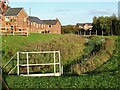
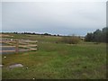
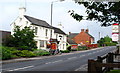
Photos of DE11 0TB


Area Information
DE11 0TB is a small, tightly knit residential postcode nestled in the South Derbyshire district, straddling the villages of Newhall and Stanton. With a population of 1,361 spread across 21.2 hectares, it is a compact area where daily life is shaped by its proximity to Swadlincote and Burton upon Trent. The ward’s history is rooted in 18th-century industrial activity, from coal mines to pottery works, though today it feels more suburban, with a median age of 47 and a strong presence of adults aged 30–64. The area’s layout, bordered by the A444 and A511 roads, offers easy access to nearby towns, while its low population density ensures a quieter, community-focused atmosphere. Residents benefit from a mix of modern and historic features, including listed buildings and a war memorial in Newhall Park. The postcode’s small size means it is ideal for those seeking a balance between rural charm and convenient connectivity, with amenities and transport links within practical reach.
- Area Type
- Postcode
- Area Size
- 21.2 hectares
- Population
- 1361
- Population Density
- 1863 people/km²
DE11 0TB is predominantly an owner-occupied area, with 65% of homes owned by residents rather than rented. The accommodation type is exclusively houses, which is uncommon in smaller postcodes and suggests a focus on family homes or semi-detached properties. Given the area’s compact size, the housing stock is likely limited, meaning buyers may need to consider nearby areas like Swadlincote or Burton upon Trent for more options. The high home ownership rate indicates a stable market, but the lack of rental properties could make it challenging for those seeking short-term accommodation. For buyers, this means a potential focus on purchasing rather than renting, with properties offering the space and privacy associated with house living.
House Prices in DE11 0TB
Showing 64 properties
| Address | Type | Beds | Baths | Last Sale Price | Last Sale Date | |
|---|---|---|---|---|---|---|
| 154 Fairfield Crescent, Newhall, Swadlincote, DE11 0TB | Semi-detached | 3 | 1 | £233,000 | Jul 2025 | |
| 120 Fairfield Crescent, Newhall, Swadlincote, DE11 0TB | Detached | 3 | 1 | £195,000 | Jun 2025 | |
| 94 Fairfield Crescent, Newhall, Swadlincote, DE11 0TB | Terraced | 2 | 1 | £145,000 | Mar 2025 | |
| 85 Fairfield Crescent, Newhall, Swadlincote, DE11 0TB | Semi-detached | 4 | 1 | £183,000 | Jan 2020 | |
| 79 Fairfield Crescent, Newhall, Swadlincote, DE11 0TB | house | - | - | £151,000 | Jul 2019 | |
| 138 Fairfield Crescent, Newhall, Swadlincote, DE11 0TB | house | - | - | £223,000 | Jul 2019 | |
| 99 Fairfield Crescent, Newhall, Swadlincote, DE11 0TB | house | - | - | £135,000 | Jun 2019 | |
| 166 Fairfield Crescent, Newhall, Swadlincote, DE11 0TB | Semi-detached | 2 | - | £128,500 | Jul 2018 | |
| 101 Fairfield Crescent, Newhall, Swadlincote, DE11 0TB | house | 2 | 1 | £119,950 | May 2018 | |
| 110 Fairfield Crescent, Newhall, Swadlincote, DE11 0TB | Terraced | 2 | 1 | £120,000 | Nov 2017 |
Energy Efficiency in DE11 0TB
The lifestyle in DE11 0TB is shaped by its proximity to retail hubs and transport networks. Within practical reach are Sainsburys Newhall, Tesco Swadlincote, and Sainsburys Swadlincote, providing everyday shopping needs. The area’s small size means residents can access these amenities without long commutes. Nearby, the A444 and A511 roads offer links to larger towns, while the ward’s historical sites, such as St John’s Anglican Church and Newhall Park’s war memorial, add cultural and recreational value. The mix of retail, transport, and heritage sites creates a convenient yet characterful environment, blending practicality with local identity.
Amenities
Schools
The nearest school to DE11 0TB is Fairmeadows Foundation Primary School, which provides education for young children and holds an Ofsted rating of ‘good’. This is the only named school in the immediate area, meaning families may need to look further afield for secondary education options. The presence of a primary school with a positive rating is a key consideration for parents, though the absence of additional schools highlights the need for nearby towns like Swadlincote or Burton upon Trent for broader educational choices. The single school in the area may also reflect the postcode’s small size, making it essential for buyers to assess the proximity of secondary schools and other educational facilities.
| Rank | School | Type | Entry gender | Ages |
|---|
Explore more schools in this area
Go to Schools tabDemographics
The population of DE11 0TB skews towards middle-aged adults, with a median age of 47 and 65% of residents owning their homes. This suggests a stable, long-term community with a focus on family-oriented living. The predominant accommodation type is houses, reflecting a residential character that prioritises space and privacy. The majority of residents identify as White, and while specific data on diversity is not provided, the age profile indicates a mix of professionals and retirees. The 65% home ownership rate aligns with a community that values property as a long-term investment. With a population density of 6,413 people per square kilometre, the area is densely populated for its size, yet the presence of houses rather than flats suggests a preference for larger, more private living spaces.
Household Size
Accommodation Type
Tenure
Ethnic Group
Religion
Household Composition
Age
Household Deprivation
NS-SEC
Explore more demographic insights in this area
Go to Demographics tabPlanning
Planning Constraints
- Flood RiskPremium
- Ramsar Wetland SitesPremium
- Area of Outstanding Natural BeautyPremium
- Protected Nature ReservePremium
- Protected WoodlandPremium