Area Overview for Sesswick Community
Photos of Sesswick Community

Area Information
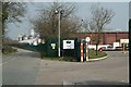
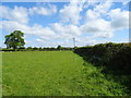
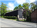
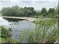
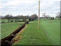
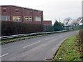
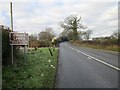
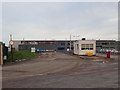
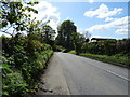
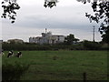
Living in Sesswick Community means choosing a defined civil parish with a distinct rural character within Wrexham County Borough. This area covers 11.0 km² and lies south-east of Wrexham, positioned near the settlement of Marchwiel. The community's boundaries are largely traced by the courses of the Rivers Dee and Clywedog, alongside Bedwell Brook. You will find the community comprises several small hamlets rather than a single dense urban centre. Historically, these settlements centred around Cross Lanes at the intersection of the A525 and B5130 roads. Isolated houses are scattered along specific routes including Holt Road, Kiln Lane, and Bangor Road. Sesswick shares its borders with neighbouring community councils such as Marchwiel, Abenbury, Isycoed, Bangor Is-y-Coed, Erbistock and Worthenbury. The name itself tells a story of early English settlement, recorded as "Sesewyke" in 1286. It suggests a connection to an Old English personal name or potentially references land ownership by St Chad. The area became part of Clwyd following local government reorganisation in 1972 before transferring to Wrexham County Borough in 1996. The Sesswick Community Council was formally established in 1972 to manage these local affairs.
- Area Type
- Parish
- Area Size
- 11.0 km²
- Population
- Not available
- Population Density
- Not available
Demographics
The population profile of Sesswick Community is dominated by older residents, with a median age of 70 years. This figure indicates an elderly-dominated demographic where the majority of the population falls into the older age brackets. Only a population of 609 residents was recorded in the 2011 Census, reflecting the small scale of this parish community. You will find that the area reflects a traditional settlement pattern rather than a youthful or family-oriented demographic shift. Home ownership stands at a high level of 77%, suggesting a neighbourhood where most households have purchased their properties. This high rate of ownership points to a stable community with long-term residents rather than a transient population. The demographic data does not breakdown household composition or predominant ethnicity in the available records, indicating a homogeneous population profile typical of rural Welsh parishes. Without specific data on religious affiliation or detailed household types, the picture remains focused on the age and ownership structure. This profile suggests an area where services and amenities are likely tailored to the needs of older, owner-occupied households living in close proximity to one another.
Household Size
Accommodation Type
Tenure
Ethnic Group
Religion
Household Composition
Age
Household Deprivation
NS-SEC
Explore more demographic insights in this area
Go to Demographics tabPlanning
Planning Constraints
- Flood RiskPremium
- Ramsar Wetland SitesPremium
- Area of Outstanding Natural BeautyPremium
- Protected Nature ReservePremium
- Protected WoodlandPremium
- Crime RiskPremium