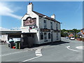
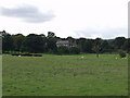
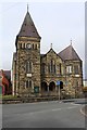
Area Overview for Rhosllanerchrugog Community
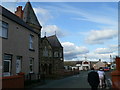
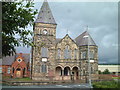
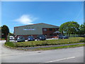
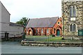
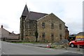
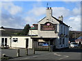
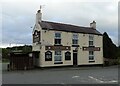
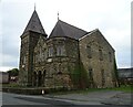
Photos of Rhosllanerchrugog Community
Area Information
Living in Rhosllanerchrugog Community offers a distinctly rural experience within the Welsh landscape. This civil parish covers an area of just 6.1 km², creating a compact and intimate neighbourhood where residents know one another. You will find a quiet setting that feels removed from the bustle of larger towns, yet it remains connected to wider transport networks. The area is small enough that daily necessities are often within walking distance or a short drive away. This parish sits within Wales, contributing to a environment that values preservation and natural beauty. The median age of residents is notably high at 70, which defines the character of the village. You are looking at a community where retirement and established families dominate the social scene rather than young professionals seeking a city commute. Homes in Rhosllanerchrugog Community reflect this demographic, often catering to those with significant life experience. Daily life here revolves around a slower pace, with neighbours prioritising nature and stability over rapid development. The compact size of the parish means you do not get lost searching for landmarks; everything in this small 6.1 km² space is central to your routine.
- Area Type
- Parish
- Area Size
- 6.1 km²
- Population
- Not available
- Population Density
- Not available
Demographics
The people of Rhosllanerchrugog Community present a specific demographic profile that shapes the local rhythm. The median age stands at 70, indicating this is an area primarily populated by older adults. This age distribution suggests a strong presence of retirees or semi-retired individuals who have settled down. With a home ownership rate of 62%, more than half of the households are outright owners or do not represent the renter market. This high level of ownership typically correlates with long-term residents who have no intention of moving soon. The household composition and accommodation type data confirm a stable settlement pattern where change happens slowly. You will encounter a predominantly settled population rather than a transient workforce. While specific data on ethnicity and religion are not detailed in the current figures, the overall structure points to a homogeneous community defined by age and tenure. The high proportion of owner-occupied homes means decisions regarding the upkeep and future of the area rest largely with the residents themselves. This demographic cluster creates a environment where investment in property and local amenities is driven by long-term residents rather than speculative buyers.
Household Size
Accommodation Type
Tenure
Ethnic Group
Religion
Household Composition
Age
Household Deprivation
NS-SEC
Explore more demographic insights in this area
Go to Demographics tabPlanning
Planning Constraints
- Flood RiskPremium
- Ramsar Wetland SitesPremium
- Area of Outstanding Natural BeautyPremium
- Protected Nature ReservePremium
- Protected WoodlandPremium
- Crime RiskPremium