Area Overview for Rhosddu Community
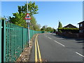
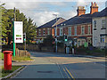
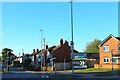
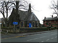
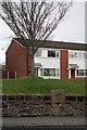
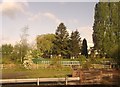
Photos of Rhosddu Community


Area Information
Living in Rhosddu Community offers a quiet existence within a defined civil parish in Wales. You will find the area covers a compact 2.2 km², creating an intimate neighbourhood where daily life moves at a slower pace. This setting is distinctive because it functions as a traditional parish with very clear boundaries and a strong sense of established local identity. When you walk through Rhosddu, the tight geographical footprint means you encounter a concentrated coastal community rather than a sprawling development. The area does not sit within an Area of Outstanding Natural Beauty or a protected nature reserve, which distinguishes it from other scenic Welsh retreats while maintaining its rural character. Residents enjoy the benefits of a small-scale settlement where everyday activities often take place within a short walk or drive. The small size of Rhosddu Community ensures that you can easily navigate the local environment without the congestion found in larger towns. Your daily routine here centres on a simple geography where the distance from home to key amenities remains short. This layout supports a lifestyle defined by simplicity and proximity, making it a practical choice for those seeking a peaceful address away from major urban centres. The community in Rhosddu Community has a distinct demographic profile that reflects its settled nature. The median age here stands at 70 years, which means you are typically dealing with an older population as you look for homes in this location. Most residents fall into the age group associated with this high median figure, suggesting RHOSDDU is a place where families have moved away and retirees have settled. Sixty-four per cent of households in Rhosddu Community own their homes outright, creating a stable environment where property turnover is likely lower than in younger markets. The total household composition indicates a broad range of living arrangements, yet the high ownership rate points to long-term residents who have stayed for decades. You will notice that the diversity of the area is defined by the predominance of local ethnic groups and age cohorts rather than transient populations. This conservatism in demographic make-up means living in Rhosddu Community offers a predictable social environment where neighbours are often lifelong friends. The absence of significant data on specific deprivation levels does not diminish the fact that a high home ownership percentage usually correlates with financial stability among residents. When you consider schools near Rhosddu, remember that the local population's age suggests a lower demand for primary education directly within the parish boundaries. The property market in Rhosddu Community is heavily weighted towards owner-occupiers rather than investors or landlords. With 64% of residents owning their homes, you encounter a housing stock built on long-term residence instead of short-term tenancies. This high rate of home ownership means that when you view properties for sale in Rhosddu Community, you are looking at houses with deep local roots. The accommodation types available here reflect the needs of an older population, likely featuring larger parcels of land or bungalows suited to retirement living. Because the most common age range aligns with the median age of 70, the demand for family-sized new builds in Rhosddu is minimal. Instead, the market relies on existing stock that has been adapted over the years. If you are a buyer considering Rhosddu, you must accept that this is not a high-turnover area where developers frequently bring fresh launches. The total accommodation types present indicate a mix that serves the established demographic, rather than a diverse array of urban apartments. This market structure provides security for sellers but may limit options for buyers seeking specific modern amenities or new builds. Understanding this dynamic helps you purchase homes in Rhosddu Community with realistic expectations about availability and stock condition. Connectivity for residents of Rhosddu Community is robust enough to support modern living standards without compromising the rural feel. Your mobile coverage score is 83 out of 100, which translates to excellent network quality for making calls and checking messages while walking around the parish. Fixed broadband quality scores 90 out of 100, ensuring you can work from home reliably even when you stay put for short visits. These high scores mean that digital connectivity in Rhosddu Community is not a barrier for remote professionals or frequent online shoppers. You do not face the slow internet speeds that often plague remote parts of Wales, as the infrastructure here meets excellent criteria defined by current quality indices. When you plan your day, you can assume that video conferencing and large file transfers will work smoothly throughout the 2.2 km² area. This level of digital readiness supports the local population, who spend a significant portion of their lives at home due to the age profile of the area. For those who value staying connected while enjoying a quiet life, the transport and digital landscape in Rhosddu Community provides the necessary foundation. There are no constraints on internet usage, allowing you to manage your affairs efficiently regardless of your specific location within the parish boundaries. Safety considerations for Rhosddu Community show low risk across several key environmental categories. The flood risk assessment passes with a score of 6.53 on a scale where lower numbers indicate less danger, confirming low flood risk coverage across the area. This means you do not need to increase home insurance premiums for overflow protection common in lower-lying coastal zones. Planning constraints remain minimal as the area has zero Ramsar wetland sites, no Areas of Outstanding Natural Beauty status, and no protected nature reserve or woodland coverage that would restrict future building plans. The absence of these designations suggests that the immediate local environment faces fewer bureaucratic hurdles for development compared to more sensitive zones. Regarding crime, specific data for this area is not currently available because risk assessments are only published for locations in England, so you must rely on general knowledge of the region. Despite this gap, the low environmental risk scores indicate a stable physical setting where residents live without constant threat from natural disasters. When you evaluate safety in Rhosddu Community, you find reassurance in the water management and planning freedoms. The only notable limitation is the lack of crime statistics, which prevents a full picture of police-reported incidents for these specific properties. How connected is Rhosddu Community with digital infrastructure?Rhosddu Community benefits from excellent digital infrastructure. Your mobile coverage scores 83 out of 100, and fixed broadband quality reaches 90 out of 100. These high ratings ensure reliable internet for working from home and heavy online usage anywhere within the 2.2 km² parish. What is the typical resident profile in this area?The community is dominated by older adults with a median age of 70. Sixty-four per cent of households own their homes, creating a stable environment. Most residents are long-term owners rather than renters or young buyers looking for family housing. Are there planning restrictions for buying or building in Rhosddu Community?No major planning constraints affect the area. There are no Ramsar wetland sites, Areas of Outstanding Natural Beauty, or protected nature reserves within the parish boundaries. This status allows for greater flexibility regarding future developments compared to more sensitive locations in Wales. Is there flood risk when buying a home in Rhosddu Community?flood risk is low according to the latest safety assessments. The area scores 6.53 out of 100 on the risk scale, where a lower number indicates less danger. Consequently, the site passes the safety check with low flood risk coverage confirmed.
- Area Type
- Parish
- Area Size
- 2.2 km²
- Population
- Not available
- Population Density
- Not available
Demographics
The community in Rhosddu Community has a distinct demographic profile that reflects its settled nature. The median age here stands at 70 years, which means you are typically dealing with an older population as you look for homes in this location. Most residents fall into the age group associated with this high median figure, suggesting RHOSDDU is a place where families have moved away and retirees have settled. Sixty-four per cent of households in Rhosddu Community own their homes outright, creating a stable environment where property turnover is likely lower than in younger markets. The total household composition indicates a broad range of living arrangements, yet the high ownership rate points to long-term residents who have stayed for decades. You will notice that the diversity of the area is defined by the predominance of local ethnic groups and age cohorts rather than transient populations. This conservatism in demographic make-up means living in Rhosddu Community offers a predictable social environment where neighbours are often lifelong friends. The absence of significant data on specific deprivation levels does not diminish the fact that a high home ownership percentage usually correlates with financial stability among residents. When you consider schools near Rhosddu, remember that the local population's age suggests a lower demand for primary education directly within the parish boundaries. The property market in Rhosddu Community is heavily weighted towards owner-occupiers rather than investors or landlords. With 64% of residents owning their homes, you encounter a housing stock built on long-term residence instead of short-term tenancies. This high rate of home ownership means that when you view properties for sale in Rhosddu Community, you are looking at houses with deep local roots. The accommodation types available here reflect the needs of an older population, likely featuring larger parcels of land or bungalows suited to retirement living. Because the most common age range aligns with the median age of 70, the demand for family-sized new builds in Rhosddu is minimal. Instead, the market relies on existing stock that has been adapted over the years. If you are a buyer considering Rhosddu, you must accept that this is not a high-turnover area where developers frequently bring fresh launches. The total accommodation types present indicate a mix that serves the established demographic, rather than a diverse array of urban apartments. This market structure provides security for sellers but may limit options for buyers seeking specific modern amenities or new builds. Understanding this dynamic helps you purchase homes in Rhosddu Community with realistic expectations about availability and stock condition. Connectivity for residents of Rhosddu Community is robust enough to support modern living standards without compromising the rural feel. Your mobile coverage score is 83 out of 100, which translates to excellent network quality for making calls and checking messages while walking around the parish. Fixed broadband quality scores 90 out of 100, ensuring you can work from home reliably even when you stay put for short visits. These high scores mean that digital connectivity in Rhosddu Community is not a barrier for remote professionals or frequent online shoppers. You do not face the slow internet speeds that often plague remote parts of Wales, as the infrastructure here meets excellent criteria defined by current quality indices. When you plan your day, you can assume that video conferencing and large file transfers will work smoothly throughout the 2.2 km² area. This level of digital readiness supports the local population, who spend a significant portion of their lives at home due to the age profile of the area. For those who value staying connected while enjoying a quiet life, the transport and digital landscape in Rhosddu Community provides the necessary foundation. There are no constraints on internet usage, allowing you to manage your affairs efficiently regardless of your specific location within the parish boundaries. Safety considerations for Rhosddu Community show low risk across several key environmental categories. The flood risk assessment passes with a score of 6.53 on a scale where lower numbers indicate less danger, confirming low flood risk coverage across the area. This means you do not need to increase home insurance premiums for overflow protection common in lower-lying coastal zones. Planning constraints remain minimal as the area has zero Ramsar wetland sites, no Areas of Outstanding Natural Beauty status, and no protected nature reserve or woodland coverage that would restrict future building plans. The absence of these designations suggests that the immediate local environment faces fewer bureaucratic hurdles for development compared to more sensitive zones. Regarding crime, specific data for this area is not currently available because risk assessments are only published for locations in England, so you must rely on general knowledge of the region. Despite this gap, the low environmental risk scores indicate a stable physical setting where residents live without constant threat from natural disasters. When you evaluate safety in Rhosddu Community, you find reassurance in the water management and planning freedoms. The only notable limitation is the lack of crime statistics, which prevents a full picture of police-reported incidents for these specific properties. How connected is Rhosddu Community with digital infrastructure?Rhosddu Community benefits from excellent digital infrastructure. Your mobile coverage scores 83 out of 100, and fixed broadband quality reaches 90 out of 100. These high ratings ensure reliable internet for working from home and heavy online usage anywhere within the 2.2 km² parish. What is the typical resident profile in this area?The community is dominated by older adults with a median age of 70. Sixty-four per cent of households own their homes, creating a stable environment. Most residents are long-term owners rather than renters or young buyers looking for family housing. Are there planning restrictions for buying or building in Rhosddu Community?No major planning constraints affect the area. There are no Ramsar wetland sites, Areas of Outstanding Natural Beauty, or protected nature reserves within the parish boundaries. This status allows for greater flexibility regarding future developments compared to more sensitive locations in Wales. Is there flood risk when buying a home in Rhosddu Community?flood risk is low according to the latest safety assessments. The area scores 6.53 out of 100 on the risk scale, where a lower number indicates less danger. Consequently, the site passes the safety check with low flood risk coverage confirmed.
Household Size
Accommodation Type
Tenure
Ethnic Group
Religion
Household Composition
Age
Household Deprivation
NS-SEC
Explore more demographic insights in this area
Go to Demographics tabPlanning
Planning Constraints
- Flood RiskPremium
- Ramsar Wetland SitesPremium
- Area of Outstanding Natural BeautyPremium
- Protected Nature ReservePremium
- Protected WoodlandPremium
- Crime RiskPremium