Area Overview for LL14 6RP
Photos of LL14 6RP
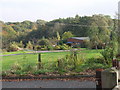
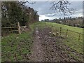
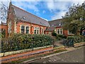
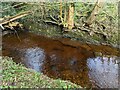
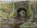
14 photos from this area
Area Information
Key information about the LL14 6RP including its size, population, and administrative classification.
- Area Type
- Postcode
- Area Size
- 2.2 hectares
- Population
- 1531
- Population Density
- 709 people/km²
House Prices in LL14 6RP
19
Properties
£187,828
Average Sold Price
£127,950
Lowest Price
£238,950
Highest Price
Showing 19 properties
| Address | Type | Beds | Baths | Last Sale Price | Last Sale Date | |
|---|---|---|---|---|---|---|
| 14 Lower School Drive, Ruabon, Wrexham, LL14 6RP | house | - | - | £223,000 | Aug 2019 | |
| 12 Lower School Drive, Ruabon, Wrexham, LL14 6RP | house | - | - | £196,000 | Feb 2017 | |
| 8 Lower School Drive, Ruabon, Wrexham, LL14 6RP | Detached | 4 | - | £228,500 | Apr 2014 | |
| 7 Lower School Drive, Ruabon, Wrexham, LL14 6RP | house | 4 | - | £197,500 | Jul 2011 | |
| 19 Lower School Drive, Ruabon, Wrexham, LL14 6RP | Detached | - | - | £211,000 | Oct 2009 | |
| 17 Lower School Drive, Ruabon, Wrexham, LL14 6RP | Detached | - | - | £183,000 | Jul 2006 | |
| 4 Lower School Drive, Ruabon, Wrexham, LL14 6RP | house | - | - | £162,000 | Jul 2006 | |
| 18 Lower School Drive, Ruabon, Wrexham, LL14 6RP | house | 4 | 2 | £238,950 | Sep 2004 | |
| 15 Lower School Drive, Ruabon, Wrexham, LL14 6RP | Detached | - | - | £182,500 | May 2004 | |
| 11 Lower School Drive, Ruabon, Wrexham, LL14 6RP | Detached | - | - | £182,500 | May 2004 |
Page 1 of 2
Energy Efficiency in LL14 6RP
Amenities
Schools
| Rank | School | Type | Entry gender | Ages |
|---|
Explore more schools in this area
Go to Schools tabDemographics
Household Size
Family (3-5 people)
most common
Accommodation Type
Houses
most common
Tenure
58
majority
Ethnic Group
White
most common
Religion
N/A
most common
Household Composition
N/A
most common
Age
47
median
Adults (30-64 years)
most common
Household Deprivation
N/A
with no deprivation
NS-SEC
29
in Lower managerial occupations
Explore more demographic insights in this area
Go to Demographics tabPlanning
Planning Constraints
- Flood RiskPremium
- Ramsar Wetland SitesPremium
- Area of Outstanding Natural BeautyPremium
- Protected Nature ReservePremium
- Protected WoodlandPremium
- Crime RiskPremium