Area Overview for LL14 5PW
Photos of LL14 5PW
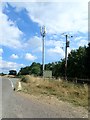
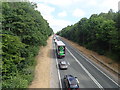
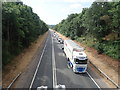
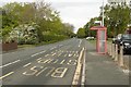
30 photos from this area
Area Information
Key information about the LL14 5PW including its size, population, and administrative classification.
- Area Type
- Postcode
- Area Size
- 2.0 hectares
- Population
- 1974
- Population Density
- 146 people/km²
House Prices in LL14 5PW
38
Properties
£101,084
Average Sold Price
£18,130
Lowest Price
£174,000
Highest Price
Showing 38 properties
| Address | Type | Beds | Baths | Last Sale Price | Last Sale Date | |
|---|---|---|---|---|---|---|
| 80 Bron Y Waun, Chirk, Wrexham, LL14 5PW | house | - | - | £165,000 | Aug 2024 | |
| 82 Bron Y Waun, Chirk, Wrexham, LL14 5PW | Semi-detached | 3 | - | £174,000 | Sep 2021 | |
| 83 Bron Y Waun, Chirk, Wrexham, LL14 5PW | house | - | - | £135,950 | Feb 2021 | |
| 85 Bron Y Waun, Chirk, Wrexham, LL14 5PW | house | - | - | £137,000 | Oct 2019 | |
| 132 Bron Y Waun, Chirk, Wrexham, LL14 5PW | house | - | - | £112,500 | Jul 2019 | |
| 135 Bron Y Waun, Chirk, Wrexham, LL14 5PW | Semi-detached | 3 | 1 | £114,000 | May 2019 | |
| 92 Bron Y Waun, Chirk, Wrexham, LL14 5PW | house | - | - | £129,000 | Feb 2018 | |
| 86 Bron Y Waun, Chirk, Wrexham, LL14 5PW | house | - | - | £125,000 | Mar 2016 | |
| 139 Bron Y Waun, Chirk, Wrexham, LL14 5PW | house | - | - | £140,000 | Jan 2016 | |
| 136 Bron Y Waun, Chirk, Wrexham, LL14 5PW | house | - | - | £115,000 | Jun 2014 |
Page 1 of 4
Energy Efficiency in LL14 5PW
Amenities
Schools
| Rank | School | Type | Entry gender | Ages |
|---|
Explore more schools in this area
Go to Schools tabDemographics
Household Size
One person
most common
Accommodation Type
Houses
most common
Tenure
61
majority
Ethnic Group
White
most common
Religion
N/A
most common
Household Composition
N/A
most common
Age
47
median
Adults (30-64 years)
most common
Household Deprivation
N/A
with no deprivation
NS-SEC
26
in Lower managerial occupations
Explore more demographic insights in this area
Go to Demographics tabPlanning
Planning Constraints
- Flood RiskPremium
- Ramsar Wetland SitesPremium
- Area of Outstanding Natural BeautyPremium
- Protected Nature ReservePremium
- Protected WoodlandPremium
- Crime RiskPremium