Area Overview for LL14 5PF
Photos of LL14 5PF
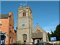
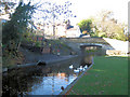
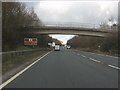
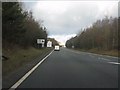
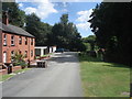
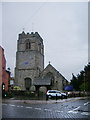
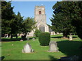
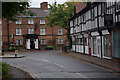
100 photos from this area
Area Information
Key information about the LL14 5PF including its size, population, and administrative classification.
- Area Type
- Postcode
- Area Size
- 1.6 hectares
- Population
- 1974
- Population Density
- 146 people/km²
House Prices in LL14 5PF
40
Properties
£94,490
Average Sold Price
£29,500
Lowest Price
£147,000
Highest Price
Showing 40 properties
| Address | Type | Beds | Baths | Last Sale Price | Last Sale Date | |
|---|---|---|---|---|---|---|
| 89 Church View, Chirk, Wrexham, LL14 5PF | Flat | - | - | £93,000 | Jul 2023 | |
| 63 Church View, Chirk, Wrexham, LL14 5PF | house | - | - | £147,000 | Sep 2019 | |
| 91 Church View, Chirk, Wrexham, LL14 5PF | Maisonette | - | - | £83,000 | Jul 2018 | |
| 61 Church View, Chirk, Wrexham, LL14 5PF | Semi-detached | - | - | £119,950 | Jul 2005 | |
| 65 Church View, Chirk, Wrexham, LL14 5PF | Semi-detached | - | - | £29,500 | Oct 1997 | |
| 67 Church View, Chirk, Wrexham, LL14 5PF | house | - | - | - | - | |
| 96 Church View, Chirk, Wrexham, LL14 5PF | Flat | - | - | - | - | |
| 82 Church View, Chirk, Wrexham, LL14 5PF | Flat | - | - | - | - | |
| 71 Church View, Chirk, Wrexham, LL14 5PF | Flat | - | - | - | - | |
| 87 Church View, Chirk, Wrexham, LL14 5PF | Flat | - | - | - | - |
Page 1 of 4
Energy Efficiency in LL14 5PF
Amenities
Schools
| Rank | School | Type | Entry gender | Ages |
|---|
Explore more schools in this area
Go to Schools tabDemographics
Household Size
One person
most common
Accommodation Type
Houses
most common
Tenure
61
majority
Ethnic Group
White
most common
Religion
N/A
most common
Household Composition
N/A
most common
Age
47
median
Adults (30-64 years)
most common
Household Deprivation
N/A
with no deprivation
NS-SEC
26
in Lower managerial occupations
Explore more demographic insights in this area
Go to Demographics tabPlanning
Planning Constraints
- Flood RiskPremium
- Ramsar Wetland SitesPremium
- Area of Outstanding Natural BeautyPremium
- Protected Nature ReservePremium
- Protected WoodlandPremium
- Crime RiskPremium