Area Overview for LL14 3EG
Photos of LL14 3EG

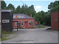
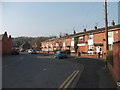
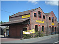
21 photos from this area
Area Information
Key information about the LL14 3EG including its size, population, and administrative classification.
- Area Type
- Postcode
- Area Size
- 73.4 hectares
- Population
- 1611
- Population Density
- 1232 people/km²
House Prices in LL14 3EG
17
Properties
£80,486
Average Sold Price
£38,500
Lowest Price
£147,500
Highest Price
Showing 17 properties
| Address | Type | Beds | Baths | Last Sale Price | Last Sale Date | |
|---|---|---|---|---|---|---|
| Bodylltyn Lodge, Park Road, Rhosymedre, Wrexham, LL14 3EG | Detached | 2 | 1 | £139,950 | Apr 2018 | |
| 4, Bodylltyn Row, Park Road, Rhosymedre, Wrexham, LL14 3EG | house | - | - | £67,000 | Feb 2017 | |
| 5, Bodylltyn Row, Park Road, Rhosymedre, Wrexham, LL14 3EG | Terraced | 1 | - | £62,000 | Jan 2014 | |
| 6, Bodylltyn Row, Park Road, Rhosymedre, Wrexham, LL14 3EG | Terraced | 1 | 1 | £83,000 | Oct 2012 | |
| Waylands, Park Road, Rhosymedre, Wrexham, LL14 3EG | Bungalow | - | - | £147,500 | Aug 2004 | |
| 1, Bodylltyn Row, Park Road, Rhosymedre, Wrexham, LL14 3EG | house | - | - | £65,000 | Apr 2003 | |
| The Points, Park Road, Rhosymedre, Wrexham, LL14 3EG | Detached | - | - | £63,500 | Jul 2002 | |
| The Elms, Park Road, Rhosymedre, Wrexham, LL14 3EG | Detached | - | - | £105,000 | Jul 2002 | |
| Ffynnon Isa, Park Road, Rhosymedre, Wrexham, LL14 3EG | Detached | - | - | £60,000 | Mar 2002 | |
| 2, Bodylltyn Row, Park Road, Rhosymedre, Wrexham, LL14 3EG | Terraced | - | - | £38,500 | Jan 2002 |
Page 1 of 2
Energy Efficiency in LL14 3EG
Amenities
Schools
| Rank | School | Type | Entry gender | Ages |
|---|
Explore more schools in this area
Go to Schools tabDemographics
Household Size
Family (3-5 people)
most common
Accommodation Type
Houses
most common
Tenure
56
majority
Ethnic Group
White
most common
Religion
N/A
most common
Household Composition
N/A
most common
Age
47
median
Adults (30-64 years)
most common
Household Deprivation
N/A
with no deprivation
NS-SEC
15
in Lower managerial occupations
Explore more demographic insights in this area
Go to Demographics tabPlanning
Planning Constraints
- Flood RiskPremium
- Ramsar Wetland SitesPremium
- Area of Outstanding Natural BeautyPremium
- Protected Nature ReservePremium
- Protected WoodlandPremium
- Crime RiskPremium