Area Overview for LL14 2SN
Photos of LL14 2SN
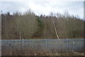
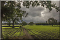
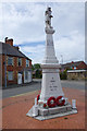
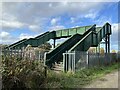
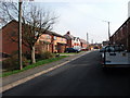
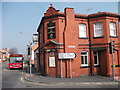
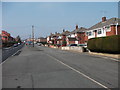
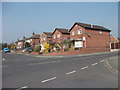
20 photos from this area
Area Information
Key information about the LL14 2SN including its size, population, and administrative classification.
- Area Type
- Postcode
- Area Size
- 4005 m²
- Population
- 1429
- Population Density
- 2172 people/km²
House Prices in LL14 2SN
16
Properties
£85,317
Average Sold Price
£55,000
Lowest Price
£101,000
Highest Price
Showing 16 properties
| Address | Type | Beds | Baths | Last Sale Price | Last Sale Date | |
|---|---|---|---|---|---|---|
| 23, The Quadrant, High Street, Johnstown, Wrexham, LL14 2SN | house | - | - | £99,950 | Apr 2022 | |
| 17 High Street, Johnstown, Wrexham, LL14 2SN | house | 5 | - | £101,000 | Aug 2017 | |
| 20 High Street, Johnstown, Wrexham, LL14 2SN | house | - | - | £55,000 | Apr 2000 | |
| 16A High Street, Johnstown, Wrexham, LL14 2SN | Terraced | 2 | - | - | - | |
| 19A High Street, Johnstown, Wrexham, LL14 2SN | Flat | - | - | - | - | |
| Surgery, High Street, Johnstown, Wrexham, LL14 2SN | restaurant_cafe | - | - | - | - | |
| Former Butchers Shop, High Street, Johnstown, Wrexham, LL14 2SN | shop | - | - | - | - | |
| Dental Surgery, 24 High Street, Johnstown, Wrexham, LL14 2SN | primary_healthcare | - | - | - | - | |
| 21A, Ground Floor Flat, The Quadrant, High Street, Johnstown, Wrexham, LL14 2SN | Flat | 1 | 1 | - | - | |
| 21B, First Floor Flat, The Quadrant, High Street, Johnstown, Wrexham, LL14 2SN | Flat | - | - | - | - |
Page 1 of 2
Energy Efficiency in LL14 2SN
Amenities
Schools
| Rank | School | Type | Entry gender | Ages |
|---|
Explore more schools in this area
Go to Schools tabDemographics
Household Size
One person
most common
Accommodation Type
Houses
most common
Tenure
51
majority
Ethnic Group
White
most common
Religion
N/A
most common
Household Composition
N/A
most common
Age
47
median
Adults (30-64 years)
most common
Household Deprivation
N/A
with no deprivation
NS-SEC
17
in Lower managerial occupations
Explore more demographic insights in this area
Go to Demographics tabPlanning
Planning Constraints
- Flood RiskPremium
- Ramsar Wetland SitesPremium
- Area of Outstanding Natural BeautyPremium
- Protected Nature ReservePremium
- Protected WoodlandPremium
- Crime RiskPremium