Area Overview for LL14 2HT
Photos of LL14 2HT
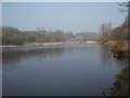
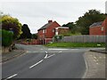
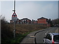
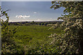
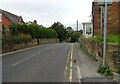
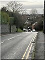
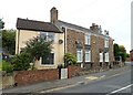
8 photos from this area
Area Information
Key information about the LL14 2HT including its size, population, and administrative classification.
- Area Type
- Postcode
- Area Size
- 1.9 hectares
- Population
- 2286
- Population Density
- 3128 people/km²
House Prices in LL14 2HT
37
Properties
£119,793
Average Sold Price
£39,000
Lowest Price
£190,000
Highest Price
Showing 37 properties
| Address | Type | Beds | Baths | Last Sale Price | Last Sale Date | |
|---|---|---|---|---|---|---|
| Ponderoza, 57 Osborne Street, Rhosllanerchrugog, Wrexham, LL14 2HT | Retail | 2 | 1 | £160,000 | Aug 2022 | |
| Annjill, 70 Osborne Street, Rhosllanerchrugog, Wrexham, LL14 2HT | Retail | 3 | 1 | £177,500 | Aug 2022 | |
| 48 Osborne Street, Rhosllanerchrugog, Wrexham, LL14 2HT | house | - | - | £190,000 | Jan 2021 | |
| Cilgwyn, 51 Osborne Street, Rhosllanerchrugog, Wrexham, LL14 2HT | Bungalow | - | - | £147,500 | Sep 2020 | |
| 25 Osborne Street, Rhosllanerchrugog, Wrexham, LL14 2HT | house | - | - | £163,000 | Aug 2020 | |
| 56 Osborne Street, Rhosllanerchrugog, Wrexham, LL14 2HT | Terraced | 3 | 1 | £103,250 | Jul 2020 | |
| Delfryn, 53 Osborne Street, Rhosllanerchrugog, Wrexham, LL14 2HT | Bungalow | 2 | 1 | £138,000 | Nov 2018 | |
| Plas Bach, 59 Osborne Street, Rhosllanerchrugog, Wrexham, LL14 2HT | Bungalow | - | - | £156,000 | Sep 2018 | |
| 45 Osborne Street, Rhosllanerchrugog, Wrexham, LL14 2HT | house | - | - | £186,500 | Jul 2018 | |
| Sandringham, 78 Osborne Street, Rhosllanerchrugog, Wrexham, LL14 2HT | house | - | - | £113,000 | Sep 2017 |
Page 1 of 4
Energy Efficiency in LL14 2HT
Amenities
Schools
| Rank | School | Type | Entry gender | Ages |
|---|
Explore more schools in this area
Go to Schools tabDemographics
Household Size
Family (3-5 people)
most common
Accommodation Type
Houses
most common
Tenure
55
majority
Ethnic Group
White
most common
Religion
N/A
most common
Household Composition
N/A
most common
Age
47
median
Adults (30-64 years)
most common
Household Deprivation
N/A
with no deprivation
NS-SEC
22
in Lower managerial occupations
Explore more demographic insights in this area
Go to Demographics tabPlanning
Planning Constraints
- Flood RiskPremium
- Ramsar Wetland SitesPremium
- Area of Outstanding Natural BeautyPremium
- Protected Nature ReservePremium
- Protected WoodlandPremium
- Crime RiskPremium