Area Overview for LL14 2BD
Photos of LL14 2BD
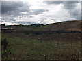
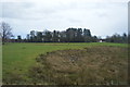
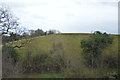
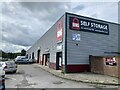
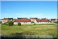
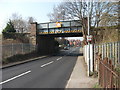
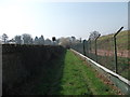
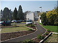
14 photos from this area
Area Information
Key information about the LL14 2BD including its size, population, and administrative classification.
- Area Type
- Postcode
- Area Size
- 3.1 hectares
- Population
- 1429
- Population Density
- 2172 people/km²
House Prices in LL14 2BD
34
Properties
£77,000
Average Sold Price
£56,000
Lowest Price
£115,000
Highest Price
Showing 34 properties
| Address | Type | Beds | Baths | Last Sale Price | Last Sale Date | |
|---|---|---|---|---|---|---|
| 22 Heol Kenyon, Johnstown, Wrexham, LL14 2BD | Detached | 3 | 1 | £115,000 | Jul 2020 | |
| 13 Heol Kenyon, Johnstown, Wrexham, LL14 2BD | Semi-detached | - | - | £60,000 | Dec 2010 | |
| 12 Heol Kenyon, Johnstown, Wrexham, LL14 2BD | Semi-detached | 3 | 1 | £56,000 | Oct 1998 | |
| Community Centre, Heol Kenyon, Johnstown, Wrexham, LL14 2BD | community_day_centre | - | - | - | - | |
| Neil Anthony, Hairdressers, Greenfield, Heol Kenyon, Johnstown, Wrexham, LL14 2BD | shop | - | - | - | - | |
| Pavilion, Heol Kenyon, Johnstown, Wrexham, LL14 2BD | Leisure | - | - | - | - | |
| 10 Heol Kenyon, Johnstown, Wrexham, LL14 2BD | Semi-detached | - | - | - | - | |
| 3 Heol Kenyon, Johnstown, Wrexham, LL14 2BD | house | - | - | - | - | |
| 1 Heol Kenyon, Johnstown, Wrexham, LL14 2BD | Semi-detached | - | - | - | - | |
| 23 Heol Kenyon, Johnstown, Wrexham, LL14 2BD | Semi-detached | - | - | - | - |
Page 1 of 4
Energy Efficiency in LL14 2BD
Amenities
Schools
| Rank | School | Type | Entry gender | Ages |
|---|
Explore more schools in this area
Go to Schools tabDemographics
Household Size
One person
most common
Accommodation Type
Houses
most common
Tenure
51
majority
Ethnic Group
White
most common
Religion
N/A
most common
Household Composition
N/A
most common
Age
47
median
Adults (30-64 years)
most common
Household Deprivation
N/A
with no deprivation
NS-SEC
17
in Lower managerial occupations
Explore more demographic insights in this area
Go to Demographics tabPlanning
Planning Constraints
- Flood RiskPremium
- Ramsar Wetland SitesPremium
- Area of Outstanding Natural BeautyPremium
- Protected Nature ReservePremium
- Protected WoodlandPremium
- Crime RiskPremium