Area Overview for LL13 9TF
Photos of LL13 9TF
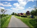
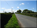
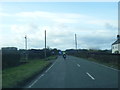
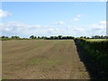
4 photos from this area
Area Information
Key information about the LL13 9TF including its size, population, and administrative classification.
- Area Type
- Postcode
- Area Size
- 1.3 km²
- Population
- 2664
- Population Density
- 83 people/km²
House Prices in LL13 9TF
13
Properties
£362,488
Average Sold Price
£345,000
Lowest Price
£379,950
Highest Price
Showing 13 properties
| Address | Type | Beds | Baths | Last Sale Price | Last Sale Date | |
|---|---|---|---|---|---|---|
| Westfield, Buck Road, Commonwood, Holt, LL13 9TF | house | 4 | - | £350,000 | May 2015 | |
| Springfield, Buck Road, Commonwood, Holt, LL13 9TF | house | 4 | - | £375,000 | Dec 2012 | |
| Bakers Corner, Commonwood Road, Commonwood, Holt, LL13 9TF | house | - | - | £345,000 | Mar 2006 | |
| Longfield Barn, Buck Road, Commonwood, Holt, LL13 9TF | Detached | - | - | £379,950 | Sep 2004 | |
| Plas Bostock Farm, Buck Road, Commonwood, Holt, LL13 9TF | Detached | 5 | 1 | - | - | |
| The Caravan, Plas Bostock Farm, Buck Road, Commonwood, Holt, LL13 9TF | Mobile Home | - | - | - | - | |
| The Caravan At, Commonwood Farm, Buck Road, Commonwood, Holt, LL13 9TF | Mobile Home | - | - | - | - | |
| The Grange, Buck Road, Commonwood, Holt, LL13 9TF | house | - | - | - | - | |
| Longfield Cottage, Buck Road, Commonwood, Holt, LL13 9TF | Detached | - | - | - | - | |
| The Warehouse, Buck Road, Commonwood, Holt, LL13 9TF | warehouse | - | - | - | - |
Page 1 of 2
Energy Efficiency in LL13 9TF
Amenities
Schools
| Rank | School | Type | Entry gender | Ages |
|---|
Explore more schools in this area
Go to Schools tabDemographics
Household Size
Two person
most common
Accommodation Type
Houses
most common
Tenure
74
majority
Ethnic Group
White
most common
Religion
N/A
most common
Household Composition
N/A
most common
Age
47
median
Adults (30-64 years)
most common
Household Deprivation
N/A
with no deprivation
NS-SEC
17
in Lower managerial occupations
Explore more demographic insights in this area
Go to Demographics tabPlanning
Planning Constraints
- Flood RiskPremium
- Ramsar Wetland SitesPremium
- Area of Outstanding Natural BeautyPremium
- Protected Nature ReservePremium
- Protected WoodlandPremium
- Crime RiskPremium