Area Overview for LL13 9PH
Photos of LL13 9PH
Area Information
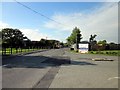
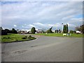
LL13 9PH is a small, tightly knit residential cluster in Wales, covering 10.6 hectares and home to 2,664 people. With a population density of 83 people per square kilometre, it’s a modest area where community ties are likely strong. The postcode sits in a region where homes are predominantly owner-occupied, reflecting a stable, mature demographic. The area’s compact size means residents are close to local amenities, rail links, and retail hubs, making it practical for daily life. While it lacks large-scale infrastructure, its proximity to Wrexham’s main centres offers access to broader services. The mix of housing types here is largely residential, with a focus on family homes, suggesting a balance between private ownership and local needs. For those seeking a quiet, manageable environment with straightforward access to essentials, LL13 9PH offers a straightforward, low-maintenance lifestyle.
- Area Type
- Postcode
- Area Size
- 10.6 hectares
- Population
- 2664
- Population Density
- 83 people/km²
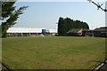
LL13 9PH is primarily an owner-occupied area, with 74% of homes owned by residents rather than rented. The accommodation types here are largely houses, which is typical for smaller, residential clusters. This suggests a market focused on private ownership rather than rental properties, which may appeal to buyers seeking long-term stability. The limited area size means the housing stock is unlikely to be vast, so availability could be constrained. For buyers, this implies a need to act decisively, as properties may not remain on the market for long. The predominance of houses also hints at a preference for standalone or semi-detached homes, which could be a draw for families or those valuing space. However, the small scale of the area means proximity to amenities and transport is key.
House Prices in LL13 9PH
No properties found in this postcode.
Energy Efficiency in LL13 9PH
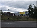
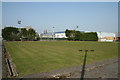
The area’s amenities include retail hubs like Co-op Wrexham, Asda Holt, and Co-op Prince, offering everyday shopping needs. Rail stations such as Wrexham Central and Gwersyllt provide access to broader transport networks, enhancing mobility. While specific parks or leisure facilities are not detailed in the data, the proximity to Wrexham’s urban centres likely means residents can access larger recreational spaces, dining options, and cultural venues. The combination of retail and rail connectivity suggests a lifestyle that balances local convenience with regional opportunities. For those prioritising practicality, the area’s amenities are sufficient for daily needs, though additional exploration may be required to uncover more niche facilities.
Amenities
Schools
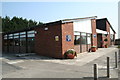
Nearby schools include St Paul’s Controlled (CIW) Primary School, St Pauls Voluntary Aided Primary School, St Christopher’s School, and Cyfle Young Mothers Unit. These institutions cater to a range of educational needs, from primary schooling to specialist support for young mothers. The presence of multiple primary schools suggests a focus on early education, which is crucial for families with young children. St Christopher’s School, while not specified further, likely serves the broader community. Cyfle Young Mothers Unit indicates a tailored approach to education for specific groups, adding diversity to the local school landscape. The mix of school types offers flexibility for parents, though the absence of secondary schools or Ofsted ratings means further research would be needed for detailed assessments.
| Rank | School | Type | Entry gender | Ages |
|---|
Explore more schools in this area
Go to Schools tabDemographics
The population of LL13 9PH skews towards adults aged 30–64, with a median age of 47. This suggests a community rooted in middle-aged households, likely with established careers and families. Home ownership is high at 74%, indicating a stable, long-term resident base. The area is predominantly occupied by people of White ethnicity, though no specific data on diversity is provided. With 83 people per square kilometre, the density is low enough to avoid overcrowding, contributing to a sense of space. The absence of detailed deprivation statistics means it’s unclear how economic factors might affect quality of life, but the high home ownership rate implies a degree of financial stability. This demographic profile aligns with a community prioritising security and continuity over rapid change.
Household Size
Accommodation Type
Tenure
Ethnic Group
Religion
Household Composition
Age
Household Deprivation
NS-SEC
Explore more demographic insights in this area
Go to Demographics tabPlanning
Planning Constraints
- Flood RiskPremium
- Ramsar Wetland SitesPremium
- Area of Outstanding Natural BeautyPremium
- Protected Nature ReservePremium
- Protected WoodlandPremium
- Crime RiskPremium