Area Overview for LL13 8NP
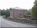
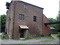
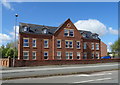
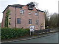
Photos of LL13 8NP


Area Information
LL13 8NP is a small, tightly knit residential postcode area in Wales, home to 1398 people. Its compact size means it likely forms a cohesive neighbourhood rather than a sprawling suburb. The area’s character is shaped by its demographic profile: residents are predominantly adults aged 30–64, with a median age of 47. This suggests a community of established professionals and families, many of whom may have lived in the area for years. The postcode’s limited scale means daily life is likely centred on nearby amenities and local connections. While it lacks the density of larger urban areas, its proximity to rail networks and retail hubs provides practical access to wider services. The absence of significant natural or planning constraints—such as protected woodlands or Areas of Outstanding Natural Beauty—means development pressures are minimal. For buyers, this represents a quiet, stable environment with a focus on convenience over grandeur. The area’s small footprint also means it is unlikely to experience rapid change, offering a predictable living experience for those seeking stability.
- Area Type
- Postcode
- Area Size
- Not available
- Population
- 1398
- Population Density
- 3021 people/km²
The property market in LL13 8NP is characterised by a low home ownership rate of 24%, which suggests that the area is more rental-focused than owner-occupied. The predominant accommodation type is flats, indicating a housing stock that may include both older converted buildings and newer developments. This mix could appeal to buyers seeking affordable, manageable properties, though the small size of the postcode means the available stock is limited. The low home ownership rate may also reflect a reliance on private or social rental options, which could influence the types of properties available for purchase. For those considering buying, the area’s compact nature means the immediate surroundings are likely to be the primary source of housing options. Flats in this area may be more suited to individuals or couples rather than larger families, given the lack of data on larger homes. Buyers should also consider the potential for limited capital growth in a small, stable market.
House Prices in LL13 8NP
No properties found in this postcode.
Energy Efficiency in LL13 8NP
Residents of LL13 8NP have access to a range of nearby amenities, including five retail outlets such as Farmfoods Hightown, Co-op Prince, and Lidl Hightown. These shops provide everyday essentials, making the area convenient for grocery shopping and routine errands. The presence of multiple railway stations within practical reach adds to the area’s connectivity, allowing residents to commute to larger towns or cities for work, leisure, or specialist services. While the data does not specify parks or leisure facilities, the availability of retail and transport options suggests a lifestyle focused on practicality and accessibility. The compact nature of the postcode means that amenities are likely to be within walking or short driving distance, reducing the need for lengthy commutes. This balance of local retail and transport links supports a functional, community-oriented way of life.
Amenities
Schools
The nearest school to LL13 8NP is Ysgol Bodhyfryd, which is categorised as an ‘other’ type. No further details on its Ofsted rating or curriculum are available in the data. This single school suggests that families in the area may have limited local educational options, potentially requiring them to travel to nearby towns for secondary education or specialist provisions. The presence of a school, even if not extensively detailed, indicates that the area is likely to be within commuting distance of larger educational hubs. For parents, this could mean a reliance on nearby towns for broader school choices, though the exact implications for daily life or school catchment areas are not specified in the data.
| Rank | School | Type | Entry gender | Ages |
|---|
Explore more schools in this area
Go to Schools tabDemographics
The population of LL13 8NP is predominantly adults aged 30–64, with a median age of 47. This reflects a mature, settled community, likely with a high proportion of working-age residents. Home ownership is relatively low at 24%, indicating that most residents are likely to be renters, possibly in private or social housing. The accommodation type is primarily flats, suggesting a mix of older housing stock and purpose-built units. The predominant ethnic group is White, with no data provided on other demographics. This composition implies a community with limited diversity in terms of ethnicity but potentially strong local ties. The low home ownership rate may affect property market dynamics, with fewer owner-occupied homes and a greater reliance on rental markets. For buyers, this could mean limited opportunities for long-term investment in property. The age profile also suggests a demand for housing that suits older adults, such as accessible layouts or proximity to healthcare services.
Household Size
Accommodation Type
Tenure
Ethnic Group
Religion
Household Composition
Age
Household Deprivation
NS-SEC
Explore more demographic insights in this area
Go to Demographics tabPlanning
Planning Constraints
- Flood RiskPremium
- Ramsar Wetland SitesPremium
- Area of Outstanding Natural BeautyPremium
- Protected Nature ReservePremium
- Protected WoodlandPremium
- Crime RiskPremium