Area Overview for LL13 8BL
Photos of LL13 8BL


Area Information
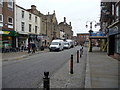
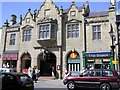
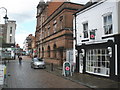
LL13 8BL is a small, tightly knit residential cluster in north Wales, home to 1524 people. Its compact nature means it feels more like a village than a sprawling suburb, with a quiet, community-focused atmosphere. The area is characterised by its modest scale, with housing primarily comprising flats, reflecting a mix of older and newer properties. Residents are predominantly adults aged 30–64, with a median age of 47, suggesting a stable, mature population. The area’s proximity to Wrexham offers easy access to urban amenities, while its smaller footprint ensures a slower pace of life. Nearby, the postcode’s rail connections to Wrexham Central and Gwersyllt stations provide straightforward links to regional transport networks. For those seeking a balance between rural tranquillity and urban convenience, LL13 8BL offers a distinct niche, though its limited size means the local landscape is shaped more by immediate needs than sprawling developments.
- Area Type
- Postcode
- Area Size
- Not available
- Population
- 1524
- Population Density
- 1766 people/km²
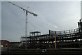
The property market in LL13 8BL is defined by its low home ownership rate of 31%, suggesting that the majority of residents rent rather than own their homes. The accommodation type is almost exclusively flats, which may be a result of the area’s small size and historical development patterns. This makes the housing stock more limited in variety compared to areas with a mix of terraced houses or semi-detached properties. For buyers, this means the available options are constrained, with a focus on flats rather than larger homes. The low ownership rate could also indicate a rental market that is competitive, with limited scope for investment in property. Given the area’s modest scale, buyers should consider nearby regions for more extensive housing choices, though LL13 8BL’s proximity to Wrexham may offer some broader opportunities for those willing to expand their search.
House Prices in LL13 8BL
No properties found in this postcode.
Energy Efficiency in LL13 8BL
The lifestyle in LL13 8BL is shaped by its proximity to practical amenities, including five retail venues such as Lidl Wrexham, Co-op Lord, and Tesco Wrexham. These stores provide access to everyday shopping needs, though the area’s small size means residents may need to travel slightly further for more specialised retail options. The rail network, with stations like Wrexham Central and Gwersyllt, offers direct links to urban hubs, enhancing the area’s connectivity. For leisure, the lack of named parks or recreational facilities in the data suggests that outdoor activities may require venturing to nearby towns. Nonetheless, the presence of multiple retail and transport options within practical reach contributes to a functional, if modest, lifestyle. The area’s character is defined by its convenience for basic needs, with the balance between local provision and regional access playing a key role in daily life.
Amenities
Schools
The only named school near LL13 8BL is Ysgol Plas Coch, which is categorised as an “other” school type in the data. No Ofsted rating or specific details about its curriculum or performance are provided, so its quality remains unassessed here. The absence of additional schools in the data suggests that families may need to look beyond the immediate postcode for a range of educational options. For those prioritising proximity to schools, the limited local provision means that commuting to nearby towns or using alternative transport links to access broader school networks may be necessary. The single listed school highlights the need for prospective residents to investigate further into its facilities and how it aligns with their children’s educational needs.
| Rank | School | Type | Entry gender | Ages |
|---|
Explore more schools in this area
Go to Schools tabDemographics
The community in LL13 8BL is predominantly composed of adults aged 30–64, with a median age of 47. This suggests a population that is largely established in careers and family life, with fewer younger residents or retirees. Home ownership is relatively low at 31%, indicating that a significant portion of the housing stock is rented. The accommodation type is almost entirely flats, which may reflect the area’s compact layout and older infrastructure. The predominant ethnic group is White, though no specific data on diversity or deprivation levels is provided. The age profile implies a community with a focus on stability, though the lack of younger residents could affect local schools and amenities. The flat-dominated housing stock may also influence the area’s character, creating a more uniform residential environment compared to areas with a mix of house types.
Household Size
Accommodation Type
Tenure
Ethnic Group
Religion
Household Composition
Age
Household Deprivation
NS-SEC
Explore more demographic insights in this area
Go to Demographics tabPlanning
Planning Constraints
- Flood RiskPremium
- Ramsar Wetland SitesPremium
- Area of Outstanding Natural BeautyPremium
- Protected Nature ReservePremium
- Protected WoodlandPremium
- Crime RiskPremium