Area Overview for LL13 7QE
Photos of LL13 7QE
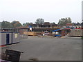
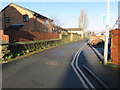

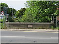
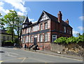
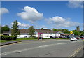
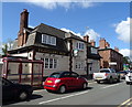
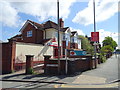
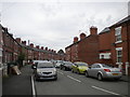
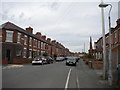
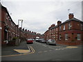
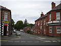
42 photos from this area
Area Information
Key information about the LL13 7QE including its size, population, and administrative classification.
- Area Type
- Postcode
- Area Size
- 2.4 hectares
- Population
- 2027
- Population Density
- 2231 people/km²
House Prices in LL13 7QE
27
Properties
£257,413
Average Sold Price
£75,000
Lowest Price
£450,000
Highest Price
Showing 27 properties
| Address | Type | Beds | Baths | Last Sale Price | Last Sale Date | |
|---|---|---|---|---|---|---|
| 10 Trem Yr Eglwys, Wrexham, LL13 7QE | house | 3 | 2 | £300,000 | Sep 2024 | |
| 20 Trem Yr Eglwys, Wrexham, LL13 7QE | house | 4 | - | £450,000 | Sep 2023 | |
| 30 Trem Yr Eglwys, Wrexham, LL13 7QE | Detached | 4 | 2 | £430,000 | Apr 2023 | |
| 17 Trem Yr Eglwys, Wrexham, LL13 7QE | house | - | - | £320,000 | Jun 2021 | |
| 16 Trem Yr Eglwys, Coed Y Glyn, Wrexham, LL13 7QE | Detached | 4 | 2 | £235,000 | Dec 2018 | |
| 32 Trem Yr Eglwys, Wrexham, LL13 7QE | house | - | - | £350,000 | Jun 2017 | |
| 11 Trem Yr Eglwys, Wrexham, LL13 7QE | Bungalow | 3 | 1 | £224,000 | Aug 2015 | |
| 37 Trem Yr Eglwys, Wrexham, LL13 7QE | Detached | 4 | 1 | £245,000 | Jun 2015 | |
| 24 Trem Yr Eglwys, Wrexham, LL13 7QE | house | - | - | £245,000 | May 2010 | |
| 35 Trem Yr Eglwys, Wrexham, LL13 7QE | Detached | - | - | £115,000 | Oct 2000 |
Page 1 of 3
Energy Efficiency in LL13 7QE
Amenities
Schools
| Rank | School | Type | Entry gender | Ages |
|---|
Explore more schools in this area
Go to Schools tabDemographics
Household Size
Two person
most common
Accommodation Type
Houses
most common
Tenure
71
majority
Ethnic Group
White
most common
Religion
N/A
most common
Household Composition
N/A
most common
Age
47
median
Adults (30-64 years)
most common
Household Deprivation
N/A
with no deprivation
NS-SEC
35
in Lower managerial occupations
Explore more demographic insights in this area
Go to Demographics tabPlanning
Planning Constraints
- Flood RiskPremium
- Ramsar Wetland SitesPremium
- Area of Outstanding Natural BeautyPremium
- Protected Nature ReservePremium
- Protected WoodlandPremium
- Crime RiskPremium