Area Overview for LL13 7NQ
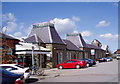
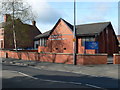
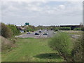
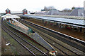
Photos of LL13 7NQ


Area Information
LL13 7NQ is a compact residential postcode in Wales, covering just 2.1 hectares and home to 1,825 people. Its high population density of 88,230 people per square kilometre reflects a tightly knit community, though the area’s small size means it is more of a cluster than a sprawling suburb. The postcode sits in a region where natural constraints are minimal, with no protected woodlands, AONBs, or Ramsar sites nearby. This makes it a practical choice for those seeking a residential area without environmental planning restrictions. Daily life here is shaped by its proximity to Wrexham’s infrastructure, with rail links and retail hubs within reach. While the area is small, its connection to nearby towns like Wrexham offers access to broader amenities. The demographic profile—primarily adults aged 30–64, with a median age of 47—suggests a community of established residents, many of whom may have ties to local employment or nearby industries. For buyers, LL13 7NQ presents a unique blend of limited space and accessibility, ideal for those prioritising convenience over expansive living.
- Area Type
- Postcode
- Area Size
- 2.1 hectares
- Population
- 1825
- Population Density
- 2498 people/km²
The property market in LL13 7NQ is characterised by a low home ownership rate of 28%, suggesting that most properties are rented rather than owned. The accommodation type is primarily houses, not flats, which may reflect a preference for single-family homes in this small area. Given the high population density and limited area size, the housing stock is likely constrained, meaning buyers may need to consider nearby postcodes for more options. The low home ownership rate could indicate a rental market dominated by landlords, which may affect property availability for first-time buyers. However, the absence of environmental planning constraints—such as protected woodlands or AONBs—makes LL13 7NQ an attractive option for developers or investors seeking to expand housing stock. For buyers, the challenge lies in navigating a limited local market while balancing proximity to Wrexham’s amenities.
House Prices in LL13 7NQ
No properties found in this postcode.
Energy Efficiency in LL13 7NQ
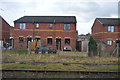
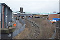
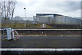
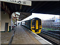
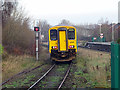
The lifestyle in LL13 7NQ is shaped by its proximity to retail and rail hubs. Within practical reach are five retail venues, including Morrisons Hightown and Aldi Hightown, providing access to groceries, household goods, and everyday essentials. The rail network, with stations such as Wrexham Central and Gwersyllt, connects residents to Wrexham and other towns, facilitating commuting and weekend travel. While the area itself is small, its integration with nearby infrastructure means residents can access broader leisure and dining options in Wrexham. The absence of named parks or leisure facilities in the data suggests that outdoor activities may require travel to nearby green spaces. Nonetheless, the compact layout and nearby amenities contribute to a convenient, though limited, lifestyle focused on practicality and connectivity.
Amenities
Schools
The only named school near LL13 7NQ is Woodlands Children’s Development Centre, which is categorised as an “other” type in the data. No Ofsted rating or specific educational focus is provided, so its role in the local education landscape remains unclear. Families with young children may find this facility useful for early years development, but the lack of traditional schools or further education institutions suggests that parents may need to travel to nearby towns like Wrexham for secondary education. The absence of comprehensive school data means it is difficult to assess the quality or range of educational provision in the area. For those prioritising proximity to schools, LL13 7NQ may require additional research into nearby institutions beyond the immediate postcode.
| Rank | School | Type | Entry gender | Ages |
|---|
Explore more schools in this area
Go to Schools tabDemographics
The community in LL13 7NQ is predominantly composed of adults aged 30–64, with a median age of 47. This suggests a mature population, likely with long-term ties to the area. Home ownership is relatively low at 28%, indicating that a significant portion of the housing stock is rented out, possibly to younger families or transient workers. The accommodation type is primarily houses, not flats, which may appeal to those seeking family-friendly layouts. The predominant ethnic group is White, though no specific diversity statistics are provided. The high population density—88,230 people per square kilometre—raises questions about the balance between residential and communal spaces. While this density could foster a strong sense of community, it may also mean limited private outdoor space. The absence of detailed deprivation data means the area’s socioeconomic challenges remain unquantified, but the low home ownership rate suggests potential affordability for renters.
Household Size
Accommodation Type
Tenure
Ethnic Group
Religion
Household Composition
Age
Household Deprivation
NS-SEC
Explore more demographic insights in this area
Go to Demographics tabPlanning
Planning Constraints
- Flood RiskPremium
- Ramsar Wetland SitesPremium
- Area of Outstanding Natural BeautyPremium
- Protected Nature ReservePremium
- Protected WoodlandPremium
- Crime RiskPremium