Area Overview for LL13 0AW
Photos of LL13 0AW
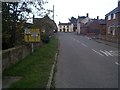
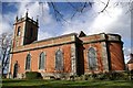
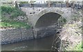
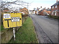
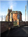
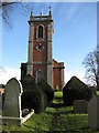
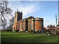
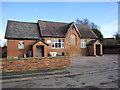
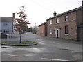
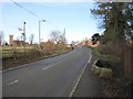
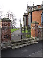
43 photos from this area
Area Information
Key information about the LL13 0AW including its size, population, and administrative classification.
- Area Type
- Postcode
- Area Size
- 1.5 km²
- Population
- 1592
- Population Density
- 79 people/km²
House Prices in LL13 0AW
61
Properties
£231,044
Average Sold Price
£119,200
Lowest Price
£405,000
Highest Price
Showing 61 properties
| Address | Type | Beds | Baths | Last Sale Price | Last Sale Date | |
|---|---|---|---|---|---|---|
| Boundary Cottage, Mulsford Road, Worthenbury, Wrexham, LL13 0AW | house | - | - | £405,000 | Nov 2024 | |
| 10 Dawson Farm Mews, Worthenbury, Wrexham, LL13 0AW | house | 3 | 3 | £215,000 | Jan 2024 | |
| 1, Rose Cottage, Church Road, Worthenbury, Wrexham, LL13 0AW | house | - | - | £119,200 | Dec 2021 | |
| Top House, B 5069 From Brookford Lodge To Church Road, Worthenbury, Wrexham, LL13 0AW | Semi-detached | 3 | 1 | £210,000 | Jul 2021 | |
| Wisteria Cottage, B 5069 From Brookford Lodge To Church Road, Worthenbury, Wrexham, LL13 0AW | house | - | - | £317,000 | Jul 2021 | |
| 6 Dawson Farm Mews, Worthenbury, Wrexham, LL13 0AW | Terraced | 2 | 2 | £210,000 | Mar 2021 | |
| 5 Dawson Farm Mews, Worthenbury, Wrexham, LL13 0AW | house | - | - | £207,500 | Dec 2020 | |
| Manor Cottage, B 5069 From Church Road To Green Lane, Worthenbury, Wrexham, LL13 0AW | house | 3 | 1 | £270,000 | Aug 2020 | |
| Covington, Church Road, Worthenbury, Wrexham, LL13 0AW | Detached | 4 | - | £300,000 | Nov 2019 | |
| The Willows, Whitehouse Mews, Worthenbury, Wrexham, LL13 0AW | Terraced | 2 | 1 | £131,000 | Jun 2019 |
Page 1 of 7
Energy Efficiency in LL13 0AW
Amenities
Schools
| Rank | School | Type | Entry gender | Ages |
|---|
Explore more schools in this area
Go to Schools tabDemographics
Household Size
Two person
most common
Accommodation Type
Houses
most common
Tenure
81
majority
Ethnic Group
White
most common
Religion
N/A
most common
Household Composition
N/A
most common
Age
47
median
Adults (30-64 years)
most common
Household Deprivation
N/A
with no deprivation
NS-SEC
40
in Lower managerial occupations
Explore more demographic insights in this area
Go to Demographics tabPlanning
Planning Constraints
- Flood RiskPremium
- Ramsar Wetland SitesPremium
- Area of Outstanding Natural BeautyPremium
- Protected Nature ReservePremium
- Protected WoodlandPremium
- Crime RiskPremium