Area Overview for LL13 0AB
Photos of LL13 0AB
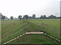
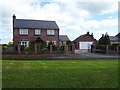
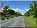
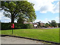
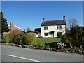
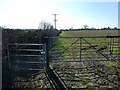
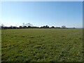
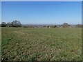
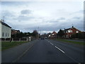
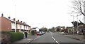
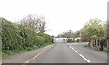
20 photos from this area
Area Information
Key information about the LL13 0AB including its size, population, and administrative classification.
- Area Type
- Postcode
- Area Size
- 42.8 hectares
- Population
- 1592
- Population Density
- 79 people/km²
House Prices in LL13 0AB
21
Properties
£185,658
Average Sold Price
£59,950
Lowest Price
£340,000
Highest Price
Showing 21 properties
| Address | Type | Beds | Baths | Last Sale Price | Last Sale Date | |
|---|---|---|---|---|---|---|
| 2 Station Road, Bangor On Dee, Wrexham, LL13 0AB | house | - | - | £180,000 | Apr 2023 | |
| Fieldoaks, Station Road, Bangor On Dee, Wrexham, LL13 0AB | Retail | 4 | 1 | £338,000 | Apr 2022 | |
| Fair Risings, Station Road, Bangor On Dee, Wrexham, LL13 0AB | house | - | - | £340,000 | Jul 2021 | |
| Ty Graig, Station Road, Bangor On Dee, Wrexham, LL13 0AB | Detached | - | - | £121,000 | Jun 2021 | |
| 2, Laurel Cottage, Station Road, Bangor On Dee, Wrexham, LL13 0AB | Semi-detached | - | - | £59,950 | Aug 2000 | |
| Lilac Cottage, Station Road, Bangor On Dee, Wrexham, LL13 0AB | Detached | - | - | £75,000 | Aug 1996 | |
| Northfields, Access Lane To Dongray Hall, Bangor On Dee, Wrexham, LL13 0AB | Detached | 3 | 2 | - | - | |
| 2, Leeks Cottage, Station Road, Bangor On Dee, Wrexham, LL13 0AB | house | - | - | - | - | |
| 1, Leeks Cottage, Station Road, Bangor On Dee, Wrexham, LL13 0AB | Semi-detached | - | - | - | - | |
| 1, Laurel Cottage, Station Road, Bangor On Dee, Wrexham, LL13 0AB | house | - | - | - | - |
Page 1 of 3
Energy Efficiency in LL13 0AB
Amenities
Schools
| Rank | School | Type | Entry gender | Ages |
|---|
Explore more schools in this area
Go to Schools tabDemographics
Household Size
Two person
most common
Accommodation Type
Houses
most common
Tenure
81
majority
Ethnic Group
White
most common
Religion
N/A
most common
Household Composition
N/A
most common
Age
47
median
Adults (30-64 years)
most common
Household Deprivation
N/A
with no deprivation
NS-SEC
40
in Lower managerial occupations
Explore more demographic insights in this area
Go to Demographics tabPlanning
Planning Constraints
- Flood RiskPremium
- Ramsar Wetland SitesPremium
- Area of Outstanding Natural BeautyPremium
- Protected Nature ReservePremium
- Protected WoodlandPremium
- Crime RiskPremium